June 8th, 2016
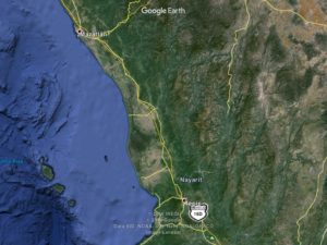
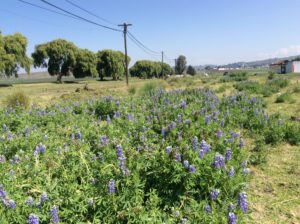
South of Mazatlán the terrain becomes a “dry tropics” habitat with plants and birds changing dramatically. Mangos are grown in the coastal regions in astounding quantities. I spent one night camping after a 91 mile day, followed by a 75 mile day to Tepic. Tepic (te-PEEK) appears to be another coastal town on the map, but is just inland enough to be 3000 feet in elevation. This was a surprise. A tough ride with the hills and made worse by getting caught in afternoon heat. Fortunately there were plenty of roadside stops with refrigerated drinks. I must have drunk a couple of gallons worth of coke, orange juice and water by the end of the day.
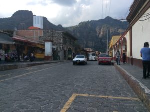
Tepic lies in a valley surrounded by hills and a few high, craggy peaks. It’s the capitol of the state of Nayarit and has a population of over 300 thousand. American businesses are becoming fewer and fewer in this area, but I did find a Subway with Wi-Fi there. American fast food is pretty much synonymous with Wi-Fi. Otherwise, it can be hard to find without getting a hotel.
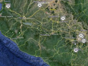
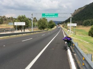
Shortly after Tepic is the first upgrade on the route to Guadalajara.
Guadalajara gains 2000 feet of elevation from Tepic, but only after several hills and valleys. I can use iPad’s version of Google Earth to a degree to estimate grades but the imagery really needs Windows to be fully utilized. The iPad gives no latitudes or longitudes and no numerical elevations. Oblique views are clumsy at best, and the only way I can see elevation change is by zooming in on a highway from a bird’s eye view, then scrolling along its path and seeing if it zooms in or out – awkward at best.
With the heat now encountered in the afternoons, I try to plan the uphills for mornings and be in a place I can shut down when it gets hot (the siesta!) – a piece of shade at the least and, when I’m lucky, a place having food of some kind with air conditioning and Wi-Fi. Pampered travel when the latter happens.
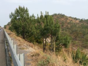
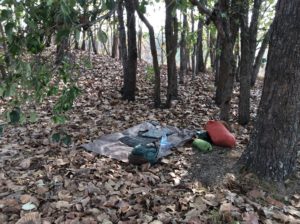
After the climb in elevation to Tepic and beyond, the air becomes dry again. Fires were burning in the mountains. The air was smoky, and occasionally I would get a wafting of pine that put me in mind of fire season in the Rockies. The climate and topography here are not unlike Montana’s Bitterroot Valley in August. I had one beautiful camp at over 5000′ in elevation that was in an oak and pine habitat not too far from Guadalajara.
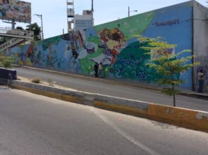
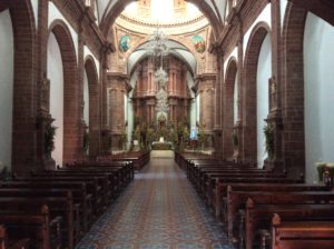
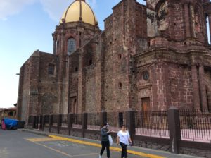
Guadalajara has a metropolitan population of over 4 million people. It has as long a post-Columbian history as any city in the Americas, going back to about 1530, with the present location established in about 1550. Cortez was in today’s Mexico City in 1520. A church in the center of town, though rebuilt after an 1800’s earthquake, was completed in the early 1600’s. Guadalajara is where Mariachi music originates. I didn’t take time to visit the main city, but probably should have. Being on the bike I just wanted to put its chaotic traffic and ludicrously bumpy streets behind me. From a hotel at the western outskirts I made one probe towards “el centro” enroute to, of all places, a Walmart to get some replacements for a few necessities lost with the pannier. The road conditions to get there, however, made it clear taking the belt route circumventing downtown was the best way to go.
Sometime after Guadalahara and towards the end of a long day a man and his wife approached me at a roadside restaurant and ended up inviting me to stay at their house. The town they lived in was La Yerbabuena and though ten uphill miles off the beaten path, I took them up on the offer. The husband, El Cebollo, spoke some English and encounters like this are a good way to learn about a given area. I was a good 20 miles from their place. They had to call ahead to make arrangements for me at their house (everybody has a cell phone here) while they went to pick up a relative at the airport in Guadalahara.
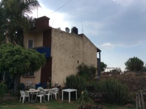
Before I could make the last miles to La Yerbabuena I received, in a deluge, the first rain I’ve encountered since Panguitch a month and a half ago. I ended up pitching the tent for the night on a patch of grass at the side of a quiet road that lead off to Yerbabuena. There were chickens next to the camp that, from all appearances, looked like free range. Then I noticed they were all roosters. Acres of them. The owner came out at a break in the storm and introduced himself. He was an affable enough guy, glad I’d found a spot to pitch the tent, and after some conversation in understandable English, I discovered the chickens were raised for fighting. Evidently it’s a hot market.

The next morning I made my way to La Yerbabuena and asked, per instructions, the first person I saw in the town for directions to “El Cebollo’s” house. After a puzzled look at the gringo on the bicicletta the guy realized I had given the nickname of someone everybody knew well. He pointed to the house.
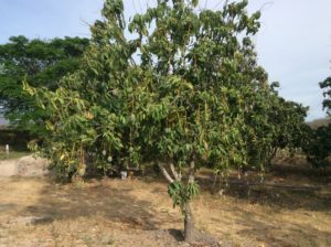
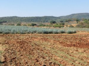
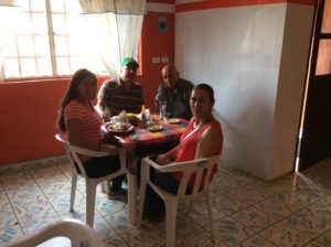
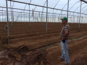
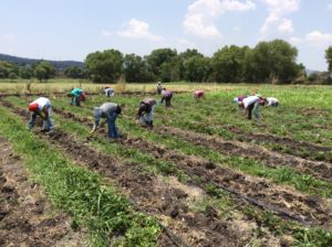
Samuel (El Cebollo), Alma and Fatima Magaña had a great place and treated me like royalty. Cebollo took me on tour of their farm where they raise strawberries and tomatoes. They own several hundred acres and much of the produce goes to the US. Samuel speaks a little English, but Fatima speaks it perfectly. Alma sent me off the next morning with can food, a bottle of ibu’s, balm for my knee and a full stomache.
The remaining 200 miles to Mexico City involve more hills and valleys that gain overall elevation. The summits are beautiful pine forests and the valleys agricultural. I had breakfast in the town of Maravatío with a guy who spoke English, Lois Rolón, and over many cups of coffee learned I was only a few miles from the Sanctuario Mariposa Monarca where the monarche butterflies gather in the winter. Maravatío is notable as well for keeping 60s vintage VW vans in service as public transportation and school buses. A Volkswagen manufacturing plant opened in Mexico City in 1962 has left a legacy of older vans and bugs throughout the country, but in Maravatío they’re everywhere.
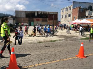
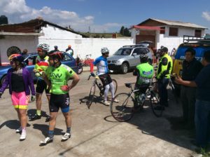
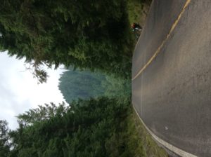
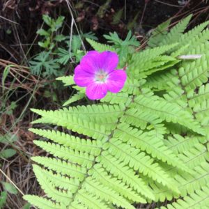
Before Mexico City itself I turned south at Atlacolmuco and on to the city of Toluca. Toluca has a population of a half-million and is 8600 feet high. I was circumventing Mexico City at a radius of about 30 miles and making my way to Tepoztlán, a town due south of the City. The parents of a friend from Logan, Javier Romero, live there and Javier arranged for me to stay for a couple of days. To get there I went through beautiful mountain towns and a 10,000 foot pass with ferns and old growth fir trees that were reminiscent of the Pacific Northwest. The mountain towns, being close to a city of 22 million people, are not surprisingly loaded with tourists. It was Sunday and food venders and artisans were everywhere. A bike race was in progress and hundreds of cyclists were passing me going the opposite way.
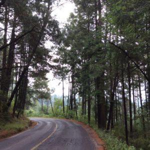

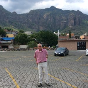
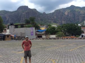
From the 10,000 foot pass the narrow but uncrowded highway drops 4000 feet to Cuernavaca, a city of 300 thousand that has a rich history from ancient times to the present. Called the City of Eternal Spring for its continually pleasant weather, some of the highlights are: It was a summer home for Aztec emperors and has ruins dating back 3000 years; Cortez established a sugar plantation there and built a castle that is today’s Museo Cuauhnahuac; legalized gambling in the first decades of the Twentieth Century attracted mafia figures Al Capone and Bugsy Seigel; Hollywood personalities have had residences there from those same years to the present lending the name Mexico’s Hollywood; Butch Cassidy and the Sundance Kid with Paul Newman and Robert Redford had scenes filmed there; Malcolm Lowry’s classic novel Under the Volcano is about Cuernavaca and it’s proximity to the 17,000 foot volcano Popocatepetl; Americans and Europeans have been retiring there for several generations and have established diverse enclaves that are now rooted in the culture.
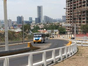
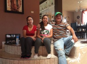
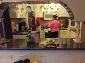
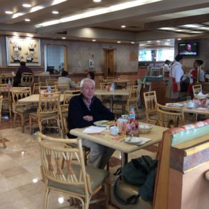
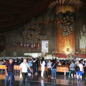
Tepoztlán is a satellite town to Cuernavaca and located in a picturesque valley surrounded by high volcanic cliffs. Javier’s parents, Javier Sr. and Mate, live above the town and were there to greet me. They fed me many meals and treated me like family for the six days I was there. The second day Javier Sr. took me on a guided trip to Mexico City where I tagged along on business errands. Javier is a retired high school mathematics teacher but now runs several outlets for the sale of lottery tickets. He keeps an apartment in Mexico City to stay at while he makes rounds to the ticket offices. He made room in his routine to show me a few sights and we spent the night at his apartment. Navigating busses and subways without him would have been a challenge; Mexico City is modern, huge, overwhelming. I was glad to see it but wouldn’t want to live there.

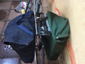
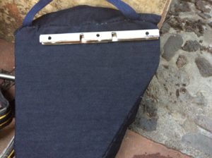
After returning from the City I made a foray into Cuernavaca and got supplies for making another pannier. I managed to find everything but it was an Easter egg hunt that took all day. The rail that hangs on the rack was one of the trickier parts and a guy at a glass shop helped me split a length of oval tubing, drill some holes and notch it out to fit the rack’s cross members. I had to settle for cotton denim instead of cordura nylon but I may attempt to oil it for a measure of waterproofing. The panniers are lined with plastic bags anyway, but the cotton will be heavier if it gets soaked. The next day I hand sewed it all together with dental floss and it works tolerably well. Tomorrow I start for Oaxaca.
great post!
Hi Steve…
I marvel at your knowledge of the history and the country you
traveling through.
I hope you write a book using your blogs.
Very interesting Steve, all of it, good job on the new pannier. The hospitality you encounter and respect is great to hear about. A lot of good information you dispense! Good luck with the ride. Seems like you’re doing well overall.
Hi Steve – I am one of Mary Wootton’s friends and I’m so glad she told me about your blog. This is great reading and your adventures are amazing. Thank you for sharing in such detail that brings the page (screen) to life. Excited to see what happens next!
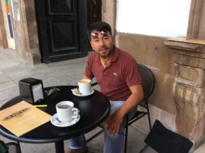
hello steve thanks for make me part of you history travel and I will glad to invite you another coffee time at the portales good luck and god bless you
we are in touch
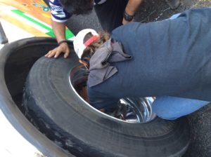
Hi Steve! What an incredible journey!! I’m caught up on your blog now and so look forward to your next post! It’s heartwarming to hear the people that welcome you into their home. You are definitely a jack of all trades, even helping a bus?!?!?! Love seeing the pictures! I’ve probably used to many explanation points, but I’m on the edge of my seat as I read your blog 🙂 I also have 6 friends following you too. Keep up the great writing and safe travels!
A lot of your friends are paying a lot of attention to your saga. Please keep writing, it’s so good.
I for one have your blog as a shortcut on my home screen.
So inspiring…
So glad to have you back online. We were jonesing for the latest installment of your incredible travelogue.
mimi
Steve:
Wonderful pictures and descriptions. Again, I’m so glad you are meeting such wonderful people on your adventure. Also, it is nice to see how beautiful that country is. Keep going man….
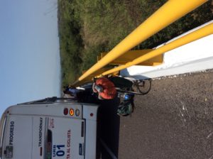
The bus driver asked for help from you, and of course you were prepared! 🙂 Beautiful photos and I’m sure you had a great time with Javier Sr. I can’t believe you’re almost to Oaxaca!