Cali to Quito, Ecuador

August 24th, 2016

Overview
Overview
Cali to Pasto
Cali to Pasto
Pasto to Quito
Pasto to Quito

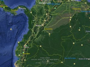
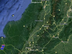
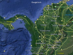
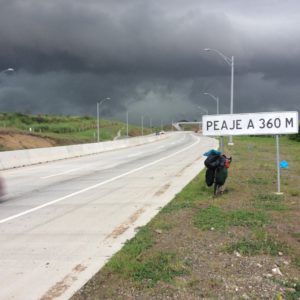
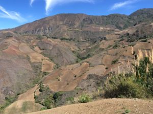
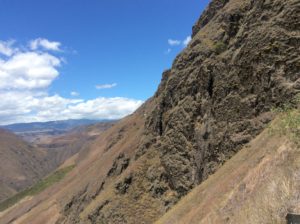
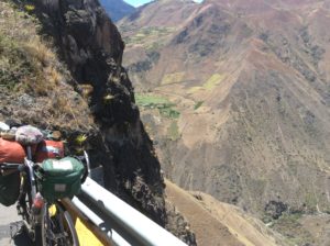
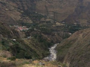
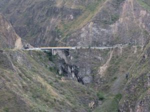
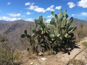
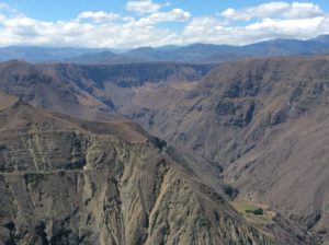
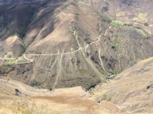
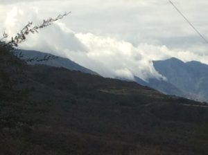
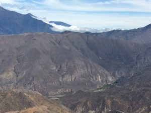
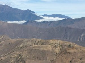
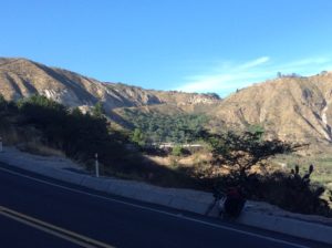
The first 25 miles south of Cali follow the flat and easy  bottom land of the Cauca Valley to its southern terminus at Santander.  After that the terrain becomes mountainous.  The city of Popayán lies at over 5000 feet, only 2000 above Cali, but a merciless 50 miles of up and down to get there.  This was only the beginning.  Getting to Quito would see me going from low points of 3 and 4000 ft, descending once to nearly a 1000 feet, up to as high as 10,500 feet a total of 6 times before reaching Quito, Ecuador.  The pitiless hills would drop to arid, desert climate, with prickly pear and pitaya cactus, then climb, over sometimes two-day rides, to genuinely cold and rainy summits in páramo habitat.

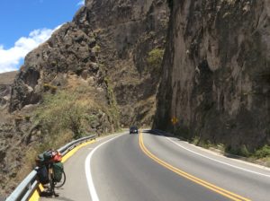
The highway to Popayán from Santander is lined with houses and small farms built long ago in a manner that could not have foreseen the modern world’s overwhelming amount of truck, automobile and motorcycle traffic.  The noise I can see locals getting used to, but living with the terrible air along the crowded highway would not be enviable.  On the bike,  pollution from immediate traffic has been a problem off and on since leaving the U.S. where our emission standards really make a positive difference.  Many of the motorcycle riders here, which at least equal the number of cars, wear respirators.   It’s not always that bad, but I’m considering getting a respirator to have when it is.  La Linea (see previous post) was the worst.

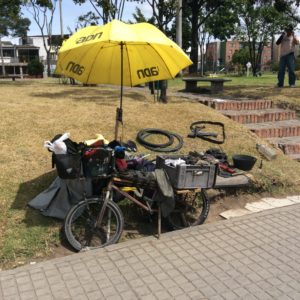
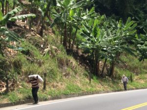
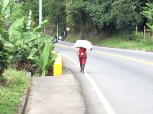
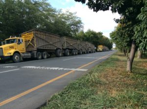
Motorcycle transportation throughout Latin America is popular and the methods of hauling stuff hilarious.  They’re typically not big bikes, in the 125cc-175cc range, and what we would have called “enduros” way back when.  I could never have the camera ready when the time was right, but some of the funnier ones have been:  A family of four- mom, dad, juvenile and infant all loaded on;  grandson giving grandmother a ride with grandmother riding sidesaddle and not looking especially happy about things; rider with passenger reaching his arms behind and toating a wheel barrow filled with cargo and going a good 30 mph;  rider with passenger carrying a load of PVC pipe in 15 foot lengths over their shoulders; young couple with a medium sized dog squeezed between them; motorcycles pulling pickup-sized trailers, one I remember loaded to about eight feet high;  good motorcycle towing broken down motorcycle;  one motorcycle cop off his bike so he could push-start a second motorcycle cop (only in Guatemala).

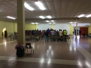
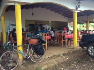
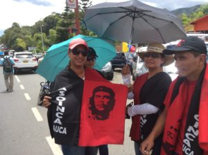
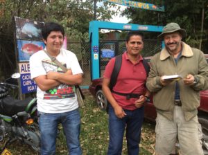
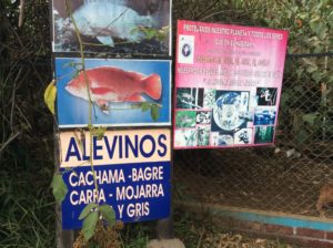
At the town of Tunia, nearing Popayán,  I encountered more protests, this time a group called Asoinca had blocked traffic.  Cars, motorcycles and trucks were lined up for a couple of miles.  This was more of a one-day affair and cops appeared to be there more as a perfunctory presence.  People were all smiles.  They weren’t letting bicycles through, however; so I was stuck for over an hour until I finally reconnoitered a way passed.  I had lunch on some shady roadside grass and while I was eating a nearby property owner came over and introduced himself.   He turned out to be a limnologist  from Naples, Italy.  He spoke enough English that we could communicate pretty well but I never got the whole story of how he ended up in this out-of-the-way corner of Colombia doing some sort of independent work with fresh-water fish.  He was shaking his head at the protesters saying that this was more of a social gathering of middle-upper-class leftists who might be called drugstore revolutionaries by an Americano.

image

Colombiano protests
Colombiano protests
Limnologist Alessandro Della Porta, right, with friends Fredy (red shirt) and Miguel.
Alessandro's
Alessandro’s facilities.

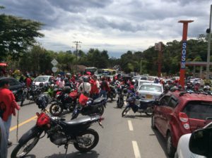
I found a way through the protesters and subsequent line of cars and trucks coming the other way. I got several miles of traffic-free travel till another major road intersected.  I made it to Popayán and scrambled for Wi-Fi to send in some answers to an email interview for an article about the trip for my hometown newspaper in Logan, Utah.  That took till after dark and I ended up in a somewhat spendy, but very nice, hotel in Popayán.

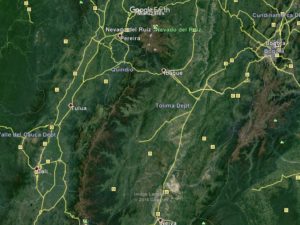
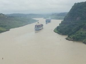
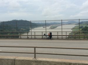
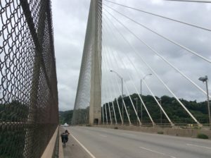
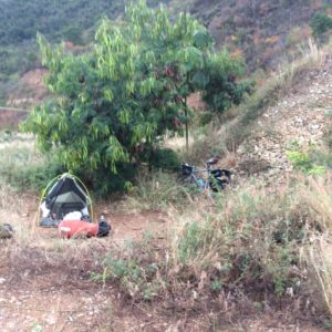
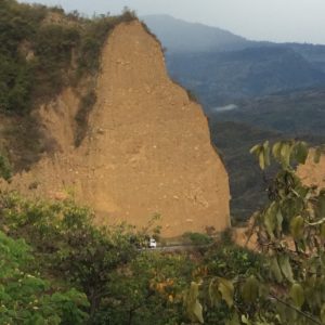
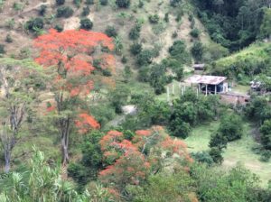
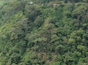
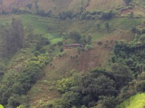
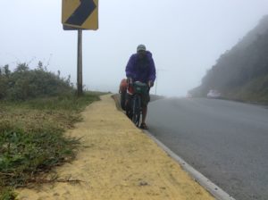
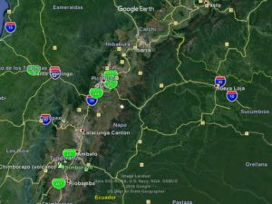
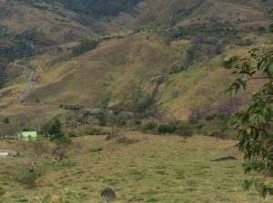
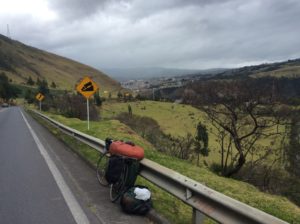
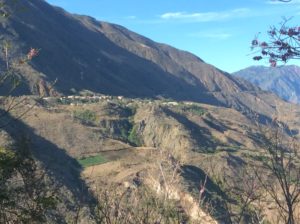
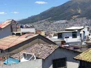
After Popayán a long grade and descent took me to the 1000 foot low point.  Two days climb from there got me to Pasto, named after an indigenous culture, and a picturesque city at 8300 feet.  Pasto lies at the foot of the active volcano, Volcán Galeras, which erupted as recently as 1993 and killed six scientists who were descending into the crater to collect gas samples.  From Pasto, continued grade leads over a 10,000 foot pass then down again to about 4000 feet, then up to Ipiales and the border with Ecuador.  From Ecuador’s border town of Tulcán you climb to 10,500 feet, then down to about 5000, then up to 7300 and the town of Ibarra.  From Ibarra, where I spent two days in a decent $10-a-night hotel recouping, you continue a climb to 10,000 again, then back down to about 6,000, then up to the final 9,400 at Quito. If your having a hard time following all this, don’t worry, so am I- the innumerable hills have become a blur and there’s more to come.  They’ve been unbelievably long and my knees could use one more gear to down-shift into.   To endure them you fall into a sort of meditation where your putting the minimum effort possible to just keep the bike in motion while trying to let your mind wander to where ever it can to pass the time.  I write the blog, practice Spanish, plan what I need in the next town, get mad at the last bus that cut it way closer than he had to.  It’s all about patience, but though time may pass slowly, it’s not boring. Going through the vegetation transitions is always interesting and with hills comes views. In the clear skies here, which contrast remarkably with the smokey skies of Mexico and thick, sea level air of Central America, the views are incredible. Getting to the top of anything is always satisfying.

Rosio Inboquingo was a the museum curator for a Mastadon excavation and indigenous cultures archeology near San Gabriel, Ecuador. She gave me a hour long 1-on-1 tour. Sorry about the unflattering photo.
Rosio Inboquingo was the museum curator for a Mastadon excavation and indigenous cultures archeology near San Gabriel, Ecuador. She gave me an hour long 1-on-1 tour.
Highway I've descended from way above.
Highway I just descended is way above.
The highway is just visible on the profile.
The road is just visible on the profile after exiting the tunnel pictured below.

image image

Pasto, Colombia
Descending to Pasto, Colombia

image

imageimageimage

A good portion of the grades go through FARC territory. This bridge was heavily guarded. I took pictures looking into the slot beneath the bridge. The guards made it clear I wasn't to photograph them.
A good portion of the grades go through FARC territory. This bridge was heavily guarded, complete with sandbag bunkers.  I took pictures looking into the slot beneath the bridge, but the guards made it clear not to photograph anything else.
Marina. Somewhere on one of these grades she had a fruit stand set up for which I got a few things. She refused payment! I told her I'd post her picture on the Internet but she had no knowledge of how to see it.
Marina.  Somewhere on one of these grades she had a fruit stand set up for which I got a few things.  She refused payment!  I told her I’d post her picture on the Internet but she had no knowledge of how to see it.

image

image

After dropping to the tunnel and beyond, you climb to, and follow, the dark plateau in the upper middle of the photo.
Side road to a farm.

image

Another scorching day at the equator.
Camping in pines at the pass above Tulcán.  Another scorching day at the equator.

imageimage

The valley of is a classic example of rain shadow. All through mist from the Pacific comes to the brink ov the valley and stops.
The valley low points are classic examples of rain shadow.  Mist rolls in like a breaking wave from the Pacific but stops at the brink of falling into the valleys, leaving a desert-dry climate.
Ibarra and 20,000 foot Mt Cayembe.
Ibarra and 19,000 foot Mt Cayembe.

I stopped in the town of Otavala, 20 miles beyond Ibarra, looking for a grocery store.  They had a Saturday bazar going that filled the streets for several blocks in all directions.  Of the many that sold clothing, I noticed for the first time since leaving the US “pile” jackets that are worn by climbers and folks in colder climates. I bought a jacket, pile pants and longjohns at DI prices.

image

Jonathan, Andres and Lino. Jonathan, originally from Prince Edward Island, has a leather working business in Otavalo and had a booth at the Bazar. He gave me a place to park the bike while I bought a pile jacket, et al. Andres (and Lino!) are Ecuadorian.
Jonathan, Andres and Lino.  Jonathan, lower photo, left, is originally from Prince Edward Island.  He has a leather working business (JJLeathersmith.com) in Otavalo and had a booth at the Bazar. He gave me a place to park the bike while I went in search of cold-weather clothing. Andres (and Lino!) are Ecuadorian.
I shared a camp (not the tent!) virtually on the equator with this Andean version of a black widow. Very colorful.
I shared a camp (but not the tent!) with this Andean version of a black widow. Very colorful.  The camp is just a couple of miles north of the Equator.

image

image

Huge moth
Huge moth
Last grade to Quito....
Last grades to Quito….
....and pulling into the City. It was Sunday and the middle lanes were closed to traffic and loaded with bikes, peds and dog walkers.
….and pulling into the City. It was Sunday and the middle lanes were closed to traffic and loaded with bikes, peds and dog walkers.  Cotapoxi is at upper left.

image

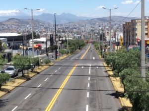
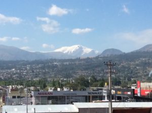
I’m in Quito now for a couple of days tracking down bike parts (never simple) and a stove for the one I lost with the pannier in Mazatlán.  The luxury of a stove I didn’t miss in tropical jungle habitat where hot food just wasn’t attractive, but I’ll now be at higher elevations for a good part of the next few months and it would be nice to heat water for morning coffee and cooking dinner.  Jonathan, from Otavalo, directed me to Quito’s yuppie enclave, Foch’s Plaza, where those types of things are sold along with having a Champs Elysees of coffee shops and restaurants.  I’m enjoying the place, but parting with a bunch of money in the process.  I have a backlog of flower photos that I’ll put out in another plant segment at some point.

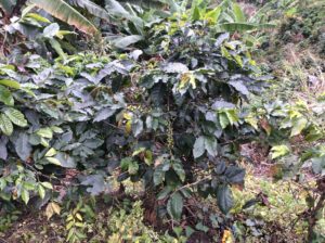
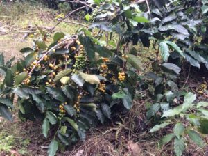
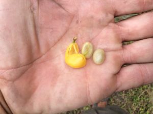
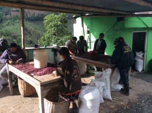
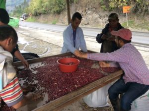
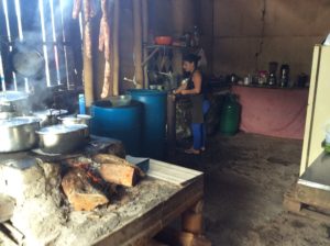
For all the coffee lovers I’ll leave you with info from Fernando Mendivil (and Alfredo Islas) of Los Alamos Cafe (“The Poplars”) for some of what goes into processing coffee beans. These guys are totally committed to the world of COFFEE and brew it as well as I’ve seen the entire trip. If you get to Navojoa, Mexico (Sonora) stop in!

WET PROCESS
In the wet process, the fruit covering the seeds/beans is removed before they are dried. Coffee processed by the wet method is called wet processed or washed coffee. The wet method requires the use of specific equipment and substantial quantities of water.

The coffee cherries are sorted by immersion in water. Bad or unripe fruit will float and the good ripe fruit will sink. The skin of the cherry and some of the pulp is removed by pressing the fruit by machine in water through a screen. The bean will still have a significant amount of the pulp clinging to it that needs to be removed. This is done either by the classic ferment-and-wash method or a newer procedure variously called machine-assisted wet processing, aquapulping or mechanical demucilaging:

In the ferment-and-wash method of wet processing, the remainder of the pulp is removed by breaking down the cellulose by fermenting the beans with microbes and then washing them with large amounts of water. Fermentation can be done with extra water or, in “Dry Fermentation”, in the fruit’s own juices only.

The fermentation process has to be carefully monitored to ensure that the coffee doesn’t acquire undesirable, sour flavors. For most coffees, mucilage removal through fermentation takes between 24 and 36 hours, depending on the temperature, thickness of the mucilage layer, and concentration of the enzymes. The end of the fermentation is assessed by feel, as the parchment surrounding the beans loses its slimy texture and acquires a rougher “pebbly” feel. When the fermentation is complete, the coffee is thoroughly washed with clean water in tanks or in special washing machines.[4]

In machine-assisted wet processing, fermentation is not used to separate the bean from the remainder of the pulp; rather, this is done through mechanical scrubbing. This process can cut down on water use and pollution since ferment and wash water stinks. In addition, removing mucilage by machine is easier and more predictable than removing it by fermenting and washing. However, by eliminating the fermentation step and prematurely separating fruit and bean, mechanical demucilaging can remove an important tool that mill operators have of influencing coffee flavor. Furthermore, the ecological criticism of the ferment-and-wash method increasingly has become moot, since a combination of low-water equipment plus settling tanks allows conscientious mill operators to carry out fermentation with limited pollution.

Any wet processing of coffee produces coffee wastewater which can be a pollutant. Ecologically sensitive farms reprocess the wastewater along with the shell and mucilage as compost to be used in soil fertilization programs. The amount of water used in processing can vary, but most often is used in a 1 to 1 ratio.

After the pulp has been removed what is left is the bean surrounded by two additional layers, the silver skin and the parchment. The beans must be dried to a water content of about 10% before they are stable. Coffee beans can be dried in the sun or by machine but in most cases it is dried in the sun to 12-13% moisture and brought down to 10% by machine. Drying entirely by machine is normally only done where space is at a premium or the humidity is too high for the beans to dry before mildewing.

When dried in the sun coffee is most often spread out in rows on large patios where it needs to be raked every six hours to promote even drying and prevent the growth of mildew. Some coffee is dried on large raised tables where the coffee is turned by hand. Drying coffee this way has the advantage of allowing air to circulate better around the beans promoting more even drying but increases cost and labor significantly.

After the drying process (in the sun or through machines), the parchment skin or pergamino is thoroughly dry and crumbly, and easily removed in the hulling process. Coffee occasionally is sold and shipped in parchment or en pergamino, but most often a machine called a huller is used to crunch off the parchment skin before the beans are shipped.

Saludos Steve.

Keep the good times rolling !!!

Costa Rica to Calí, Colombia

August 10th, 2016

I flew from Panama City to Bogota, Colombia. The Darien is the stretch
I flew from Panama City to Bogotá, Colombia. The Darién Gap, a distance of about 70 miles, is the stretch from the terminating highway below Panama to the nearest north-south running highway in Colombia.
The route went from Bogota south and wet to T
The route went from Bogotá west to Ibagué and curved gradually south to Calí.

I finally left the Casino/Hotel in San Isidro with legs that were yet walking-stiff but pedaling was OK.   Flat terrain led to Panama City, uneventful but not boring. From Panama City I had a couple of choices for getting to South America proper.  A paved road leads east and south out the Isthmus for over a hundred miles before it ends at what’s called the Darién Gap.  From there a 70 mile expanse of jungle must be crossed to reach the nearest Colombian road.  To travel the Americas strictly terrestrially, one would have to cross the Darién Gap.  No permanent roads exist there and to this day it’s a smuggling route (one of many) for cocaine et al headed to the U.S.  It’s also territory controlled at least in part by the FARC (Armed Revolutionary Forces of Columbia), a group of guerrilla revolutionaries that have been fighting the established government in Colombia since the early 1960s. More about them below, but the upshot is that the Darién is a dangerous place. Routes through it wax and wane with ever consuming jungle growth but vehicles have been known to make it through. A Sweedish kid in his twenties tried to walk through it in 2013 and, they think, he was thought by the FARC to be a spy of some kind and they executed him. His remains were found in 2015. They say Panamanians will hire out a squad of armed guards to escort the more intrepid thru. I crossed the Darién off the list.

imageimage

This photo and the two above were taken at a Messianic compound that I pulled into to fix a flat and ended up spending the night. Above is a gathering that started in the middle of the night and was still going on when I eat the nex morning.
This photo and the two above were taken at a Messianic compound that I pulled into to fix a flat and ended up spending the night. Above is a gathering that started in the middle of the night and was still going on when I left in the morning.

The next option was taking a sailboat from Colon (the east side of the Canal and on the Caribbean) to Colombia’s Cartegena. It takes about a week, visits tropical islands, and could have been a great respite from pedaling.  I’m realizing though that time is getting short if I want to make southern Argentina before about March, 2017, the end of the Austral summer.   There are several summits along the way I’d like to get to as well.  That corner of the world is inhospitable enough in the summer and, as the only continental land mass in those latitudes, South America’s slim profile gets hammered by circumpolar wind. Wind is a way of life there and cycling can be really tough if it’s direction is anything but at your back. All I can say is that people do it, but I don’t want to get caught there in the winter.

Flying from Panama City to Bogotá or Medellín was the third option and the cheapest as well. According to my friend Jóse, who I met traveling north in Costa Rica, flying to Medellín cost about $100. The sailboat was more like $500 or $600 from what I found on the Internet.  Both Bogotá and Medellín are well south of Cartegena, cutting off more than a third of Columbia, saving additional time. If I ever feel guilty about not cycling that part, I’ll come back with some friends and have a holiday cycling what I’m sure is a beautiful part of Columbia.

Anyway, I chose to fly and rode straight to the airport once I got to Panama City naively thinking I’d just get the $100 ticket right there. The lady at the terminal, however, quoted me $750, but I could fly that night! She said to try the Internet, so I went to a spendy airport hotel to mull things over. Surfing the net I finally found a round trip fare for $225 that left for Bogotá the next afternoon. My seat will be vacant for the return flight at the end of August. I was also able to book a hotel and, as a wonder of the modern computer world, there was a guy holding a sign up with my name on it when I got there- a first for me- for a complimentary ride to the Hotel Bogotá. $30-a-night w/ breakfast.  The Panama airport hotel was $125 per night and breakfast was $16.  And Colombian coffee is unbelievable. More below on that as well.

Colombia was not immune to the post WWII problems that seemed to plague Latin America. The troubles are rooted in the 1920s and 30s when, once again, communism was becoming popular in poorer countries around the world, particularly those with a wealthy, elite minority relying on labor.  Colombia’s disfunctionality with the United States, though, goes back to Teddy Roosevelt and the building of the Panama Canal.  Panama was then part of Colombia and treaties with the United States had been in place since the 1840s for use of land transportation across the Isthmus.  Sans canal, it was still easier for ships to swap goods there than to go around Cape Horn.  U.S. presence was allowed essentially in exchange for protection from piracy and revolutionaries.  The U.S. readily deployed military there.  When the California gold rush began in 1849 the U.S. was allowed to build and operate a railroad. This all jibed well with Monroe Doctrine.

From as early as the Conquistadores a canal was envisioned, but in the 1880s France’s Ferdinand de Lesseps, the prime developer of the Suez Canal, got investment money together and began the Panama project.  The plan failed for a number of reasons but the most important were i) they attempted to dig down to sea level over the canal’s length- same as Suez, but far too ambitious here- and ii) Panama’s wet season took the lives of some 22,000 workers over 8 years due mainly to yellow fever and Malaria.  The causes of each were not then proven to be from mosquitos. By 1889 the project was bankrupt and officially became a scandal. The French courts handed out several convictions of fund misappropriation that included Lesseps and even Gustave Eiffel of Eiffel Tower fame, but neither spent time in jail.

A MAN A PLAN A CANAL PANAMA. (Palindrome!) Looking towards the Atlantic and the C Cut which required removal of the most amount of
A MAN, A PLAN, A CANAL, PANAMA. (A palindrome!) Looking towards the Atlantic and the Culebra Cut which crosses the continental divide and required removal of the vast majority of the canal’s overburden.
Looking towards the Paciic.
Looking towards the Paciic.  The Miraflores Locks are to the left.
The Centennial Bridge, one of two crossing the Canal.
Last leg to the Panama airport and impending rain.
Cooincedental odometer reading at the airport hotel in Panama. 5001 miles from Logan, Utah.

In 1894 the French tried to renew the project pretty much for enabling the sale of a viable concern. By 1903 the U.S. Senate agreed to a greatly reduced purchase price but it depended on a new Colombian treaty as to who did what with the finished product. Any potential agreements were never ratified by the Colombian government, but, very typical of Teddy Roosevelt, when the U.S. got wind of Panamanian rebels seeking independence, Roosevelt (president at the time) gave them the United States’ full support.   A coup succeeded with the help of U.S. war ships preventing the Colombian army from putting down the rebellion. It amounted to “gunboat diplomacy” and was an act of war against Colombia. Naturally, the new Panamanian government cooperated well with the U.S.  After-the-fact reparations were made to Colombia in 1921 with a payment of $25,000,000.  Colombia in return recognized Panama’s sovereignty.

In 1904 the U.S. began work but wisely chose a design that included a system of locks that raised the ships about 50 feet to a man made lake.  This design involved far less digging.  Malaria and yellow fever were then understood to be from mosquitos and measures were taken to prevent the heavy losses the French encountered. There were, none-the-less, 5,600 out of 75,000 workers that died from disease and accidents. The canal was finished in 1914.

A roaddside cafe where I got breakfast and was pleasantly surprised when some folks who had already come and gone paid for it!
A roadside cafe where I got breakfast and was pleasantly surprised when some folks who had already come and gone paid for it!

I spent two nights in Bogotá and a full day chasing bike parts (more tires and brakes) and having the bottom bracket race tightened slightly.  None of it was simple but Bogotá leads Latin America (and possibly the world) in bike path travel so getting around was not bad for a city of 8 million people.

Bogota bike path.
Bogotá bike path.
You see occasional mobile bicycle repair stations.

Charting a route through Colombia was done with consideration of what might be described as a low level civil war that’s been going on with more or less the original protagonists, and their descendants, since 1964.  It has roots before that to 1949 when a liberal presidential candidate, Jorge Gaitán, was assassinated igniting a nine year war, The Violencia, between liberals and conservatives.  Much of it was fought in rural areas and between towns with respective leanings.  The conservative led government kept much of it out of the press and consequently there are many details lost to history.  They think 200 to 300 thousand lives were taken and over 2 million displaced.  Mixed up in the fighting was the PCC (Partida Comunista Colombiana).  They were a Marxist guerrilla group that formed shortly after the Colombian government’s violent repression of a 1928 strike protesting conditions and wages for fruit workers.  This made, at times, for a 3-sided war loaded with terror and atrocity.

In 1958 liberals and conservatives came to an agreement and the war boiled down to a fight against the PCC.  The PCC of course supported union activities and one of the landmark events segueing into The Violencia was the Colombian government’s repression of the above mentioned fruit worker’s strike.  It occurred near Santa Marta on Colombia’s Caribbean Coast.  The number killed varies wildly, but they were protesting working conditions for the U.S. owned  American Fruit Company which is today’s Chiquita Brands International.  The company has a long history of human rights abuses, a notably poor track record for environmental practices, and has been in Federal Court in the 21st century for illegally funding Colombian paramilitaries.  More on Chiquita here.  One of several Colombian novels that chronicle the massacre at Santa Marta is One Hundred Years of Solitude by Nobel laureate Gabriel García Márquez.

The PCC by 1960 was splitting into factions that either pursued legal channels of resistance or those wanting to continue fighting.  Out of this was born the FARC, the Revolutionary Armed Forces of Colombia, in 1964.  They’ve carried on the 50 year low level civil war that I’m now navigating.  They control large areas of rural Colombia for which the Colombian military effectivly doesn’t tread.  A 2016 estimate of the FARC held areas is found here.  On the plus side a peace agreement has been underway in Cuba for some months and was recently signed.  It still needs a referendum vote.  On the negative side, it’s said that many, as with the split with the PCC 50 years ago, will continue fighting.  A good article on what rural Colombia is now facing is here.  It’s all further complicated by paramilitary groups, closely allied to and often overlapping with Colombian military, and then of coarse the drug cartels.  The cartels ally themselves to both the paramilitaries and the FARC as needed and they get all the cooperation money can buy.  Being middlemen between coca growers and the cartels is one way the FARC sustain themselves, which amounts to a tax.  Another way is kidnapping/ransom which was especially popular in the 1990s but waned in the 21st century as the FARC has tried to gain legitimacy as a recognized army and not a terrorist group.  It still goes on today to some extent and a lone North American on a bicycle would be an easy target.  (Of course, in my case they’d be disappointed to find a dearth of people willing to pay much of a ransom).

No modern history of Colombia would be complete without mention of Pablo Escobar for whom probably more Hollywood movies have been made than Wyatt Earp and Custer combined.  I’ve probably bored you with enough history for now, but just google Escobar to find out more of candidate assassinations, Plata o Plomo diplomacy and the horrible world associated with drug trafficking.

The flight to Bogotá lifted me to almost 9,000 feet elevation from sea level.  Not surprisingly the city has a never ending spring-like climate.  Immediately leaving the city on the bike I gained a low pass to about 9,500 feet and then descended over the next 70 miles to 1000 feet spending a short lived elevation bank account.   Bogotá is a thriving city that’s friendly, as big cities go, but the valley I descended into was not.  A couple of restaurants wouldn’t serve me and everywhere it appeared I was viewed with suspicion.  When you don’t speak the language fluently there has to be a certain amount of effort by both parties if you want to communicate.  These guys were just stonewalling me.  Whether it’s connected to revolutionaries, paramilitaries or just the zeitgeist I haven’t found out.  I did pass two people walking down the highway, one with bandelerros over his shoulders, the other with an assault rifle.  They were both in civilian clothing.

Camp after Bobota. I actually heard machine gun fire that night across a canyon.
A camp southwest of Bogotá. I  heard machine gun fire that night across a canyon below the camp. It wasn’t like people were fighting, more like somebody working on his weapon and testing it out every 15 minutes or so for an hour.
Part of the long descent from Bogata.
Part of the long descent from Bogotá.
Beginning La Linea near Ibague.
Beginning La Linea near Ibagué.

I got food where I could and began the climb to Ibagué (“music city” and home to a conservatory) where the road enters the mountains and areas where coffee is grown.  Here, people were altogether more friendly.  The highway climbs to a 10,000 foot pass over what’s called La Linea.

Coffee!
Coffee!

image

Two beans to a hull. The beans have a sweet mucusy membrane, the removal of which is part of the science and alchemy of making the best coffee.
Two beans to a hull.  A member of the bedstraw family, Rubeaceae, the fruits have a sweet mucilage membrane, the removal of which is part of the science and alchemy of making the best coffee.  Coffee making is approaching the sophistication of wine making.  Help me out Fernando from Novajoa!
Hauling coffee beans. The trees above are bananas.
Hauling coffee beans. The trees above are bananas which are grown here as well.

image

Coffee
The coffee plants are the fine, horizontal rows.
Lunch stop and more buddies.
Lunch stop and a more friendly populace.
Sharing the road.
Sharing the road.
People
Sorting beans by hand.   Gladys, Yeni are on the left.  Not sure who’s who on the rest but they’re  Jetson, Jemes, Jhom, Gonzalo, Luis and Carlos.
Sorting beans by hand.
These guys were laughing (mostly at me) and seemed to be  having a good time.  Judging from their coffee I’ll guess that the best beans never leave the country.
House and farm on a very steep slope.

Seeing the coffee growing first hand gives one an appreciation for what goes into it.  Paying a little extra for Fair Trade supported brands is the least we can do.  And I don’t doubt that the demand for cocaine from a world of cocaine addicts is substantial, but the coffee addicts have to outnumber the cocaine addicts 1000-to-1.  If they got more $ for coffee they could abandon coca altogether!  The $billions put into the War on Drugs would more than cover it.

The climb over La Linea took two days.  I got caught by near darkness trying to find a camp on the steep mountain road where few if any places to pitch a tent  existed.   La Linea is two-lane and has a steady stream of semi and bus traffic going 24-7 on a highway that the U.S. wouldn’t even allow heavy trucks on.  It’s a main artery for transportation between the elongated valleys having the cities of Medellín and Calí on one side of the mountain,  and Bogotá on the other.  They have, however, been working on a new highway that’s nothing short of an engineering marvel.  It’s been many years in the works, and will be many more, but there are a number of tunnels, some accessible from the present highway.  With permission from a couple of workers, who really could have cared less, I slept in one.  Later, some cyclists I met in Calí (Jonathon and Gustavo, pictured below), noted wryly that the tunnel finally got used by someone.

image

Camp in the tunnel.
Hotel La Linea.  A bit drippy but I found a fairly dry spot.

image

Summit of La Linea. It's maybe 45 F and misty rain falling..
Summit of La Linea. It’s maybe 45 F and misty rain falling.
3 & 4-needle pines along La Linea.

image

imageimage

The 6000 foot descent down the other side was steep enough to be slow and scary as well as putting considerable wear on the new brakes.  Flatter terrain led 150 or so miles to Calí where I am now staying three days at the Ruta Sur Hostel.  Jonathan and Gustovo led me here and it has been a great place to rest and work on the blog.

Another flat tire fix turning into a place to stay. Jose and Jairo and Jose's wife Maria below, ran a restaurant but had a place I could pitch the tent. Two meals and the tent site were about $10.
Another flat tire fix turning into a place to stay.  Jose,  Jairo and Jose’s wife Maria, below, ran a restaurant a ways out from any towns and had a place I could pitch the tent. Two meals and the tent site were about $10.

image

Walter and Claudia were from Calí and had traveled by Motorcycle to Patagonia. Walter donated a couple of dollars.
Walter and Claudia were from Calí and had traveled by Motorcycle to Patagonia. Walter donated $5 to the cause.
Jonathan and Gustavo who rode passed me on their bikes coming into calí and then took me to a coffee shop. Jonathan is an expat from the UK teaching English in Calí. I'm expecting plenty of "peer review" from each as well as from Jonathon's students.
Jonathan and Gustavo rode passed me on their bikes coming into Calí and then took me to a coffee shop.  Jonathan is an expat from the UK teaching English in Calí.  On Colombian history, I’m expecting plenty of “peer review” from each, as well as from Jonathan’s students.
These behemoths weren't common but you'd see them. This one's 5 cars long. They don't travel that fast, but the last trailer is usually moving side-to-side 2 or 3 feet.
These behemoths weren’t common but you’d see them. This one’s 5 cars long. They don’t travel that fast, but the last trailer might move side-to-side 2 or 3 feet and will swat whatever gets in the way.


image image

From the top, Heather, Renny and Eva.
Life at the Ruta Sur in Calí.  From the top, Heather, Renny and Eva.  Heather is a dietician from the UK and traveling the world; Renny is a musician and on a shorter vacation from Montreal;  Eva Lopez managed the hostel.  Eva made everybody feel very welcome and is an amazing force of positive energy and a tireless worker.  The world could definitely use more Eva’s.  Tough place to leave.

Today I head for Ecuador and may be to the border in a few days.