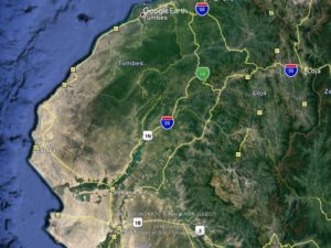
From Tumbes the route follows the coast to Piura.Piura to Chiclayo is 140 miles of desolate desert.Kept near the coast here in intermittent ag land and sand.North of Chimbote, Hwy 123 is a dirt road that cuts over to the Santa River and on to the state of Ancash and city of Huaraz to the west of the high peaks.
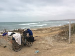
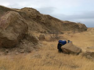
After Tumbes, Peru, ten miles of highway leads to the ocean and a scenic, winding 100 mile stretch of xeric but beautiful landscape. Got a bit of tailwind. As you turn inland again the scenes could be in Uinta Basin badlands, complete with myriad dirt roads taking off to well pads for oil drilling. Traffic light, camping easy. Spur roads that were mostly grown over with dry grass took off to well pads long in disuse. The first night out was as peaceful as anything I’d seen since Sonora. No bugs, not terribly hot, clear skies, dying wind in the evening, and best of all, desert-quiet.
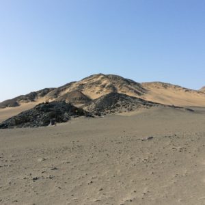
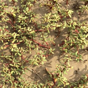
Reaching the ocean.Well pad camp.All this was at one time extensively explored for oil. There are only a handful of wells pumping today though. The grassy flats are old well pads.
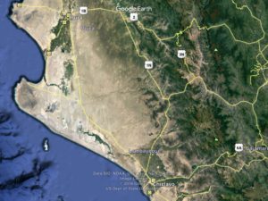
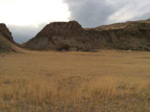
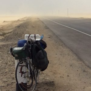
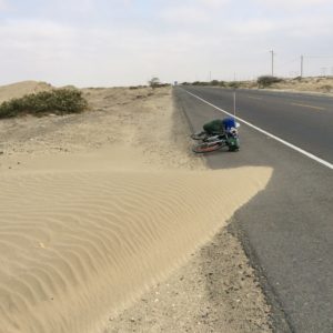
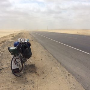
After a sublime night on the desert it all changed. The tail wind became a head wind and over the course of two more days vegetation disappeared altogether and was replaced by blowing sand. Some tough days of deafening, demoralizing headwind followed by nights of sandstorm that permeated the gear, food, clothing, bike. Ironically though, as far as grinding out continent, the straight roads made for making better time than in Ecuador or Colombia. At the camps, I chose not to pitch the tent, for fear it would be destroyed, and had to sleep out in it. One night was especially grim. I had planned on two long days for the 140 mile trek from Piura to Chiclayo (Lambayeque, actually), but ended up taking two nights and three long days with the headwind encountered. Fortunately, I brought extra water- over three gallons- and had enough to get by. On the upside there was coastal cloud cover and it wasn’t terribly hot- nights were even cold.
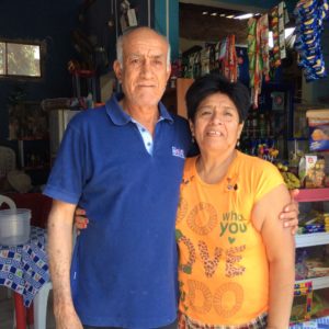
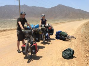
Getting ready for three days on the desert south of Piura.Jorge and Lua. They ran a cafe in Piura that served very good, home cooked food that I happened onto by accident. Inside there was a poster of themselves, children and grand children on their 65th anniversary. I told them my parents made it to 68 years but weren’t in as good of shape as them.
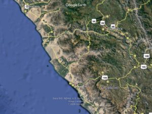
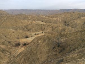
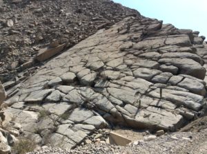
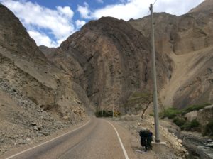
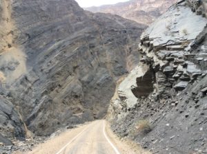
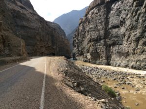
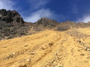
Beyond Chiclayo the wind continued until I turned inland south of Trujillo. A mostly smooth dirt road led to the Rio Santa and a hundred mile canyon topping out at the Callejón de Hauylas, the valley below the mountains of the Cordillera Blanca. Once on the Rio Santa, the road is one-lane paved but with such course aggregate in the asphalt that much of the preceding dirt road was smoother. The traffic dwindled to a car every ten minutes or so and the peaks and ridges on either side of the canyon rose many thousands of feet above- Cordillera Blanca to the east, Cordillera Negra to the west. Rock fall in the gorge can be dangerous particularly when afternoon winds pick, often strong enough to dislodge smaller pebbles. Riding the canyon on a rainy day wouldn’t be advisable.
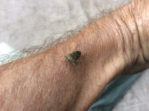
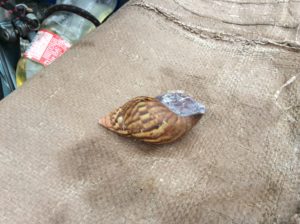
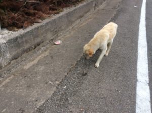
Blowing sand. That horizontal thing sticking out the back is a car antenna I used for some of the dogs. I’ve been chased by hundreds of them since crossing into Mexico but generally they run harmlessly along side. The Peruvian dogs, however, seem bigger and more threatening and I’ve been bitten twice, though they’ve yet to really break the skin. One dog globbed on to a pannier and made me drag him ten yards before I stopped and he ran off. Just raising the antenna in the air as they approach is usually all it takes to ward them off.
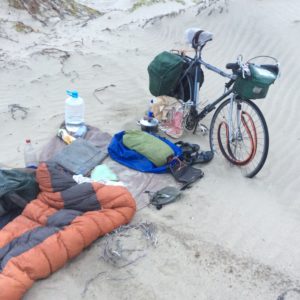
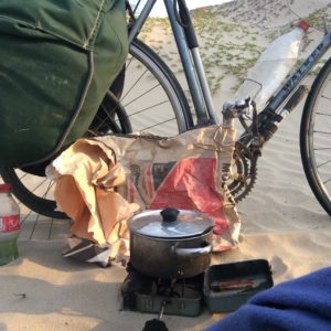
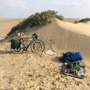
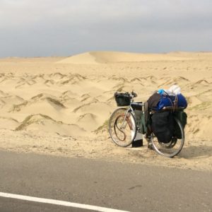
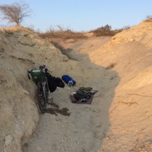
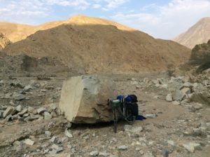
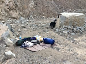
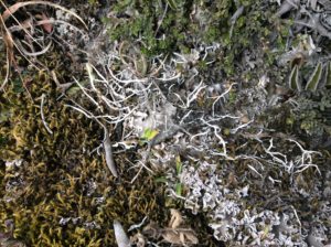
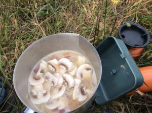
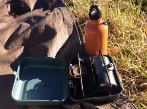
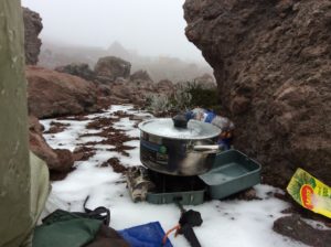
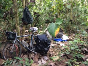
Sandy camp.I could usually find a piece of garbage to make a wind screen for the stove.Another sandy camp. The pingo-like sand mounds give some wind protection.
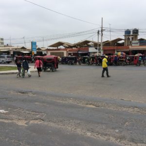
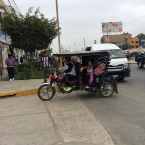
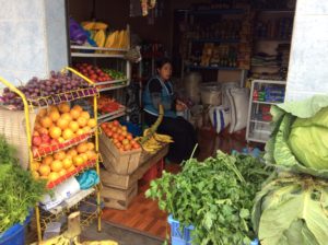
Lambayeque. Motorcycle drawn tuktuks out number cars in northern Peru.
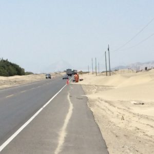
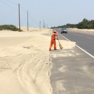
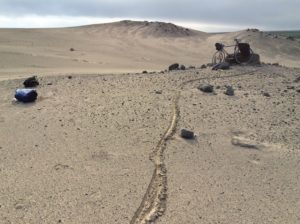
These guys are working with wheel barrows and shovels to stem what’s essentially a sand tide.I don’t know what he did but he’s sure getting punished for it.Camp in his little arroyo was fairly wind protected but such places were few.
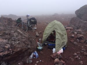
Blew hard all night here but not as much drifting sand.Mauro from Germany and Emilie from Quebec. They were coming from Ushuaia, Argentina and headed to Alaska. We swapped stories for 45 minutes out in the middle of nowhere.A great camp along the Rio Santa. Finally out of the wind.
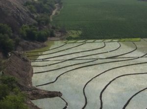
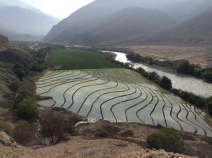
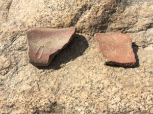
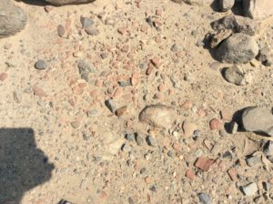
Rice paddies and corn from an extensive irrigation system fed by the Rio Santa and Cordillara Blanca glaciers.Lots of signs along the Rio Santa for archeology stuff. I hiked around a little at one place and found some pot sherds.
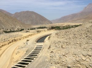
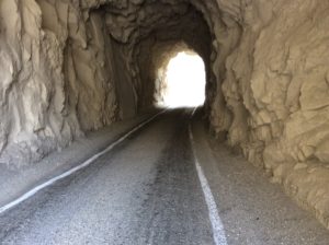
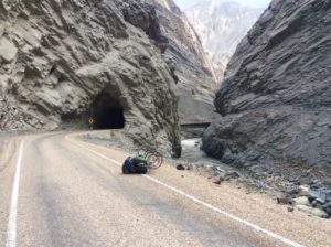
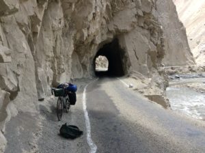
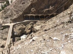
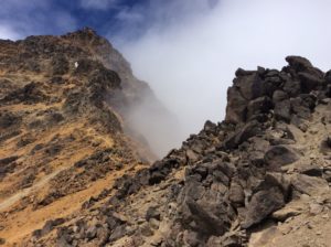
Irrigation diversionDid some fun 4th class scrambling on these granite slabs.Getting into the inner gorge of the Rio Santa. Thirty five tunnels over about 50 miles.
The inner gorge is called Canyon Del Pato or Duck Canyon.
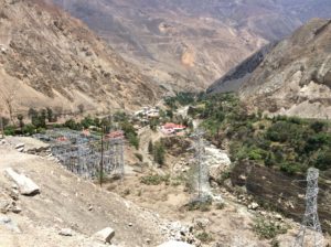
Huallanca, a hydroelectric town….…..with electricity generated here. Upstream 11 km and over 300 meters vertically, water from the Rio Santa is diverted into a sloping tunnel that acts as an enormous penstock to drive turbines. It generates electricity as a dam would but without water impoundment. A good portion of northern Peru gets power from here.
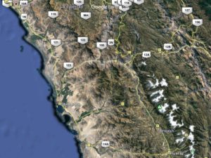
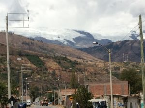
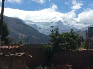
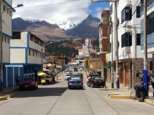
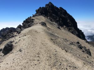
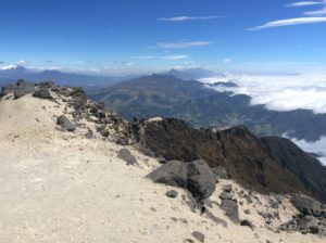
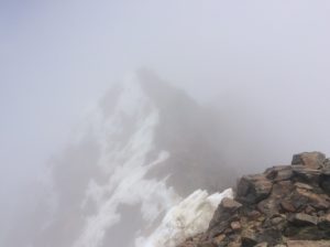
After several days riding, Canyon Del Pato widens into a valley and a string of towns. Huaraz is furthest upstream and is where I am now. The peaks of the Cordillera Blanca loom over the valley like a breaking wave. The highest is Peru’s high point, Huascaran, at 22,200 feet. The glaciers of this range are being particularly affected by climate change but you sure wouldn’t know it to look up at them. The summits are encased in Alaska-like ice caps.
Huaraz is a crossroads for South American climbing and everywhere there are shops and restaurants with climbing themes and dozens of guide services. The coffee shops are loaded with Americans and Europeans. Peru has attempted to require guides for its major summits the way Ecuador has, but policies have met with a bit more civil disobedience here from locals and foreigners alike. Much of the climbing is guided regardless and I imagine it’s a sort of golden age for picking a career as a guide. On the flip side, the real adventures of original exploration are essentially over and, aside from things like winged suit flying, guiding tourists may be all that’s left.
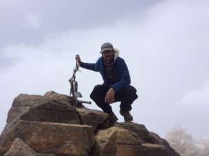
I had it in mind to give Huascaran a try but knew I needed to find a partner. Huascaran’s glaciers are far more involved than something like Chimborazo and it’s customary to have at least a couple of people on a rope when climbing through crevasses. When I got here, though, I learned that climbing had pretty well shut down on all the higher peaks for the season which usually ends in August. I learned as well that in late July an avalanche on Huascaran had killed several people and there evidently hasn’t been much activity on the mountain since then. I wasn’t too disappointed by the shutdown; hanging out in coffee shops, resting and eating seemed to be a far more attractive alternative.
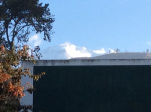
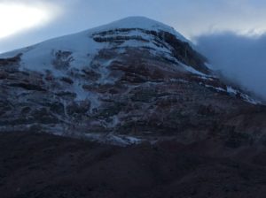
Summit of Huascaran. One of the few times it had been out of the clouds.
Huaraz
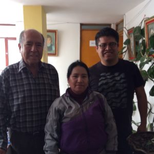
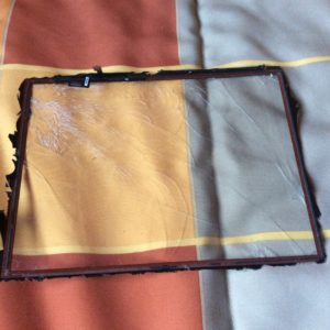
In Huaraz I needed also to look for tires and tubes for the bike as well as to order a new touch screen glass for the iPad. The iPad is in combination with a fold up keyboard that offers good protection, but it’s seen some tough duty. I’ve rolled over on it at night in the tiny tent a couple of times as well as trapping pieces of debris against the glass when folding it up. It became a spider web of cracks, amazingly it still worked, but needed to be fixed. There are several instructional videos on making the repair, which looked doable, but ordering a new glass wasn’t easy. Anything coming from outside of Peru takes several weeks to deliver (which I suppose precludes offers of care packages, but I sure appreciate the thought). I found this out only after ordering and paying for one already. I figured I could spend some time in the mountains waiting for delivery, but not for three weeks. After long hours on the Internet I found one in Lima but paying for it and arranging delivery required multiple telephone conversations that the folks at the hotel I’m staying, Soledad (www.lodgingsoledad) thankfully took care of. It took some doing, but the iPad’s like new again. I bought a second insulite sleeping pad and cut part of it up for a protective case, put together with duct tape.
Anibal, Liria and Francisco Romero at the Soledad B&B were a great help in getting the glass for the computer.Old iPad screen
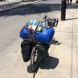
Finding bike parts hasn’t been simple either and the Colombian highways that were loaded with “Olympic trainees” has dwindled to few if any cyclists in Peru, bike shops following suit. In Colombia I never felt quite up to par as these guys would go flying passed me all decked out in cycling outfits and I’d be putting along, in shorts, Tevas, a dirty tee shirt and no helmet. I’m missing those guys now. But, after searching a while in Huaraz, I at least found a tire to carry as a spare. I may not get another chance at a full bike shop until Mendoza, Argentina, a couple of thousand miles away.
From here I’ll take backroads to Cusco over what looks to be beautiful but difficult terrain. Wi-Fi may be in short supply for a couple of weeks so I may be out of touch. Now that the austral spring equinox has past, I’m looking forward to longer days that will increase both from seasonal change as well as direction of travel to higher latitudes. I left Logan just after northern spring equinox and the “twelve-and-half-hour day” has followed me to here. There have been quite a few times I had energy for more miles but got stopped by darkness.
I’ve been a week in Hauraz and I’ll be glad to get moving again.
Well, I’ve made it to Peru after longer than intended travel through Ecuador. Not only does the mountainous terrain there make for low mileage days but the zig-zagging roads make progress towards the southern tip of the continent just about grind to a halt. The lack of progress really went unnoticed though, because it’s all very beautiful and continually interesting. The time slips away and overall seems to pass more quickly now then when I started out over five months ago. Several days were spent hiking two volcanos near Quito as acclimation for climbing Chimborazo, Ecuador’s highest point at 20,400 feet, then more days for a failed attempt on the mountain itself. On top of everything I’ve lost days to illnesses for which I have no explanation except mild food poisoning. Chicken is a Latin American mainstay- they eat it breakfast, lunch and dinner- and in Ecuador it will come with a meal whether you specifically order it or not. Biting into it and finding the meat not thru-cooked always leaves you wondering what the next week will bring.
From the hostel in Fuch’s Plaza in Quito I found a nearby outdoor shop that rented gear and functioned as what appeared to be a brokerage for guide services. Three or four years ago the Ecuadorian gov’t declared that its main summits can only be climbed with a guide. At the surface, the reasoning is safety related- the volcanos are subject to rockfall and avalanches for which there have been a few fatalities over the years- but I doubt they overlooked revenues and job creation. At the outdoor shop I tried to get a feel for what the policies were and how strict the enforcement. The owner at this particular shop was of course eager to sign me up and didn’t seem to care what kind of shape I was in. I told him I needed to acclimate first and his response was that he could provide a guide for that too. I said I’d get back to him.
I needed at some point to replace the camp stove I had lost way back in Mazatlán and the shop at Fuch’s plaza had a few. They were mostly butane canister type and though light weight and easy to use, required fuel canisters that are not readily available. I was looking to purchase another MSR Whisperlite, like the one I lost, or one that burned kerosine or diesel. The Whisperlite burned white gas, but ordinary gasoline would do in a pinch, and they can be jetted for diesel. Well, it turned out he had one stove there that would burn gasoline- it was a primus. Swedish-invented primuses are wonderful stoves, last indefinitely and can burn ordinary gasoline. They’re what I grew up with- my dad bought me a Svea (primus being the type, Svea the brand variation) in the early 1970’s that I used for many years. Aside from the fact that they stink (from an olfactory point of view) and are cumbersome to use, they’re heavy. The model he had for sale, similar to what we would have called an Optimus, was especially heavy because of the case it came with. These stoves are almost completely obsolete now in the U.S. and I’ve picked Sveas up at garage sales and thrift stores for just a few dollars in recent years. A couple occupy basement shelves at home where I’m wondering if Smithsonian might one day be interested in them. Even Whisperlites are becoming hard to find from retailers as the world seems to want the convenience of canisters. Well, this dinosaur was going for an obscene $100 but I went for the bird in hand. In retrospect I would have done better to order what I really wanted on the Internet (eBay) and waiting for delivery in a place conducive to hanging out for a few days……like Fuch’s Plaza. After paying $114 with tax I left with that sinking feeling of having been suckered.
The next day, without knowing what I was going to do about the “guide question”, I set out to climb Pichincha, a 15,700 foot peak near Quito. To get to it involved riding the bike first over a 12,000 foot pass, then dropping 1500 feet to the town of Lloa (‘yo-a) and then up dirt roads to as far as I could reasonably take the bike. A 4×4 track leads to a hut at over 14,000 feet, but I locked the bike to a fence post at about 12,000 feet. The majority of my gear was left at the hotel at Fuch’s Plaza, so I as traveling light.
LloaPichincha
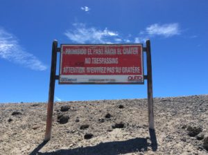
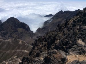
Pichincha erupted as recently as 2002 covering the town of Lloa in ash. Technically it has since been illegal to go to it’s top or into the crator, but warning signs were obviously being ignored. I had a beautiful hike over blocky pinnacles and surprisingly solid rock to the summit. Views to the west were a sea of clouds over the Pacific. To the east it was just the opposite, the high peaks of Cotopaxi and Cayambe hidden in clouds but surrounded by xeric plains of rain shadow. It was a long day, the most exciting of it finding my way back to the hotel through five or so miles of Quito’s labyrinth of streets after dark.
Warning sign at PichinchaPichincha’s calderaSummitLooking south to the Ilinizas, Cotopaxi to the left.
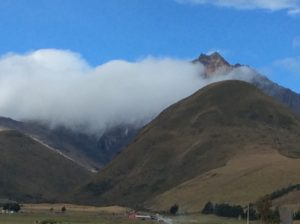
The next peak in the acclimation process was Iliniza which lay to the south. I left the Quito hostel and took the main highway for 30 miles to a turn off on an outlandishly bumpy cobblestone road that I had to walk the bike for much of. After 5 miles I found a good camp site close to the foot of Iliniza. Iliniza is on Ecuador’s list of “major peaks” and therefore required a guide, so I was keeping a low profile and camped out of sight in some pines. I got a 4 am start to hike Iliniza Norte, the lower of the volcano’s twin summits at just under 17,000 feet. I hiked the remaining road to a trail head and then on to just short of a permanently occupied refugio at about 15,000 feet. Nearing the hut shortly after day break, I noticed a trail leading to the right that appeared to be a bypass and, in a game of cat-and-mouse with the park people, took it. This turned out to be the main path the the north summit and I had a beautiful hike to it, all to myself. Way towards the bottom on the descent I encountered someone who appeared official and asked where I’d been but I just shrugged and told him I’d been a couple of kilometers up the trail.
Iliniza Norte is to the right in the notch in the trees, and Iliniza Sur left. Sur gets the brunt of the weather and is more difficult to climb.Iliniza NorteIliniza has a thousand or so foot slope of loose sand making for a little extra acclimation excersize.Looking towards the summit.Twin summitTopCooking on the new stove- life’s good!
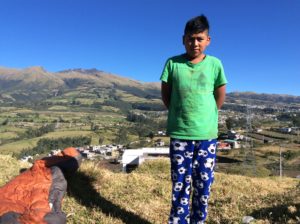
I spent another night in the secluded campsite and bounced back down the cobblestone the next morning. After a long day of relentless grades on the main highway to the south I threw down that evening, just at dark, on a less-than-ideal camp that overlooked some houses. Kids were playing games in a lighted, dirt street below but they could see me up there when I walked around and soon were all staring up at me. I tried to just ignore it and only wanted to get some sleep. Well, soon the father and mother, led by about ten children, climbed up the hill in the dark to see what I was about. After a minute or so of broken conversation, and seeing the bike a gear strewn about, the mother was insisting that I come down and stay with them! I explained I was “muy cansado” (very tired) and just wanted to get some sleep. The father understood perfectly and they thankfully left me alone. End of story, except for the next morning when one of the children, Anderson Caiza, brought me a two-litre bottle of water and helped hold the bike while I packed it.
Anderson
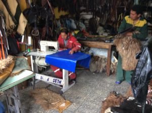
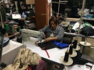
In one of the towns I passed I noticed a leather/saddlery shop that had a bolt of vinyl coated nylon visible near the entrance. This is the stuff climber’s haul bags and river bags are made of- really tough, waterproof material. The orange bag that I lay on top of the panniers was worn out to begin with (actually it was a bag that belonged to my dad) and was now pretty much a few tatters encasing a plastic garbage bag. I had these guys sew me up a new one, using the old bag as a pattern. It worked well enough, the price was right, $15, but one small problem in that the drawstring wouldn’t cinch the end closed on the much stiffer material. Oh well, I’d think about it and make modifications later. I moved on to the town of Ambato and the turnoff to go to Chimborazo. Dropping into town (Ambato is in an uncircumventable hole- it’s all the way down and all the way back up again) I noticed another sewing shop with more nylon-reinforced vinyl. The lady there made a flap for the bag to close it up and now I have a very good, waterproof sack for the sleeping bag and clothing. I also bought a yard or so more material that I’ll at some point replace the already deteriorating denim pannier I made back in Mexico.
New bag at the saddlery shop.Round II and an added flap.New (antient) stove. The orange fuel bottle I scored for 50 cents, but discovered it had a small hole (manufacturing defect). One of my cleverer solutions ever was to make the hole into a pour spout using a presta valve from an innertube, for which I keep several multi-patched spares. Gaskets came from the cut up tube and I did it all while sitting in camp- no awkward explanations at ferreterias (hardware stores) required. Too bad it still leaked afterwards- my pillow got the worst of it- and I threw the damned thing away. I found a plastic coke bottle works just as well and pours OK.
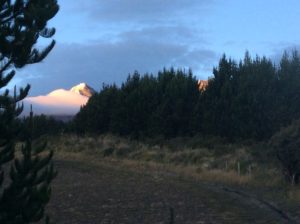
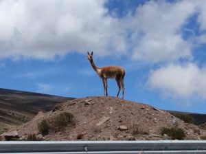
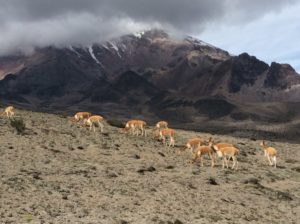
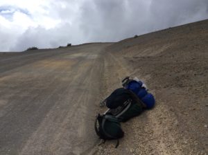
Leaving Ambato, I started up grades towards the refugios on Chimborazo. In two more days I went from 8000 feet to nearly 16,000 feet on the bike and was in an alpine world of sparse vegetation, rock, vicuñas and snow flurries. The lower refugio, Carrel Hut, had a good restaurant for reasonable prices and is where guided trips up the mountain are organized. One of the guides there first quoted me a price to climb Chimbo of $280, consistent with what I was told at the sports shop in Quito, but then upped it to $380 later that afternoon. I said I’d think about it, but then lost a day to being sick, probably from eating my own 3-day old leftovers from chicken that may have been tainted to begin with. Two days later I felt better and, though not 100%, took a walk in thick fog up to the next hut, Whymper, at 16,400 feet. I felt OK at Whymper, walked a little more and ended up pounding out hands-in-your-pockets trail to about 18,500 feet and near to where glacier travel begins. Seeing this much of the mountain and the remaining snow slog, the $380 didn’t seem worth it for what was essentially boot/ ice ax/ crampon rental.
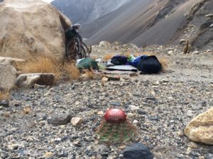
Vicuña.Vicuñas with Chimbo in back.Cycling at nearly 16,000 feet.Camp near the Carrel Hut
Returning to Carrel, the guide then quoted me $200, but I needed to confirm it with the manager of the huts when he arrived later that morning. For $200 I was again considering it, but when the manager arrived he upped it back to $280 and expressed displeasure that I went as far as I did up the mountain. I had had enough at that point and packed up to go.
One aside about Chimborazo is that relative to the center of the Earth, it’s the world’s highest mountain due to the equatorial bulge caused by centripetal forces of the spinning planet. It’s a contrived sort of statistic, but a draw for people wanting to climb it and one can see an impetus for commodification- if they can make a buck off it, they will. I should mention also that the oblate geometry also makes the mouth of the Mississippi River “higher” than its headwaters. As an excersize to the reader (many of whom I know can answer it), tell me why the Mississippi doesn’t flow the other way!
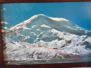
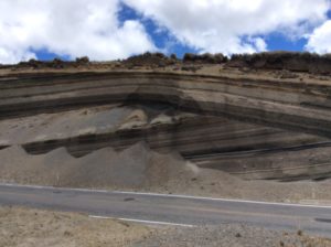
Photo showing routes on Chimborazo. I was on the “red line” to just below the last switchbacks before the long ridge to the summit.Chimborazo.Another puzzle: This is a textbook “angular unconformity” near Chimborazo. How did the upper group become folded (curved) while the lower stayed straight?Disposing of the meat that was making me sick was easy.
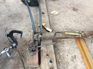
So, it was back down to about 10,000 feet and the city of Riobamba where I needed to attend to another important bicycle repair that came to my attention just before getting to Chimborazo. It seems the front forks became loose and began vibrating when I put the brakes on. Usually this means the headset bearings need tightening or replacing. On closer inspection I could see that the braze (weld) where the steering tube attaches to the fork crown had failed- the cobblestone road at Iliniza was the last straw. It really couldn’t come completely apart because the bolt & nut stem attaching the front brake locked the two pieces together. I couldn’t otherwise see any signs of cracking or deformation. It had to be repaired though, regardless. I was trying to imagine the best way to do it and finding some used forks was one option. If I were at home it would have been simple; re-braze the joint. Here, I needed to find both someone with an oxy-acetylene torch and the necessary skill to make the braze. Either that or somebody with an oxy-acetylene torch willing to let me do the braze for a price.
The fork crown- steering tube braze is probably about the trickiest joint in frame building. Among a few possibilities, brass brazing rod is the weld material generally used and I figured- hoped- it was common here along with the accompanying flux that allows the molten metal to flow. It all works similar joining copper plumbing fittings, but far less straightforward or user friendly. Temperatures are critical. The steel is “Colombus SL” (actually SLX- the latest and greatest circa 1980) and is an Italian chromium-molybdenum steel comparable to American 4140. If the steel gets too hot though it becomes brittle and is subject to cracking. In making a braze, molten brass travels to where the steel is the hottest and controlling it in the fork crown is especially tricky because of differences in the thickness of the steel- it’s easy make thin places hot, difficult to make thick places hotter than the thin places and woe is thee should a thin place get too hot.
After knocking on a few more-or-less unfriendly doors, I found a mechanic’s shop that was willing to “rent” his torch, and also had on hand a stick of brass rod and flux. After removing the forks from the bike and taking the brake stem out, the steering tube and crown could be pulled apart for cleaning. I could then inspect the joint and realized that I had only “tacked” the two together and never came back to fully braze it. Well, the “tack” lasted 35 years! The re-braze was a challenge; a little kid tripped over the torch hoses and knocked the forks down while I was brazing, and then the acetylene ran out. I told the owner I was out of gas and he said he’d be back in five minutes with more. As a little background and at the risk of boring everyone with all this technical stuff, Ecuadorian oxy-acetylene outfits use an oxygen bottle just like ours. The acetylene, however; comes from these ungainly tanks that look a little like potbelly stoves. I didn’t get a picture of one but if I again get the opportunity, I will. How he was going to exchange this massive tank with another in “cinco minutos” was beyond me, but I was hopeful. Sure enough, in five minutes he returned, not with another tank, but with what appeared to be a small plastic bag containing some rocks. He unbolted a swinging door low down on the tank, threw some rocks in, sealed it up, and voilà, I had gas again. I didn’t waste his time asking stupid questions, but did do some research when I got to a hotel later that night. Acetylene gas was traditionally made by heating calcium carbonate (limestone) in a kiln to make calcium carbide which can then be reacted with water to make acetylene gas in a ridiculously simple stoichiometry. In the past it was used to light everything from gas street lamps to coal miner’s carbide headlamps- cavers still use them today. (They went out of style in coal mines when it was discovered the lamps could ignite methane gas). How safe these welding tanks are I have no idea, but it’s how they do it in Ecuador.
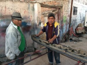
Brazing the fork crown.Nestor, the shop owner is on the right.Finished and installed.
With the forks brazed I reassembled the bike, but with no fine tuning adjustments, and went in search of a hotel. It was by then after dark and it took a while to find one. The next morning I took it all apart again and did some hand filing to get the headset race to seat properly and then hit it with spray paint. Between working on that and another round of illness, I spent three nights at the hotel. In that time, amazingly, I got to know the girl working the front desk a little and by the last day she had proposed marriage, and was willing to pay a price for it. She was a music student trying to get into a university in the U.S. and wanted citizenship. I answered by holding my wrists up in the manner of when being handcuffed.
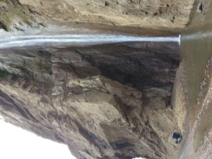
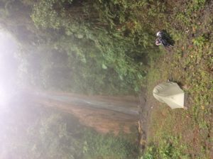
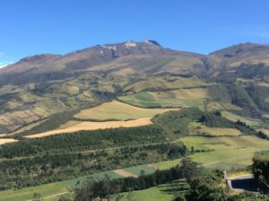
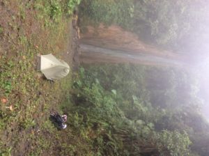
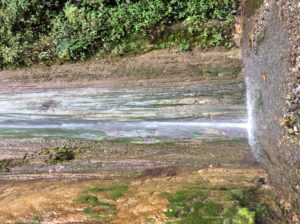
I left Riobamba still not feeing 100% and got less than 10 uphill miles to Cajabamba, and checked into another hotel. Next day I felt pretty normal again and did another day of uphill and then descended, finally, onto the Pacific side and into all those clouds I had been getting glimpses of ever since the rainshadows of Colombia. That first afternoon the fog was thick enough that I quit early when I saw a public lands-type sign indicating a side road to a waterfall. A two kilometer descent down a dirt road led to San Rafael Cascada and a beautiful, if out of the way, camp. The next day’s descent spit me out onto coastal plains and jungle. I had dropped from 12,500 feet to about 800 feet in less than 40 miles.
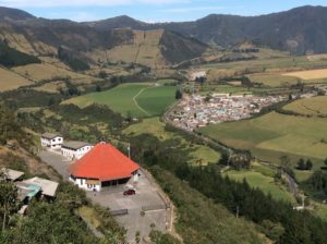
A few images of Cajabamba, a typical mountain town of Ecuador. I think the Native people are Quichuan, but there are really several native lineages in the “Sierra” that I’d like to learn more about.
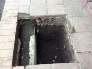
Watch where you walk at night. This is sidewalk but these hazards are in the streets as well where cars (and bikes!) can hit them.
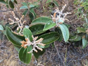
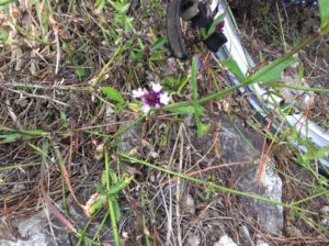
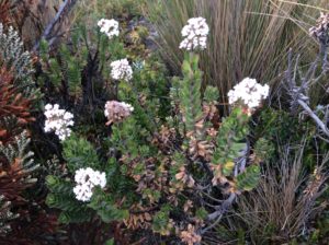
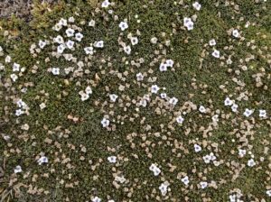
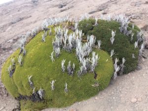
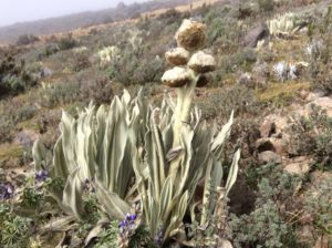
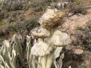
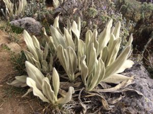
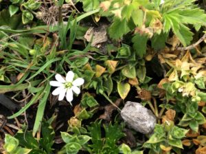
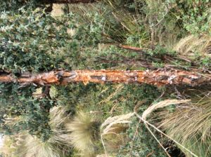
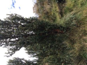
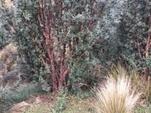
Quenual trees, or paper bark trees. A species of Polylepsis, they grow at elevations as high as 17,000 feet making them the world’s highest growing trees.These Quenuals are at about 12,500 feet.San Rafael Falls
After egressing the mountains there was nothing ahead but straight, flat, windless terrain that might be considered boring but here it was a welcome relief. I did back-to-back 90 mile days, had an easy border crossing into Peru (the place was practically vacated), and now I’m in Tumbes, Peru only a few miles from the coast. In a few days time I’ve gone from treeless páramo, to jungle, to desert scrub and now, almost without warning, the terrain is becoming pure desert. I’m anticipating Atacama-like desert sand within the next few days. Tomorrow I’ll have about a 10 mile ride to the coast proper, and am looking forward to a hundred or so miles of highway right on the ocean.
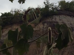
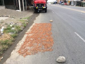
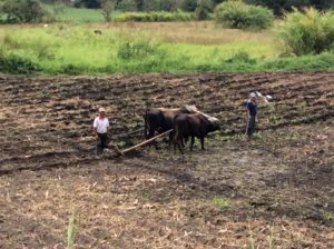
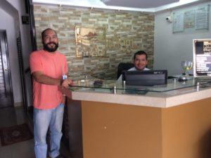
Back in jungle, not my favorite.Drying cocoa (as opposed to coca) grown in Ecuador’s coastal region.Plowing a field in Ecuador the old fashioned way.Bernardo and Rodolfo put up with me for a couple of days at the hotel in Tumbes while I worked on the blog.