Quito to Tumbes, Peru

September 10th, 2016

image

image


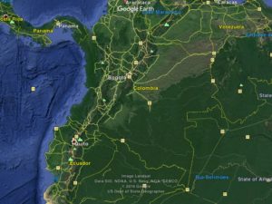
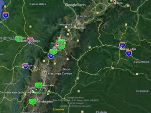
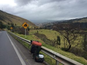
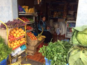
Well, I’ve made it to Peru after longer than intended travel through Ecuador.   Not only does the mountainous terrain there make for low mileage days but the zig-zagging roads make progress towards the southern tip of the continent just about grind to a halt.  The lack of progress really went unnoticed though, because it’s all very beautiful and continually interesting.  The time slips away and overall seems to pass more quickly now then when I started out over five months ago.  Several days were spent hiking two volcanos near Quito as acclimation for climbing Chimborazo, Ecuador’s highest point at 20,400 feet, then more days for a failed attempt on the mountain itself.   On top of everything I’ve lost days to illnesses for which I have no explanation except mild food poisoning.  Chicken is a Latin American mainstay- they eat it breakfast, lunch and dinner- and in Ecuador it will come with a meal whether you specifically order it or not.  Biting into it and finding the meat not thru-cooked always leaves you wondering what the next week will bring.

From the hostel in Fuch’s Plaza in Quito I found a nearby outdoor shop that rented gear and functioned as what appeared to be a brokerage for guide services.  Three or four years ago the Ecuadorian gov’t declared that its main summits can only be climbed with a guide.  At the surface, the reasoning is safety related- the volcanos are subject to rockfall and avalanches for which there have been a few fatalities over the years- but I doubt they overlooked revenues and job creation.  At the outdoor shop I tried to get a feel for what the policies were and how strict the enforcement.  The owner at this particular shop was of course eager to sign me up and didn’t seem to care what kind of shape I was in.  I told him I needed to acclimate first and his response was that he could provide a guide for that too.  I said I’d get back to him.

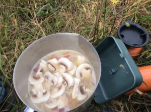
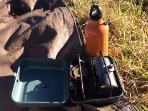
I needed at some point to replace the camp stove I had lost way back in Mazatlán and the shop at Fuch’s plaza had a few.  They were mostly butane canister type and though light weight and easy to use, required fuel canisters that are not readily available.   I was looking to purchase another MSR Whisperlite, like the one I lost, or one that burned kerosine or diesel.  The Whisperlite burned white gas, but ordinary gasoline would do in a pinch, and they can be jetted for diesel.  Well, it turned out he had one stove there that would burn gasoline- it was a primus.  Swedish-invented primuses are wonderful stoves, last indefinitely and can burn ordinary gasoline.  They’re what I grew up with- my dad bought me a Svea (primus being the type, Svea the brand variation) in the early 1970’s that I used for many years.  Aside from the fact that they stink (from an olfactory point of view) and are cumbersome to use, they’re heavy.  The model he had for sale, similar to what we would have called an Optimus, was especially heavy because of the case it came with.  These stoves are almost completely obsolete now in the U.S. and I’ve picked Sveas up at garage sales and thrift stores for just a few dollars in recent years.  A couple occupy basement shelves at home where I’m wondering if Smithsonian might one day be interested in them.  Even Whisperlites are becoming hard to find from retailers as the world seems to want the convenience of canisters.  Well, this dinosaur was going for an obscene $100 but I went for the bird in hand.  In retrospect I would have done better to order what I really wanted on the Internet (eBay) and waiting for delivery in a place conducive to hanging out for a few days……like Fuch’s Plaza.  After paying $114 with tax I left with that sinking feeling of having been suckered.

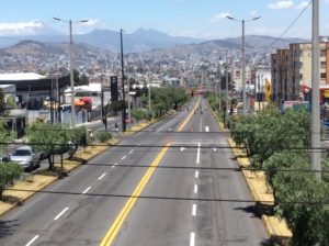
The next day, without knowing what I was going to do about the “guide question”, I set out to climb Pichincha, a 15,700 foot peak near Quito.  To get to it involved riding the bike first over a 12,000 foot pass, then dropping 1500 feet to the town of Lloa (‘yo-a) and then up dirt roads to as far as I could reasonably take the bike.  A 4×4 track leads to a hut at over 14,000 feet, but I locked the bike to a fence post at about 12,000 feet. The majority of my gear was left at the hotel at Fuch’s Plaza, so I as traveling light.

Lloa
Lloa
Pichincha
Pichincha

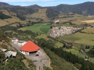
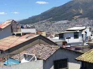
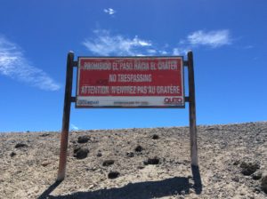
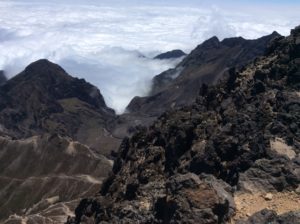
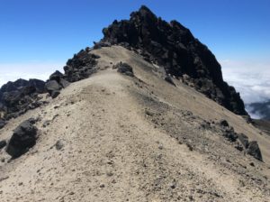
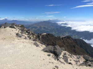
Pichincha erupted as recently as 2002 covering the town of Lloa in ash.  Technically it has since been illegal to go to it’s top or into the crator, but warning signs were obviously being ignored.  I had a beautiful hike over blocky pinnacles and surprisingly solid rock to the summit.  Views to the west were a sea of clouds over the Pacific.  To the east it was just the opposite, the high peaks of Cotopaxi and Cayambe hidden in clouds but surrounded by xeric plains of rain shadow.   It was a long day, the most exciting of it finding my way back to the hotel through five or so miles of Quito’s labyrinth of streets after dark.

Warning sign at Pichincha
Pichincha's caldera
Pichincha’s caldera
Summit
Summit
Looking south to the Ilinzias
Looking south to the Ilinizas, Cotopaxi to the left.

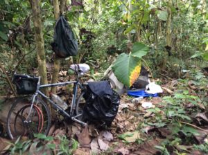
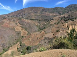
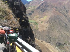
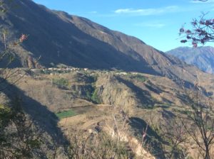
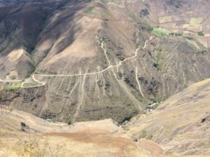
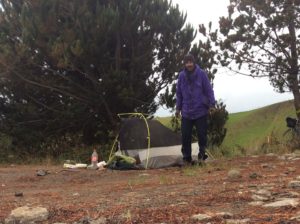
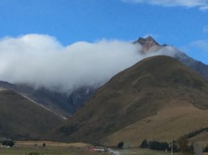
The next peak in the acclimation process was Iliniza which lay to the south. I left the Quito hostel and took the main highway for 30 miles to a turn off on an outlandishly bumpy cobblestone road that I had to walk the bike for much of.  After 5 miles I found a good camp site close to the foot of Iliniza.  Iliniza is on Ecuador’s list of “major peaks” and therefore required  a guide, so I was keeping a low profile and camped out of sight in some pines.   I got a 4 am start to hike Iliniza Norte, the lower of the volcano’s twin summits at just under 17,000 feet.  I hiked the remaining road to a trail head and then on to just short of a permanently occupied refugio at about 15,000 feet.  Nearing the hut shortly after day break, I noticed a trail leading to the right that appeared to be a bypass and, in a game of cat-and-mouse with the park people, took it.  This turned out to be the main path the the north summit and I had a beautiful hike to it, all to myself.  Way towards the bottom on the descent I encountered someone who appeared official and asked where I’d been but I just shrugged and told him I’d been a couple of kilometers up the trail.

Iliniza Norte is to the right in the notch in the trees, and Iliniza Sur left. Sur gets the brunt of the weather and is more difficult to climb.
Iliniza Norte
Iliniza Norte
Iliniza's slopes of loose sand.
Iliniza has a thousand or so foot slope of loose sand making for a little extra acclimation excersize.
Looking towards the summit.
Twin Summit
Twin summit
Top.
Top
Cooking on the new stove- life's good!
Cooking on the new stove- life’s good!

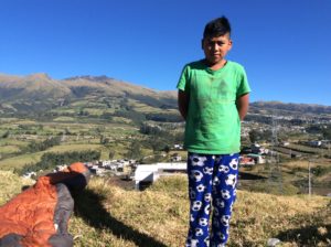
I spent another night in the secluded campsite and bounced back down the cobblestone the next morning.   After a long day of relentless grades on the main highway to the south I threw down that evening, just at dark, on a less-than-ideal camp that overlooked some houses.  Kids were playing games in a lighted, dirt street below but they could see me up there when I walked around and soon were all staring up at me.  I tried to just ignore it and only wanted to get some sleep.  Well, soon the father and mother, led by about ten children, climbed up the hill in the dark to see what I was about.  After a minute or so of broken conversation, and seeing the bike a gear strewn about, the mother was insisting that I come down and stay with them!  I explained I was “muy cansado” (very tired) and just wanted to get some sleep.  The father understood perfectly and they thankfully left me alone.  End of story, except for the next morning when one of the children, Anderson Caiza, brought me a two-litre bottle of water and helped hold the bike while I packed it.

Anderson
Anderson

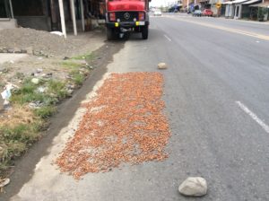
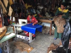
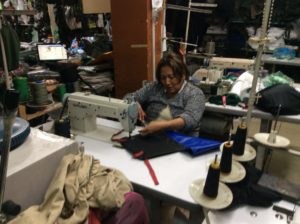
In one of the towns I passed I noticed a leather/saddlery shop that had a bolt of vinyl coated nylon visible near the entrance.   This is the stuff climber’s haul bags and river bags are made of- really tough, waterproof material.  The orange bag that I lay on top of the panniers was worn out to begin with (actually it was a bag that belonged to my dad) and was now pretty much a few tatters encasing a plastic garbage bag.  I had these guys sew me up a new one, using the old bag as a pattern.  It worked well enough, the price was right, $15, but one small problem in that the drawstring wouldn’t cinch the end closed on the much stiffer material.  Oh well, I’d think about it and make modifications later.  I moved on to the town of Ambato and the turnoff to go to Chimborazo.  Dropping into town (Ambato is in an uncircumventable hole- it’s all the way down and all the way back up again) I noticed another sewing shop with more nylon-reinforced vinyl.   The lady there made a flap for the bag to close it up and now I have a very good, waterproof sack for the sleeping bag and clothing.  I also bought a yard or so more material that I’ll at some point replace the already deteriorating denim pannier I made back in Mexico.

New bag.
New bag at the saddlery shop.
Round II and an added flap.
New (antient) stove. The fuel bottle I scored for 50 cents, but discovered it had a small hole (manufacturing defect). One of my cleverer solutions ever was to make the hole into a pour spout using a presta valve from a tube. Gaskets came from the tire and I did it all sitting in camp. Too bad it still leaked afterwards- my pillow got the worst of it.
New (antient) stove. The orange fuel bottle I scored for 50 cents, but discovered it had a small hole (manufacturing defect). One of my cleverer solutions ever was to make the hole into a pour spout using a presta valve from an innertube, for which I keep several multi-patched spares. Gaskets came from the cut up tube and I did it all while sitting in camp- no awkward explanations at ferreterias (hardware stores) required.  Too bad it still leaked afterwards- my pillow got the worst of it- and I threw the damned thing away.  I found a plastic coke bottle works just as well and pours OK.

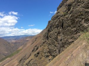
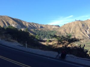
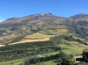
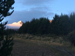
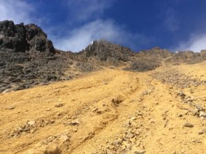
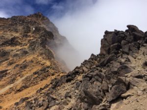
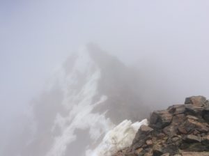
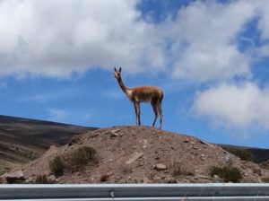
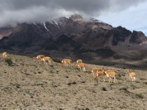
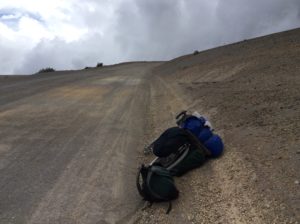
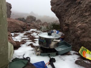
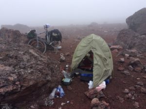
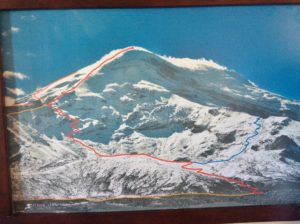
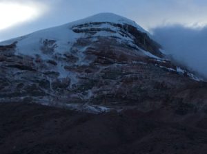
Leaving Ambato, I started up grades towards the refugios on Chimborazo.  In two more days I went from 8000 feet to nearly 16,000 feet on the bike and was in an alpine world of sparse vegetation, rock, vicuñas and snow flurries.  The lower refugio, Carrel Hut, had a good restaurant for reasonable prices and is where guided trips up the mountain are organized.  One of the guides there first quoted me a price to climb Chimbo of $280, consistent with what I was told at the sports shop in Quito, but then upped it to $380 later that afternoon.  I said I’d think about it, but then lost a day to being sick, probably from eating my own 3-day old leftovers from chicken that may have been tainted to begin with.  Two days later I felt better and, though not 100%, took a walk in thick fog up to the next hut, Whymper, at 16,400 feet.   I felt OK at Whymper, walked a little more and ended up pounding out hands-in-your-pockets trail to about 18,500 feet and near to where glacier travel begins.   Seeing this much of the mountain and the remaining snow slog, the $380 didn’t seem worth it for what was essentially boot/ ice ax/ crampon rental.

Vicuña.
Vicuña.
Vicuñas with Chimbo in back.
Cycling at nearly 16,000 feet.
Camp near the Carrel Hut

image

Returning to Carrel, the guide then quoted me $200, but I needed to confirm it with the manager of the huts when he arrived later that morning.  For $200 I was again considering it, but when the manager arrived he upped it back to $280 and expressed displeasure that I went as far as I did up the mountain.  I had had enough at that point and packed up to go.

One aside about Chimborazo is that relative to the center of the Earth, it’s the world’s highest mountain due to the equatorial bulge caused by centripetal forces of the spinning planet.  It’s a contrived sort of statistic, but a draw for people wanting to climb it and  one can see an impetus for commodification- if they can make a buck off it, they will.  I should mention also that the oblate geometry also makes the mouth of the Mississippi River “higher” than its headwaters.  As an excersize to the reader (many of whom I know can answer it), tell me why the Mississippi doesn’t flow the other way!

Photo showing routes on Chimborazo. I was on the "red line" to about the last switchback before the long ridge to the summit.
Photo showing routes on Chimborazo. I was on the “red line” to just below the last switchbacks before the long ridge to the summit.
Chimborazo.
Chimborazo.
Another puzzle: This is a textbook. Unconformity near Chimborazo. How did the upper group become folded while the lower stayed straight?
Another puzzle: This is a textbook “angular unconformity” near Chimborazo. How did the upper group become folded (curved) while the lower stayed straight?
Disposing of the meat that was making me sick was easy.

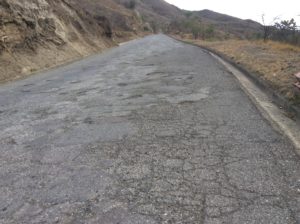
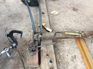
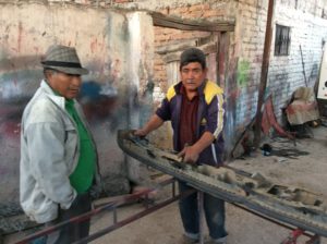
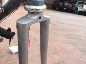
So, it was back down to about 10,000 feet and the city of Riobamba where I needed to attend to another  important bicycle repair that came to my attention just before getting to Chimborazo.  It seems the front forks became loose and began vibrating when I put the brakes on.   Usually this means the headset bearings need tightening or replacing.  On closer inspection I could see that the braze (weld) where the steering tube attaches to the fork crown had failed- the cobblestone road at Iliniza was the last straw.  It really couldn’t come completely apart because the bolt & nut stem attaching the front brake locked the two pieces together.  I couldn’t otherwise see any signs of cracking or deformation.  It had to be repaired though, regardless.  I was trying to imagine the best way to do it and finding some used forks was one option.  If I were at home it would have been simple; re-braze the joint.  Here, I needed to find both someone with an oxy-acetylene torch and the necessary skill to make the braze.  Either that or somebody with an oxy-acetylene torch willing to let me do the braze for a price.

The fork crown- steering tube braze is probably about the trickiest joint in frame building.  Among a few possibilities, brass brazing rod is the weld material generally used and I figured- hoped- it was common here along with the accompanying flux that allows the molten metal to flow.  It all works similar joining copper plumbing fittings, but far less straightforward or user friendly.  Temperatures are critical.  The steel is “Colombus SL” (actually SLX- the latest and greatest circa 1980) and is an Italian chromium-molybdenum steel comparable to American 4140.  If the steel gets too hot though it becomes brittle and is subject to cracking.  In making a braze,  molten brass travels to where the steel is the hottest and controlling it in the fork crown is especially tricky because of differences in the thickness of the steel-  it’s easy make thin places hot, difficult to make thick places hotter than the thin places and woe is thee should a thin place get too hot.

After knocking on a few more-or-less unfriendly doors, I found a mechanic’s shop that was willing to “rent” his torch, and also had on hand a stick of brass rod and flux.  After removing the forks from the bike and taking the brake stem out, the steering tube and crown could be pulled apart for cleaning.  I could then inspect the joint and realized that I had only “tacked” the two together and never came back to fully braze it.  Well, the “tack” lasted 35 years!  The re-braze was a challenge; a little kid tripped over the torch hoses and knocked the forks down while I was brazing, and then  the acetylene ran out.  I told the owner I was out of gas and he said he’d be back in five minutes with more.  As a little background and at the risk of boring everyone with all this technical stuff, Ecuadorian oxy-acetylene outfits use an oxygen bottle just like ours. The acetylene, however; comes from these ungainly tanks that look a little like potbelly stoves.  I didn’t get a picture of one but if I again get the opportunity, I will.  How he was going to exchange this massive tank with another in “cinco minutos” was beyond me, but I was hopeful.  Sure enough, in five minutes he returned, not with another tank, but with what appeared to be a small plastic bag containing some rocks.  He unbolted a swinging door low down on the tank, threw some rocks in, sealed it up, and voilà, I had gas again.  I didn’t waste his time asking stupid questions, but did do some research when I got to a hotel later that night.  Acetylene gas was traditionally made by heating calcium carbonate (limestone) in a kiln to make calcium carbide which can then be reacted with water to make acetylene gas in a ridiculously simple stoichiometry.  In the past it was used to light everything from gas street lamps to coal miner’s carbide headlamps- cavers still use them today.  (They went out of style in coal mines when it was discovered the lamps could ignite methane gas).  How safe these welding tanks are I have no idea, but it’s how they do it in Ecuador.

Brazing the fork crown.
Nestor, the shop owner.
Nestor, the shop owner is on the right.
Finished and installed.

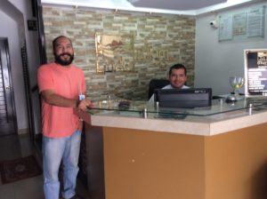
With the forks brazed I reassembled the bike, but with no fine tuning adjustments, and went in search of a hotel.  It was by then after dark and it took a while to find one.  The next morning I took it all apart again and did some hand filing to get the headset race to seat properly and then hit it with spray paint.  Between working on that and another round of illness, I spent three nights at the hotel.  In that time, amazingly, I got to know the girl working the front desk a little and by the last day she had proposed marriage, and was willing to pay a price for it.  She was a music student trying to get into a university in the U.S. and wanted citizenship.  I answered by holding my wrists up in the manner of when being handcuffed.

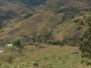
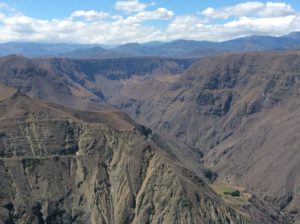
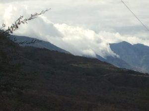
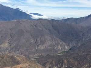
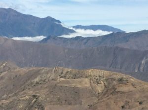
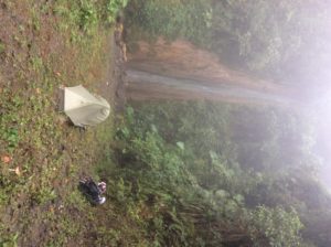
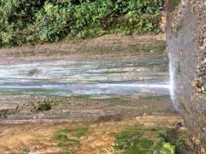
I left Riobamba still not feeing 100% and got less than 10 uphill miles to Cajabamba, and checked into another hotel.  Next day I felt pretty normal again and did another day of uphill and then descended, finally, onto the Pacific side and into all those clouds I had been getting glimpses of ever since the rainshadows of Colombia.  That first afternoon the fog was thick enough that I quit early when I saw a public lands-type sign indicating a side road to a waterfall.  A two kilometer descent down a dirt road led to San Rafael Cascada and a beautiful, if out of the way, camp.  The next day’s descent spit me out onto coastal plains and jungle.   I had dropped from 12,500 feet to about 800 feet in less than 40 miles.

A few images of Cajabamba, a typical mountain town of Ecuador. I think the people are Quichuan, but there are really several native lineages.
A few images of Cajabamba, a typical mountain town of Ecuador. I think the Native people are Quichuan, but there are really several native lineages in the “Sierra” that I’d like to learn more about.

image


Watch where you walk at night. This is sidewalk but these hazards are in the streets as well where cars (and bikes!) can hit them.

imageimageimageimage

Quenual trees. A species from Polylepsis, these trees grow to the world's highest elevations, as much as 17,000 feet.
Quenual trees, or paper bark trees.  A species of Polylepsis, they grow at elevations as high as 17,000 feet making them the world’s highest growing trees.
These Quenuals are at about 12,500 feet.
San Rafael Falls
San Rafael Falls

image

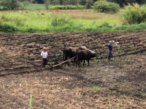
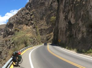
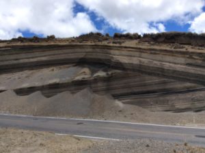
After egressing the mountains there was nothing ahead but straight, flat, windless terrain that might be considered boring but here it was a welcome relief.  I did back-to-back 90 mile days, had an easy border crossing into Peru (the place was practically vacated), and now I’m in Tumbes, Peru only a few miles from the coast.  In a few days time I’ve gone from treeless páramo, to jungle, to desert scrub and now, almost without warning, the terrain is becoming  pure desert.  I’m anticipating Atacama-like desert sand within the next few days.  Tomorrow I’ll have about a 10 mile ride to the coast proper, and am looking forward to a hundred or so miles of highway right on the ocean.

Back in jungle, not my favorite.
Drying cocoa (as opposed to coca) grown in Ecuador's coastal region.
Drying cocoa (as opposed to coca) grown in Ecuador’s coastal region.
Plowing a field in Ecuador the old fashioned way.
Bernardo and Rodolfo put up with me for a couple of days at the hotel in Tumbes.
Bernardo and Rodolfo put up with me for a couple of days at the hotel in Tumbes while I worked on the blog.

Cali to Quito, Ecuador

August 24th, 2016

Overview
Overview
Cali to Pasto
Cali to Pasto
Pasto to Quito
Pasto to Quito

The first 25 miles south of Cali follow the flat and easy  bottom land of the Cauca Valley to its southern terminus at Santander.  After that the terrain becomes mountainous.  The city of Popayán lies at over 5000 feet, only 2000 above Cali, but a merciless 50 miles of up and down to get there.  This was only the beginning.  Getting to Quito would see me going from low points of 3 and 4000 ft, descending once to nearly a 1000 feet, up to as high as 10,500 feet a total of 6 times before reaching Quito, Ecuador.  The pitiless hills would drop to arid, desert climate, with prickly pear and pitaya cactus, then climb, over sometimes two-day rides, to genuinely cold and rainy summits in páramo habitat.

The highway to Popayán from Santander is lined with houses and small farms built long ago in a manner that could not have foreseen the modern world’s overwhelming amount of truck, automobile and motorcycle traffic.  The noise I can see locals getting used to, but living with the terrible air along the crowded highway would not be enviable.  On the bike,  pollution from immediate traffic has been a problem off and on since leaving the U.S. where our emission standards really make a positive difference.  Many of the motorcycle riders here, which at least equal the number of cars, wear respirators.   It’s not always that bad, but I’m considering getting a respirator to have when it is.  La Linea (see previous post) was the worst.

Motorcycle transportation throughout Latin America is popular and the methods of hauling stuff hilarious.  They’re typically not big bikes, in the 125cc-175cc range, and what we would have called “enduros” way back when.  I could never have the camera ready when the time was right, but some of the funnier ones have been:  A family of four- mom, dad, juvenile and infant all loaded on;  grandson giving grandmother a ride with grandmother riding sidesaddle and not looking especially happy about things; rider with passenger reaching his arms behind and toating a wheel barrow filled with cargo and going a good 30 mph;  rider with passenger carrying a load of PVC pipe in 15 foot lengths over their shoulders; young couple with a medium sized dog squeezed between them; motorcycles pulling pickup-sized trailers, one I remember loaded to about eight feet high;  good motorcycle towing broken down motorcycle;  one motorcycle cop off his bike so he could push-start a second motorcycle cop (only in Guatemala).

At the town of Tunia, nearing Popayán,  I encountered more protests, this time a group called Asoinca had blocked traffic.  Cars, motorcycles and trucks were lined up for a couple of miles.  This was more of a one-day affair and cops appeared to be there more as a perfunctory presence.  People were all smiles.  They weren’t letting bicycles through, however; so I was stuck for over an hour until I finally reconnoitered a way passed.  I had lunch on some shady roadside grass and while I was eating a nearby property owner came over and introduced himself.   He turned out to be a limnologist  from Naples, Italy.  He spoke enough English that we could communicate pretty well but I never got the whole story of how he ended up in this out-of-the-way corner of Colombia doing some sort of independent work with fresh-water fish.  He was shaking his head at the protesters saying that this was more of a social gathering of middle-upper-class leftists who might be called drugstore revolutionaries by an Americano.

image

Colombiano protests
Colombiano protests
Limnologist Alessandro Della Porta, right, with friends Fredy (red shirt) and Miguel.
Alessandro's
Alessandro’s facilities.

I found a way through the protesters and subsequent line of cars and trucks coming the other way. I got several miles of traffic-free travel till another major road intersected.  I made it to Popayán and scrambled for Wi-Fi to send in some answers to an email interview for an article about the trip for my hometown newspaper in Logan, Utah.  That took till after dark and I ended up in a somewhat spendy, but very nice, hotel in Popayán.

After Popayán a long grade and descent took me to the 1000 foot low point.  Two days climb from there got me to Pasto, named after an indigenous culture, and a picturesque city at 8300 feet.  Pasto lies at the foot of the active volcano, Volcán Galeras, which erupted as recently as 1993 and killed six scientists who were descending into the crater to collect gas samples.  From Pasto, continued grade leads over a 10,000 foot pass then down again to about 4000 feet, then up to Ipiales and the border with Ecuador.  From Ecuador’s border town of Tulcán you climb to 10,500 feet, then down to about 5000, then up to 7300 and the town of Ibarra.  From Ibarra, where I spent two days in a decent $10-a-night hotel recouping, you continue a climb to 10,000 again, then back down to about 6,000, then up to the final 9,400 at Quito. If your having a hard time following all this, don’t worry, so am I- the innumerable hills have become a blur and there’s more to come.  They’ve been unbelievably long and my knees could use one more gear to down-shift into.   To endure them you fall into a sort of meditation where your putting the minimum effort possible to just keep the bike in motion while trying to let your mind wander to where ever it can to pass the time.  I write the blog, practice Spanish, plan what I need in the next town, get mad at the last bus that cut it way closer than he had to.  It’s all about patience, but though time may pass slowly, it’s not boring. Going through the vegetation transitions is always interesting and with hills comes views. In the clear skies here, which contrast remarkably with the smokey skies of Mexico and thick, sea level air of Central America, the views are incredible. Getting to the top of anything is always satisfying.

Rosio Inboquingo was a the museum curator for a Mastadon excavation and indigenous cultures archeology near San Gabriel, Ecuador. She gave me a hour long 1-on-1 tour. Sorry about the unflattering photo.
Rosio Inboquingo was the museum curator for a Mastadon excavation and indigenous cultures archeology near San Gabriel, Ecuador. She gave me an hour long 1-on-1 tour.
Highway I've descended from way above.
Highway I just descended is way above.
The highway is just visible on the profile.
The road is just visible on the profile after exiting the tunnel pictured below.

image image

Pasto, Colombia
Descending to Pasto, Colombia

image

imageimageimage

A good portion of the grades go through FARC territory. This bridge was heavily guarded. I took pictures looking into the slot beneath the bridge. The guards made it clear I wasn't to photograph them.
A good portion of the grades go through FARC territory. This bridge was heavily guarded, complete with sandbag bunkers.  I took pictures looking into the slot beneath the bridge, but the guards made it clear not to photograph anything else.
Marina. Somewhere on one of these grades she had a fruit stand set up for which I got a few things. She refused payment! I told her I'd post her picture on the Internet but she had no knowledge of how to see it.
Marina.  Somewhere on one of these grades she had a fruit stand set up for which I got a few things.  She refused payment!  I told her I’d post her picture on the Internet but she had no knowledge of how to see it.

image

image

After dropping to the tunnel and beyond, you climb to, and follow, the dark plateau in the upper middle of the photo.
Side road to a farm.

image

Another scorching day at the equator.
Camping in pines at the pass above Tulcán.  Another scorching day at the equator.

imageimage

The valley of is a classic example of rain shadow. All through mist from the Pacific comes to the brink ov the valley and stops.
The valley low points are classic examples of rain shadow.  Mist rolls in like a breaking wave from the Pacific but stops at the brink of falling into the valleys, leaving a desert-dry climate.
Ibarra and 20,000 foot Mt Cayembe.
Ibarra and 19,000 foot Mt Cayembe.

I stopped in the town of Otavala, 20 miles beyond Ibarra, looking for a grocery store.  They had a Saturday bazar going that filled the streets for several blocks in all directions.  Of the many that sold clothing, I noticed for the first time since leaving the US “pile” jackets that are worn by climbers and folks in colder climates. I bought a jacket, pile pants and longjohns at DI prices.

image

Jonathan, Andres and Lino. Jonathan, originally from Prince Edward Island, has a leather working business in Otavalo and had a booth at the Bazar. He gave me a place to park the bike while I bought a pile jacket, et al. Andres (and Lino!) are Ecuadorian.
Jonathan, Andres and Lino.  Jonathan, lower photo, left, is originally from Prince Edward Island.  He has a leather working business (JJLeathersmith.com) in Otavalo and had a booth at the Bazar. He gave me a place to park the bike while I went in search of cold-weather clothing. Andres (and Lino!) are Ecuadorian.
I shared a camp (not the tent!) virtually on the equator with this Andean version of a black widow. Very colorful.
I shared a camp (but not the tent!) with this Andean version of a black widow. Very colorful.  The camp is just a couple of miles north of the Equator.

image

image

Huge moth
Huge moth
Last grade to Quito....
Last grades to Quito….
....and pulling into the City. It was Sunday and the middle lanes were closed to traffic and loaded with bikes, peds and dog walkers.
….and pulling into the City. It was Sunday and the middle lanes were closed to traffic and loaded with bikes, peds and dog walkers.  Cotapoxi is at upper left.

image

I’m in Quito now for a couple of days tracking down bike parts (never simple) and a stove for the one I lost with the pannier in Mazatlán.  The luxury of a stove I didn’t miss in tropical jungle habitat where hot food just wasn’t attractive, but I’ll now be at higher elevations for a good part of the next few months and it would be nice to heat water for morning coffee and cooking dinner.  Jonathan, from Otavalo, directed me to Quito’s yuppie enclave, Foch’s Plaza, where those types of things are sold along with having a Champs Elysees of coffee shops and restaurants.  I’m enjoying the place, but parting with a bunch of money in the process.  I have a backlog of flower photos that I’ll put out in another plant segment at some point.

For all the coffee lovers I’ll leave you with info from Fernando Mendivil (and Alfredo Islas) of Los Alamos Cafe (“The Poplars”) for some of what goes into processing coffee beans. These guys are totally committed to the world of COFFEE and brew it as well as I’ve seen the entire trip. If you get to Navojoa, Mexico (Sonora) stop in!

WET PROCESS
In the wet process, the fruit covering the seeds/beans is removed before they are dried. Coffee processed by the wet method is called wet processed or washed coffee. The wet method requires the use of specific equipment and substantial quantities of water.

The coffee cherries are sorted by immersion in water. Bad or unripe fruit will float and the good ripe fruit will sink. The skin of the cherry and some of the pulp is removed by pressing the fruit by machine in water through a screen. The bean will still have a significant amount of the pulp clinging to it that needs to be removed. This is done either by the classic ferment-and-wash method or a newer procedure variously called machine-assisted wet processing, aquapulping or mechanical demucilaging:

In the ferment-and-wash method of wet processing, the remainder of the pulp is removed by breaking down the cellulose by fermenting the beans with microbes and then washing them with large amounts of water. Fermentation can be done with extra water or, in “Dry Fermentation”, in the fruit’s own juices only.

The fermentation process has to be carefully monitored to ensure that the coffee doesn’t acquire undesirable, sour flavors. For most coffees, mucilage removal through fermentation takes between 24 and 36 hours, depending on the temperature, thickness of the mucilage layer, and concentration of the enzymes. The end of the fermentation is assessed by feel, as the parchment surrounding the beans loses its slimy texture and acquires a rougher “pebbly” feel. When the fermentation is complete, the coffee is thoroughly washed with clean water in tanks or in special washing machines.[4]

In machine-assisted wet processing, fermentation is not used to separate the bean from the remainder of the pulp; rather, this is done through mechanical scrubbing. This process can cut down on water use and pollution since ferment and wash water stinks. In addition, removing mucilage by machine is easier and more predictable than removing it by fermenting and washing. However, by eliminating the fermentation step and prematurely separating fruit and bean, mechanical demucilaging can remove an important tool that mill operators have of influencing coffee flavor. Furthermore, the ecological criticism of the ferment-and-wash method increasingly has become moot, since a combination of low-water equipment plus settling tanks allows conscientious mill operators to carry out fermentation with limited pollution.

Any wet processing of coffee produces coffee wastewater which can be a pollutant. Ecologically sensitive farms reprocess the wastewater along with the shell and mucilage as compost to be used in soil fertilization programs. The amount of water used in processing can vary, but most often is used in a 1 to 1 ratio.

After the pulp has been removed what is left is the bean surrounded by two additional layers, the silver skin and the parchment. The beans must be dried to a water content of about 10% before they are stable. Coffee beans can be dried in the sun or by machine but in most cases it is dried in the sun to 12-13% moisture and brought down to 10% by machine. Drying entirely by machine is normally only done where space is at a premium or the humidity is too high for the beans to dry before mildewing.

When dried in the sun coffee is most often spread out in rows on large patios where it needs to be raked every six hours to promote even drying and prevent the growth of mildew. Some coffee is dried on large raised tables where the coffee is turned by hand. Drying coffee this way has the advantage of allowing air to circulate better around the beans promoting more even drying but increases cost and labor significantly.

After the drying process (in the sun or through machines), the parchment skin or pergamino is thoroughly dry and crumbly, and easily removed in the hulling process. Coffee occasionally is sold and shipped in parchment or en pergamino, but most often a machine called a huller is used to crunch off the parchment skin before the beans are shipped.

Saludos Steve.

Keep the good times rolling !!!