Costa Rica to Costa Rica

July 24, 2016

Lake Arenel area
Lake Arenel area
San Jose to San Isidro

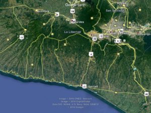
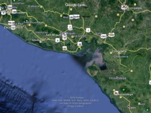
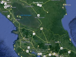
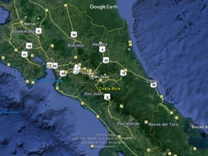
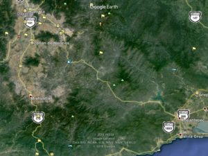
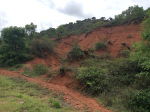
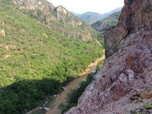
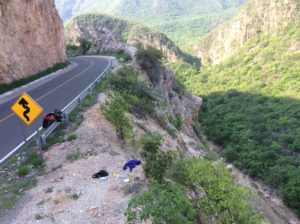
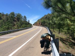
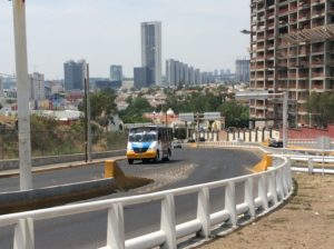
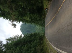
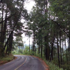
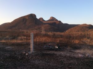
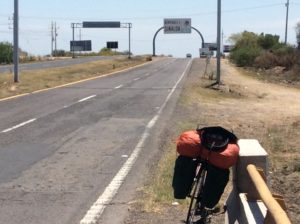
Well, I’m still in Costa Rica.  It’s turning out to be a hard place to leave and for two reasons; i) there’s a lot to see and do here and ii) the roads to get to any of it are unbelievably hilly and winding.  I’ve tried to plot as linear a route through it as possible, but regardless  have put in double the miles required to cross El Salvador, a country of similar size.  A day’s ride encounters continuous Sisyphean up/down hills with one section having the high point of the Pan American highway for North America at just under 11,000 ft.  This pass is considered the main highway, and the shortest route thru, but can be detoured by a coastal route which I would have taken had I realized its height.  Having done it, I’m glad I did- it was incredible.

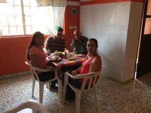
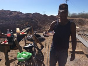
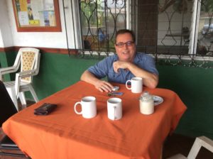
I forgot to mention in the last post that not far into Costa Rica I passed the first fellow cross-country bike traveler I’ve seen yet, he headed north. We stopped and talked. His name was Jóse (joe-see) and he’s Brazillian. He had traveled from Ushuaia, the southern tip of Argentina and where I’m theoretically headed. Jóse’s heading for Alaska. I managed to lose his contact information before I could get it into the computer so, Jóse, if you log onto cyclingagain.com send me a note with your info.  If you go through Logan, Utah I’ll line you up with 20 different people you can stay with.

Jose
Jose

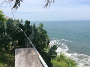
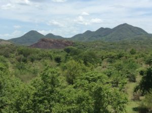
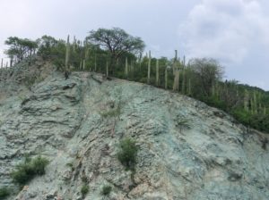
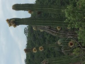
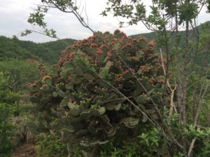
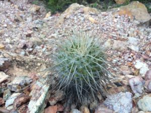
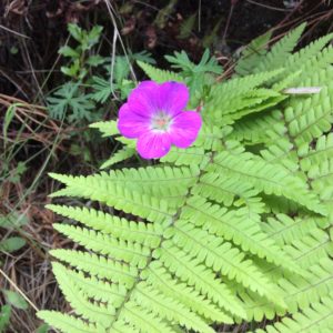
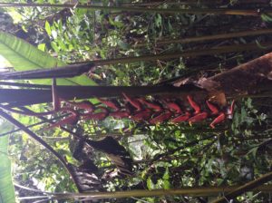
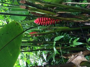
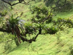
Guatamala leads the world in having the greatest number of endemic species, that is, species that occur only in Guatamala.  Costa Rica though, leads the world in overall biodiversity having 4% of the Earth’s species while having only 0.03% of the land mass.    Much of the rainforest is still unexplored and new species are discovered routinely.  Being an object of world wide study as well as having a thriving tourist industry has kept the country’s natural habitat well insulated from extractive industries.  About 25% of the country is protected as parks and preserves.  Any logging of wild habitat has been essentially eliminated in the 21st century.

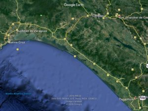
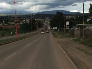
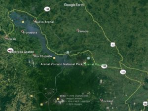
Several people recommended Bosque Nuboso Monteverde National Park but to get there meant not only hills but also retracing the route to get back to the main highway.  I settled instead for a route around Lake Arenal followed by a tertiary highway that clipped a corner of the cloud forest habitat of Monteverde between the towns of Fortuna to San Ramone.  From there main highways took me to San Jose, Costa Rica’s capitol.

Andre Brousseau......
Andre Brousseau kept me well entertained in the town of Neuevo Arenal on Lake Arenal.  He’s from Quebec and has lived in Vancouver, BC, but has recently set up shop in Costa Rica as a realtor.  He had a few insights into the myriad computer issues I’ve had.
....and his real estate company.
Andre’s real estate company.
Hitchhiker
Hitchhiker

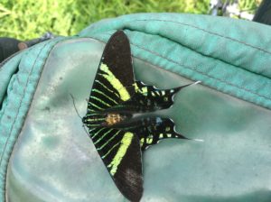
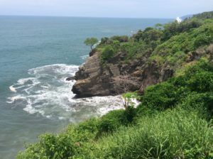
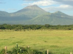
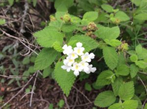
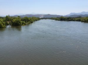
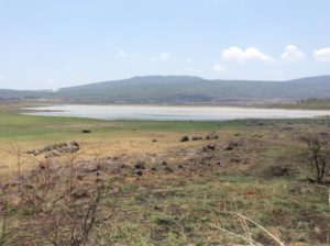
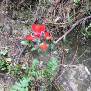
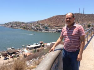
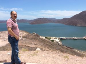
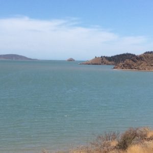
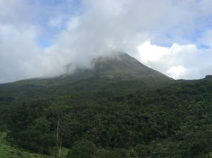
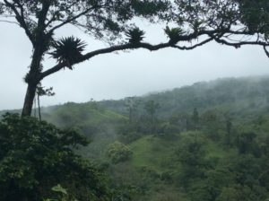
Lake Arenal is actually a reservoir who’s  impoundment has been expanded over the years, with its present size completed in 1979.  Built mostly for hydroelectricity potential, it supplied Costa Rica with 70% of its power in 1979.  Growth in consumption has reduced that percentage to around 15% today.   While in the Lake Arenal area I spent an evening and morning hiking around Volcán Arenal in rainforest habitat that leads into lava flows higher on the volcano’s flanks.  Arenal began a slow, depositional eruption in 1968 and continued poring debris 4000 feet down its west side till December, 2010. Climbing it is illegal but locals have been to the summit since it stopped erupting, although at the risk of breathing toxic gasses.  A national park is on the volcano’s west side but I ended up paying a pricey $8 fee to hike in a privately owned system of trails that abut the park and are more accessible to a bicycle traveler.  I saw rainbow-billed toucans, a scarlet-rumped tanager, a glimpse of a spider monkey, crested guans, chachalacas.  There are several species of chachalacas, but one that’s been with me since Sonora has a call as penetrating as a sandhill crane but with distinct notes that defy description.  Maybe like a rooster trying to mimic the catcalls of a shrike- you’d just have to hear one.  I first heard them when I was sick north of Mazatlán where they added a bit of bizarreness to a delerious night in the gravel pit.

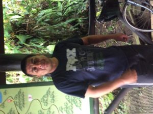
There was a building at the trailhead where the fees were collected by a guy who was well versed in the natural sciences of the area, Walter Stellar. He spent quite a bit of time with me explaining birds and plants. Evidently ecotourism has evolved in Costa Rica to the point where younger folks go to school for a couple of years for accreditation as a tour guide. They’re given a solid background in binomial taxonomy for plants, birds and mammals and learn some of the science behind adaptations.  They’ll know the basics of geology and human history.

Walther Sellar
Walter Stellar
Mount Arenal
Mount Arenal

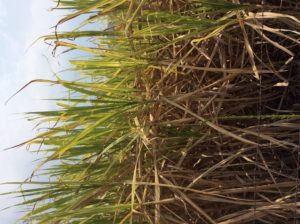
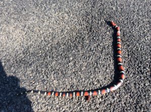
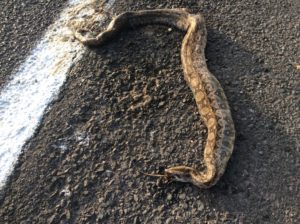
Venomous fer-de-lances, pit vipers like our rattle snakes- but no rattles- are found in the area and a few folks had just returned from photographing one near the trailhead. Walter walked with me to see it but the snake had moved on a few minutes before we got there. I saw people’s pictures though and he looked big and formidable.  It kept me on edge walking the trails.  Walter explained a little of the development of anti-venoms and how individuals from the same species can have different neurotoxins that require specific anti-venom.  The anti-venom is derived by giving horses small doses for which the animals create their own antibodies.  Then both the horse’s blood and antibodies are matched to a patient.  It’s low probability to have a bad encounter hiking a trail, but he said folks working sugarcane fields with machetes are bitten not infrequently and the country prides itself with quick response time and few if any fatalities.  In historic times people would often die from fer-de-lance bites. It was all quite fascinating.

Arenal rainforest
Arenal rainforest
Butressed tree trunks. Walther explained this is an adaptation to give shallow-rooted, but large trees a means of support.
Butressed tree trunks called yoss. Walter explained this is an adaptation to give shallow-rooted, but large trees a means of pyramidal support.

image

The growths on the tree limb are bromeliads, a sort of benign parasite (epiphyte) that tap into the life lines of a host tree. They collect water in their centers that in turn are host to other aquatic species. Here, poison dart frogs carry tadpoles as they're morphing into adults.
The growths on the tree limbs (above and below) are bromeliads, a sort of benign parasite (epiphyte) in the pineapple family that taps into the life lines of a host tree.  They collect water in their centers that in turn are host to other aquatic species. In Central America poison dart frogs carry tadpoles to them when they’re ready to morph into adults.

image

Bridge with grated steel decking......
Bridge with grated steel decking……
......with some problems.
……and some problems.

image

The guilty look of a dog that just ate my leftover chicken I was saving for lunch.
The guilty look of a dog that just ate leftover chicken I was saving for lunch.

image image image image image image

Translucent pedals
Translucent petals.
Ant trails.
Ant trails.

Next was a hilly route to San Ramone and then on to San Jose.   I needed at some point to replace the hiking shoes lost back in Mazatlán. I wanted to do a long hike to Coasta Rica’s highest point, 12,500 foot Chirripó, which was coming up.   San Jose was about the last chance for shoes.  I actually found a pair of lightweight Merrils for a premium price, but they should last awhile.  I had been in Tevas (a sort of hiking-grade sandal) since about Flagstaff, AZ.

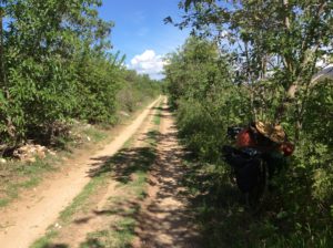
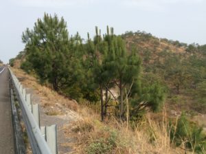
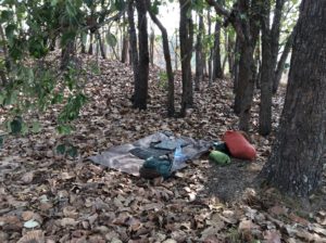
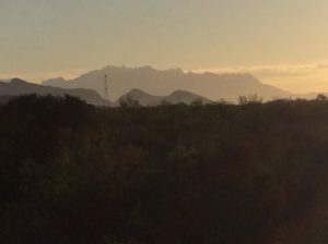
I left San Jose and began the long but fairly steady grade to the 10,970 foot pass located a half mile from 11,300 foot Cerro de la Muerte.  The highway traces an antient route from the southern coast over the crest of the Cordillera Talamanca to the Central Valley where San Jose is located.  Rainy weather at this elevation, even in tropical Coast Rica, can be quite cold, as I found out spending a wet night at about 9,500 feet.  Early Europeans were known to have perished there.  I was glad to have hiking shoes.

These rainforest streams are ice-cold and actually have species of trout in them.
These rainforest streams are ice-cold and have species of trout in them.

image

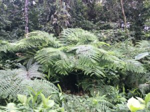
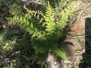
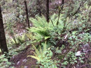
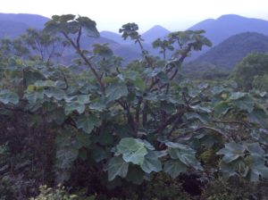
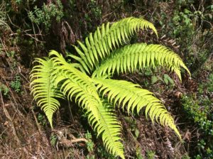
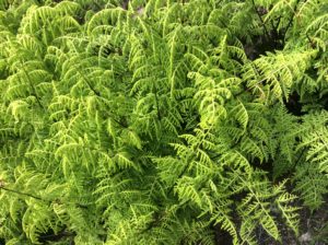
Above: Lophosoria quadripinnata

imageimageimageimageimage

Camp on the way to 11,000 ft pass near Cerro del Muerte.
Camp on the way to the 11,000 ft pass near Cerro de la Muerte.

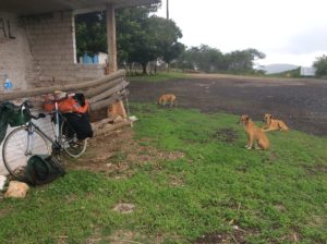
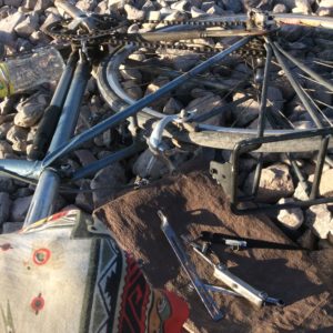
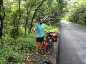
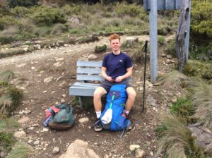
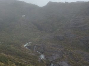
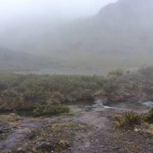
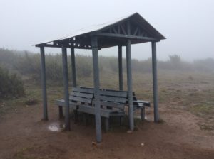
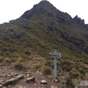
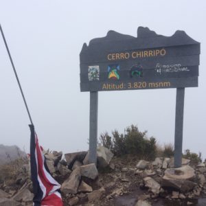
After a descent of almost 9000 feet to the town of San Isidro (and the total wearing out of a set of brakes), I checked into a hotel (and casino!) and investigated logistics for climbing Chirripó.  The 12,522 foot Chirripó requires a 25 mile round trip and nearly 9000′ of elevation gain. There is a hotel of sorts at about 11,000 feet that people usually stay at for about $16 a night. I did it as a “one-dayer” but really should have stayed a couple of days at the hut exploring an incredible place.  The Central American version of “alpine” is a unique habitat called the páramo which on Chirripó has become a world destination for botanists.  I saved no time in doing the long day as I needed two extra days languishing at the hotel in San Isidro till I could walk normally again after running much of the downhill trail.  Two days at the hut would have been far preferable.  I must say though that my knees held up well-  they were a worry not only in doing the long hike but for the bike journey in general.  All my problems however seem to have been a function not of worn meniscuses but rather of disuse- the biking has been a cure for that.

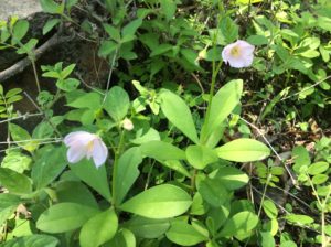
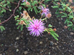
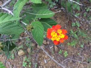
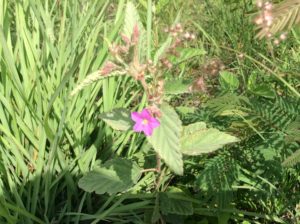
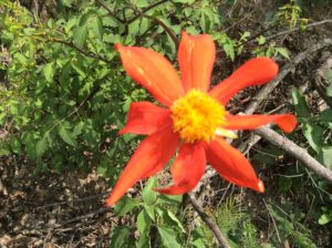
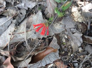
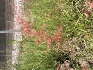
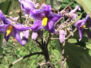
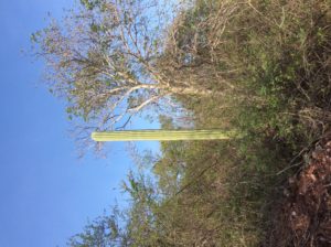
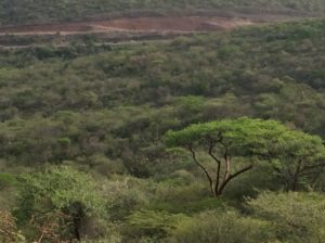
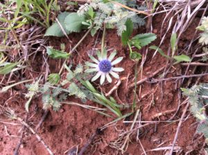
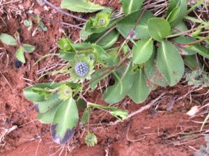
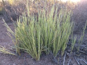
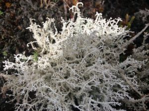
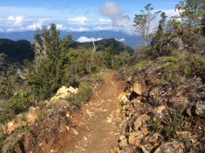
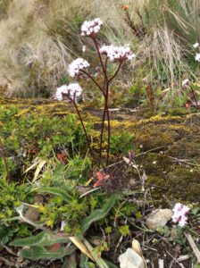
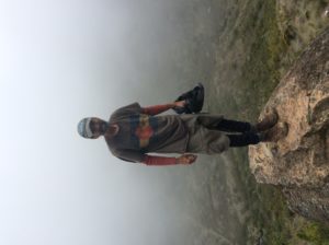
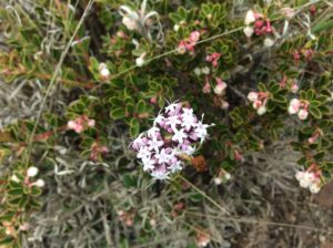
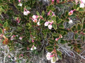
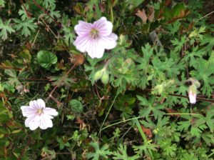
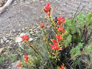
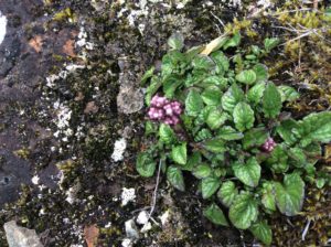
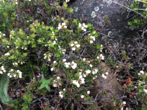
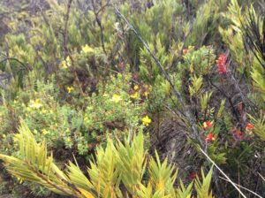
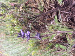
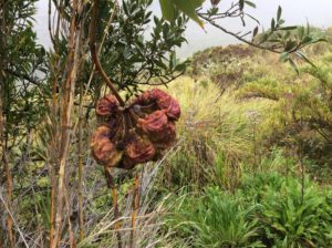
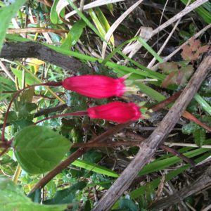
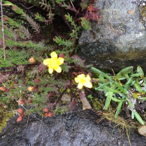
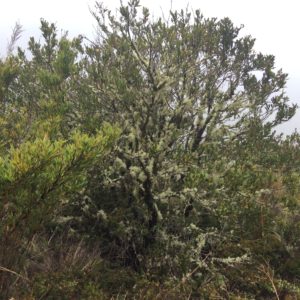
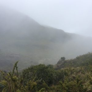
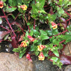
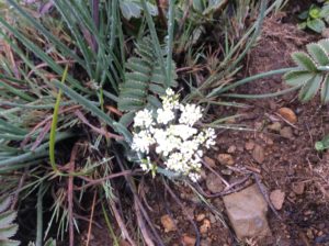
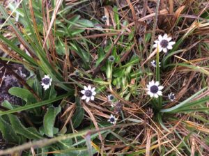
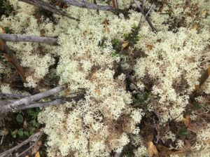
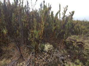
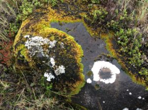
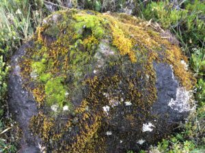
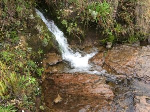
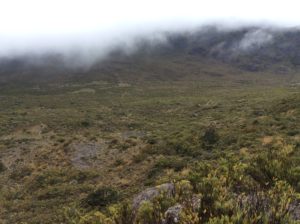
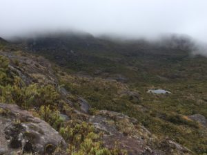
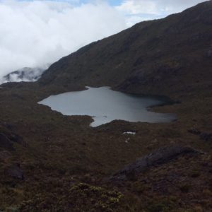
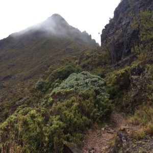
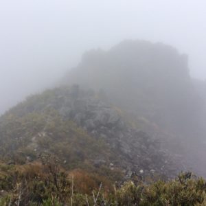
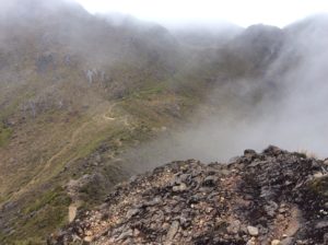
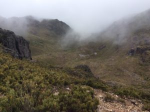
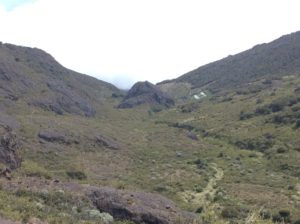
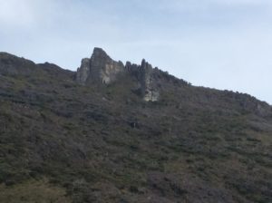
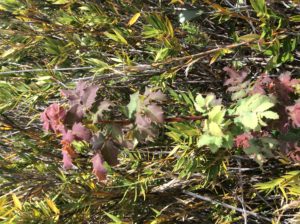
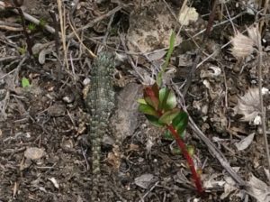
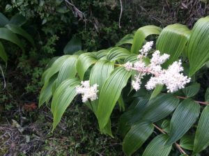
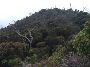
After trying to figure out the busses, I ended up taking a 4:00 am taxi 15 miles to the trailhead town of San Gerrardo for about $30.  The bike was left at the hotel.   I was hiking by 5:00 am while it was still dark.  I kept at a steady pace and did the round trip in about 12 hours.  The weather overall treated me pretty well with mist and occasional clearing, but on the descent the last few kilometers were done in a downpour and a trail that was a muddy river.  The photos below outline the trip- enjoy a virtual ascent.  Once in the “sky island” habitat, many plants became identifiable as counterparts to those in the alpine Rockies and Arctic.  Many are endemic and I wish I knew more which was which.

Something comparable to the arctic's reindeer lichen.
Something comparable to the arctic’s reindeer lichen.

image

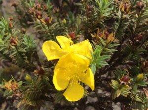
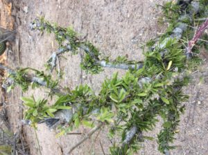
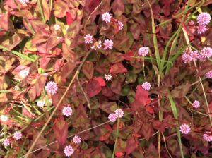
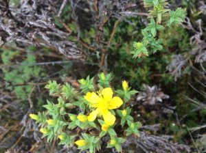
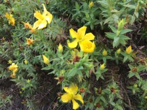
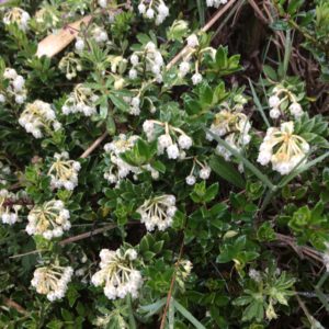
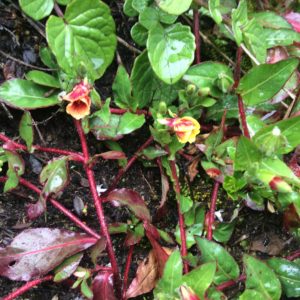
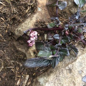
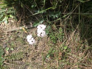
Above: Hypericum sp., or St. John’s wort.

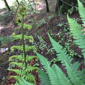
Below:  Dryopteris wallichiana

image

A fall on some slippery rocks and attempting to save the iPad. No big deal at home, but I've taken more care of it since it's the tropics.
A fall on some slippery rocks and attempting to save the iPad (which I did!). No big deal at home, but I take better care here with the greater risk of infection in the tropics.

image image

Chirripo trail.
Chirripo trail where you first emerge into the Paramo.

image

"Johann" but he had another pronunciation. He was from the Netherlands and we walked a couple of miles of trail together. He was an intern studying hotel management in San Jose.
“Johann” but he had another pronunciation I couldn’t get. He was from the Netherlands and we walked a couple of miles of trail together. He was an intern studying hotel management of all things in San Jose.

image

image

Heather/heath.
Heather/heath maybe Pernettya sp.

image

Geranium
Geranium
Castelella
Castilleja

image image image

Some counterpoint to shrubby cinquefoil.

image image image image image image

Lichens here could pass or Boreal Usnea hirta
The lichens clinging to the tree branches could pass for the Rockies’ Usnea hirta.

image image

image

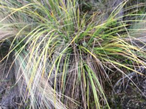
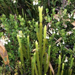
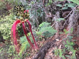
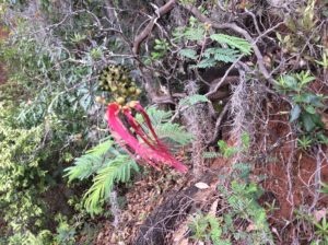
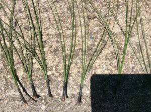
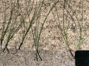
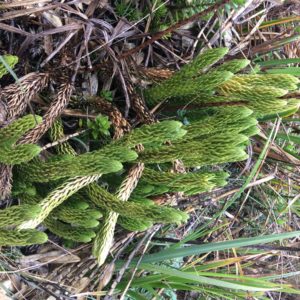
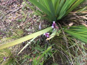
Above: Lycophytes.  Posssibly  Lycopodium clavatum or Phlegmariurus sp.

image image

The day started clear but mist came from the Atlantic side that led to some light rain.

image

Above:  Lycophytes

Vaccinium counterpart.

image

Achillea?

image

More Reindeer lichen
More Reindeer lichen.

image image image

Water I didn't hesitate to drink untreated.
Water I didn’t hesitate to drink untreated.

image

Glaciated valley
Glaciated valley.
Tarn
Glacial tarn.
Chirripo summit, a genuine horn.
Chirripo Summit. For the climbers out there, the fina summit trail was "3rd class".
For the climbers out there, the final summit trail was “3rd class”.
Claytonia megariza!
Claytonia megarhiza!
Summit. There were a few seconds of clearing, but no views of the oceans- just a sea of lower level clouds.

image image image

Achillea?
Achillea?
Straia or scratches left by a glacier.
Crestone Base, the high camp / hotel for Chirripo.
Crestone Base, the high camp / hotel for Chirripo, seen from a distance.
The Crestones. Granitic rocks above the Hotel that have climbs on them.
The Crestones, granitic rocks above the Hotel that have climbs on them.

imageimage

Smilacina Racemosa?
Maianthemum racemosa?

image

Above: Macrothelypteris torresiana

image

Forest fire remains.
Fly agaric, a poisonous anamita that grows in Alaska and New Zealand.
Amanita muscaria or fly agaric, a “risky” hallucinegen native to the Northern Hemisphere but now grows world wide.

Tomorrow if my legs are under me again I’ll start for Panama.  Never saw a Quetzal!


El Salvador, Honduras, Nicaragua, Costa Rica


July 13th,  2016

The winding road at the bottom was long and hilly but beautiful.
Closeup of El Salvador.  The winding road at the bottom was long and hilly but beautiful.
Ffggjfg
A small corner of Honduras was crossed.  I stayed in Choluteca before crossing to Nicaragua.


image

Tyttjydjj
Nicaragua & Costa Rica.

I detoured San Salvador, El Salvador’s capitol, and instead took a beautiful and winding road along the southern coastline that reminded me of Northern California’s Highway 1.  The rugged coastline gives way to more agricultural land to the south of San Salvador.   I stayed a night in Zacatoluca, a town that’s been in El Salvador’s news recently for the attempted arrest of its police chief on corruption charges and colluding with gangs.  He managed to slip away and it’s believed he was tipped off by authorities farther up the ladder.  Corruption is rampant in El Salvador.


El Salvador coast.
El Salvador coast.  Hermosa.
Still seeing cactus.

El Salvador, like its neighbors, endured civil war in the last quarter of the twentieth century. Once again a United Nation’s brokered peace ended hostilities, this time in 1992. The ceremony for the peace treaty was held at Chapultepec Castle in Mexico City where the president of El Salvador shook hands with leaders of the five main factions of revolutionary resistance. The resistance forces were granted a party in parliament. They struggled for the first years, but have won the last two presidential elections with Salvador Sanchez Cerén in office today.

El Salvador is home to two of the world’s most notorious gangs, Mara Salvatrucha 13 (MS 13) and Calle 18.  As civil war spread in the late 1970s the United States under the Carter Administration took in thousands of El Salvadoran refugees, many of whom were settled in poorer areas of Los Angeles, California.  Once there, they learned about American gang culture in an environment that couldn’t have been much improvement over civil war.  Many ended up in jail.  After the peace accords were signed a good portion were repatriated, particularly those serving prison sentences.  When they returned home they brought gang culture with them which easily found a foothold in an impoverished El Salvador.   Today the two gangs fight with eachother and with police.  The boundaries of all sides overlap.  The reasons for fighting are unrelated to the civil war and amount to a cycle of endless retaliation.  They find work doing “security” for the drug cartels. Homicide in the US was 4 per 100,000 persons in 2015 and as high as 16 in cities like Chicago and Los Angeles.  In the UK it was 1 per 100,000.  In El Salvador it was 103 per 100,000.  This is the highest rate of killing in any country that’s not officially at war.  Honduras and Guatemala are not far behind.   Check out http://www.insightcrime.org/news-analysis/insight-crime-homicide-round-up-2015-latin-america-caribbean for more info.

The city of San Salvador abuts Lago de Ilapango which is the caldera of a super volcano. The volcano is dated to have had a major eruption in the 500s AD and speculated to be the cause of an unusually hard winter and cool summer in the years 535-36 AD in Europe.   The result was crop failures and famine.

The morning I left Zacatoluca I stopped at a coffee shop and was asked by a guy, Manuel Barahona, where I was headed.  A native El Savadoran, he spoke English well and after talking a minute I offered to buy him coffee.  He declined but we sat talking for over an hour while I fixed a flat.  We went over some of my passport woes and he explained the procedures by showing me his passports of which he had one from El Salvador and one from the US.  He also had a California driver’s license.  He said he started out in the US 35 years ago as a taxi driver in Atlanta and later San Francisco.  He eventually became a citizen.  He now owns a trucking company in El Salvador.  He also owns a house in Redwood City (Menlo Park) near the Stanford campus.  He should have been buying me coffee.

Uh
Manuel Barahoma.
Kuyg
Zacatoluca
Many El Savadorean business signs have white lettering on a red background that's a vestige of the civil was revolutionaries. Whether it's a sort of union or just symbolic I never found out.
Manuel pointed out that many El Savadoran business signs have white lettering on a red background, sometimes with a star, that’s a vestige of the civil war revolutionaries. Whether it’s a sort of union or just symbolic I never found out.
Hh
I passed several wood shops in El Salvador.  I make part of my living doing the same stuff these guys do.  The shop in this photo and the two below are owned by Jose Alcides Echegoyen.  (503) 64262218.  He’s taking orders!

Jiiugugui

Kfkhghvjgg


Hgughggjyjy
Readjusting and oiling a hub race.  These are vintage Campagnolo parts from the mid 1970s.  “Campy” components were said then to last a lifetime and it’s been a good portion of one for me now.  They’re still as good as new.
Gcf
The black clip slides off and exposes an oil journal.  I add a few drops of 140 WT gear oil with a syringe.  For the bottom bracket I remove the seat post and pour in a 1/4 cup of oil and lay the bike on one side then the other.  I do it once a month or so, or after riding in heavy rain.
This tire's completely had it but is still holding air!
This tire’s completely had it but is still holding air!

image

Buying a tire in a chaotic bazar in Masaya.
Buying a tire in a chaotic bazar in Masaya.  No armed security here.
G
Shop owned by Armando Romero.
J
His wood lathe….
J
…….and joiner.
Iui
Armando drying wood.  His younger brother is on the bicycle.  (503) 76490019 – He’ll take orders as well!
Uhh
Looking across Lake Nicaragua to a faint outline of Ometepe, the world’s largest freshwater island.

image

Wind farm along Lake Nicaragua. The enormous prop appears to be made of a composite of some kind.
Wind farm along Lake Nicaragua. The enormous prop appears to be made of a light weight composite of some kind.

image

Welcome to Honduras!
John,hvh
Honduras becomes noticeabley drier and has open savannahs.  Both Honduras and Nicaragua have about 1/5 the population density of El Salvador.
Uhhuhu
Honduras

I clipped a corner of Honduras that was less than 100 miles long and for which I spent only one night in the town of Choluteca.  I learned that I had distant relatives in the capitol, Tegucigalpa, about a day’s ride out of the way.  It was, however, an uphill day’s ride and I decided not to do it.  So, I had two border crossings in two days and long lines both entering and exiting each.  El Salvador and Honduras both had the “option” of just walking through but Nicaragua finally had check points that told you where you needed to go.  I’ll always wonder what would have happened if I would have skipped immigration coming into El Salvador; Nicaragua didn’t seem too concerned with previous countries.  Manuel seemed to think my problems could have been solved with a bribe.

Jerry gym,jaejr
San Cristobal, the highest point in Nicaragua at 5725 Ft.

Jbh

Uuuh

image

Cows and horse-drawn carts were common in rural Nicaragua.

Nicaragua is regarded as the poorest country per capita in Central America.  Cycling through you see fewer cars on rural sections and horse drawn carts are everywhere, even a few in the outskirts of Managua itself.   Poor maybe, but not impoverished, and the gut feeling is that people there are engaged and working.  Some statistics put Nicaragua at a better wealth equality than either Honduras, El Salvador or Guatemala and is close to that of the United States.  Not to get too carried away with comparisons, but if Guatemala seemed idle, Nicaragua seemed busy.  Their highways were the best of Central America yet, and consistently good throughout.  I know I got heckled a lot less there.

Nicaragua has had a great deal of turmoil throughout the Twentieth Century.  In a gray mix of Monroe Doctrine, Roosevelt Corollary and protection of American investments in Central America (Nicaragua was then, and is still today, a proposed site for a Pacific-Atlantic canal) the US Marines occupied an unstable Nicaragua in 1912 and stayed till 1933 except for a short period in 1925.  During this time Anastasio Samoza held positions with the marines and found his way to a contrived sort of presidency in 1937, a few years after the marines left.  In 1934 he had a resistor of the US’s installed government, Augusto Sandino, assasinated.  Today’s Sandinistas (the FSLN) take their name from Sandino.

Samoza evolved into a textbook example of a corrupt dictator.  Among many notorious acts, he dutifully declared war on Germany when the time came but never supplied troops.  He instead took the opportunity to confiscate German assets and land posessions in Nicaragua for personal profit.  He was finally assasinated in 1956 and a more benevolent son took over for a few years but died of a heart attack.  Several Samoza puppets held the presidency until 3rd son Anastasio Samoza Debayle became president in 1967.  To paint a picture of what he was like, he made the famous statement I don’t want an educated work force, I want oxen.  

In 1972 Managua endured a devistating earthquake that destroyed much of the city.  Emergency aid was sent from around the world but rumors were out that supplies weren’t getting to intended destinations.  Pittsburg Pirates outfielder and now hall-of-famer Roberto Clemente had donated and organized 3 plane loads of goods thought to have been held up by corrupt officials.  He traveled with a 4th plane to make sure it got to folks in need but the plane went down and he was killed.  He’s remembered though by Nicaraguans and south of Managua in the town of Masaya he has a stadium named after him.

The years following the earthquake showed haphazard rebuilding in Managua, and further increase in wealth for the Samoza family.  Rizing unpopularity saw the end of the Samozas in Nicaraguan politics in 1979 when they were ousted by the Sandinistas.  The new government was led by  a committe of several persons, the Junta.  They had ties with communist Cuba but with the reputation the Samozas had created, the Sandinistas were granted aid for a short time by the Carter Administration.  When it was later learned that Nicaragua was supplying arms to El Salvadoran rebels the aid was cut off.  Ronald Reagan then came to power and any thoughts of aid were turned instead into support for Samoza-led Contras then amassing on the Honduran border.  The United States congress was divided on the issue but the passing of the Boland Ammendmant was a measure to stop military aid to Nicaragua.  Members of the Reagan Administration and the CIA attempted to go around the amendment and it soon evolved into the Iran-Contra scandal.  The details are many and tragic, loaded with failed policy, and at times comical.  Go to https://www.brown.edu/Research/Understanding_the_Iran_Contra_Affair/n-contrasus.php for more of the story.    The big picture might be summed up as the United States and the Soviet Union (through Cuba) supplying some of the world’s most sophisticated weaponry to a pair of opposing sides for whom concepts like communism and capitolism were at most abstractions: They slaughtered eachother.

The FSLN’s Daniel Ortega assumed the first Sandanista presidency in the late 1980s, but under international pressure a free election was held in 1990.   Ortega lost to former Junta member Violeta de Barrios Chamorros.  He ran and lost a couple of more times but then won in 2007 and holds the presidency today.  He’s been a controversial figure over the years and has many times surprised the world with stands on given issues.  If nothing else he’s a survivor.

image image image image image image image

Shop of Armando Romero. An area between Managua and Masaya had several shops that were really turning out some fine work. This shop belongs to Armando Romero. 764 90019.
An area between Managua and Masaya had several shops that were really turning out some fine work. This shop belongs to Jose Leonel Ambota Chavez.  C177747829.  He had an antiquated cell phone and no knowledge of Internet use.

image

Welcome to Costa Rica
Welcome to Costa Rica!  The bird center screen in the lower photo has his head buried in the abdomen and was kicking up dirt with his feet to get in as far as possible.  Watching them was hilarious.

After long and glacially-slow moving immigration lines (in un-glacial heat) I crossed into Costa Rica where camping again became easy.  I even spent one night in a pine forest on the order of hundreds of acres is size that someone had planted evidently for a timber investment.  Hearing the wind through pines was a nice reminder of home.  Camping opportunities since leaving Mexico have been few and hotels expensive.  I paid $75 one night in Managua, $60 routinely in El Salvador and $60 the one night in Honduras.  I probably could have done better but at the end of a long day there’s not much energy left for shopping around.  Planning ahead with Internet searches is tedious and fraught with obsolete websites.  Hotels in one town in El Salvador, Usulutan, repeatedly turned me away.  I barely found a place in waning daylight, and it’s a town where a gringo took chances being out after dark.  I’m now at Nuevo Arenal on Lake Arenal in a reasonably priced hotel in an otherwise expensive economy.  The lake is amazingly beautiful but correspondingly touristy at an international level.  English speakers are common.  It’s been rainy.


Tehuantepec to El Salvador

July 1st, 2016

Chiapas
Chiapas
Hhgg
Guatemala

After the several days of hill climbs I took an easy day after Tehauntepec going only twenty miles to the next town, Juchitán.  The topography there is coastal flats and a mix of jungle and agriculture.  Ten miles from Juchitán I could see a column of black smoke coming from the town.  Going into town you cross a wide, four lane bridge spanning a sizable river.   On the other side sat two smoldering busses, end to end, each blocking a direction of traffic.  More protests. The busses would have been set on fire about the time news of the killings in Nochixtlan reached the coast.   I could see a way the bike could squeeze through around the bus blocking the oncoming traffic lane.  Just then a power line that went along the left side of the bridge fell to the railing/decking. A guy on foot moving ahead of me started to turn back.   The fallen wire made a ninety degree turn from a pole at the busses and crossed over them where it was burned through.  It had landed on top of the bus I was headed for, but had left a way under it at the bus’s end, so I crossed over anyway.  There was some steel decking that I wanted to keep the rubber-tired bike moving over, but the guy on foot was unaffected so I guess it was safe.  I just wanted to get to town and duck into another hotel.

The town was completely on edge.  Businesses were closed and two large grocery stores had put plywood sheets over their windows.  Two hotels turned me away but I did find a decent place towards the center of town.  I got groceries at a small store that kept its wrought iron gate/door locked and handed stuff through the bars.  I found a bank ATM and was relieved to get some cash after not being able to in Tehauntepec.

This bridge I'm pretty sure is the one the lady on Democracy Now was interviewed under. I was warned by bystanders about taking pictures and I'm not including any with recognizable faces. With The number of iPhones around I'm not sure how they could really control it.
Nochixtlan.  This bridge I’m pretty sure is the one the lady on Democracy Now was interviewed under. I was warned by bystanders about photos as I was taking them.  Ostensibly, both sides could have reasons for not wanting them.  I’m not including any with recognizable faces.  Though with the number of iPhones around- and everybody here, down to the most unlikely you could imagine, has them- controlling it would be impossible.
Nochixtlan.
Nochixtlan.
El Cameron Yautepec, a mountain town south of Oaxaca.

At this point I just wanted to put distance between me and the protests.  The hills/wind/road surface/ shoulder/weather stars all aligned and the next day I did a 98 mile day to Arriaga, followed by a 92 mile day to Mapastepec and then 70 to Tapachula which is then less than a half-day’s ride to the border with Guatemala.   In Tapachula though, which is in Chiapas, protests were once again starting up.  But everyone was all smiles, as in Nochixtlan where I first encountered it all.  It had the feel of a farmer’s market with tarps and umbrellas set up among the stopped trucks.  Food vendors were pedaling carts through the melee.  They seemed confident in their solidarity and appeared to be more catching up on gossip than preparing for a show down.

Burned busses.
The burned busses are at the top of the photo.  I took this the following day heading out of town.
Protests beginning in Tepachula, Chiapas.

image Continue reading Tehuantepec to El Salvador

Tepoztlán to Tehauntepec

Mexico City area. Tepoztlan is about where the 115D is
Mexico City area. Tepoztlan is about where the 115D is in the lower right.
Tepoztlan to Oaxaca follows the diagonal
Tepoztlan to Oaxaca follows the SE trending diagonal…..
....and continues to Tehauntepec
….and continues to Tehauntepec.

Leaving the sanctuary of Javier’s and Mate’s wasn’t easy.  On the way out of town Javier drove ahead of me to go to a Tepoztlán bike shop where the day before we had “next day ordered” brake pads and cables.  Javier was skeptical they could get the parts and sure enough they weren’t even open for business when we got there at noon.  We made goodbyes and I rode 20 miles to Cuautla and found a well stocked shop within a kilometer of the highway.  There was a decent $12-a-night hotel (with a swimming pool!) a block away so I checked in and spent the afternoon giving the bike a brake job along with putting on two new tires.  That night it rained hard and I was glad to be indoors.  It seems to rain at some point during most days now, usually in the afternoons, but it’s not predictable.  The elevation is high enough that getting wet means getting cold and it’s reminiscent of the Tetons or Yellowstone in the summer.

These are wires from tire fragments that collect on the shoulders. They caused many flats.
These are wires from steel belted tire fragments that collect on the shoulders. They’ve caused many flats.

Flat farmland terrain from Cuautla leads 40 miles to Matamoros and from there into a world of hilly, serpentine and shoulderless road, but with slower moving and lighter traffic.

Camp with a view
Camp with a view.

image

Quartzite! First non-volcanic rock seen since Leaving the Colorado Plateau north of Flagstaff.
Quartzite! First non-volcanic rock seen since leaving the Colorado Plateau north of Flagstaff.

The hill climbs were long and steep.  The relatively short time spent on the downhills means most of the day is spent in first-gear climbing.  You sort of just Zen-out and try to expend a minimum of effort.  The drudgery is offset by scenery, and the scenery here is greatly enhanced by cleaner and drier air where you can see for great distances.   The continent is necking down and there are less sources of pollution.

This was such a great camp I knocked off twenty miles early and spent the afternoon hiking around and taking pictures. Rained hard that night with some of the sharpest thunder I've heard in a while
This area had such great camp sites I knocked off twenty miles early and spent the afternoon hiking around and taking pictures. Rained hard that night with some of the sharpest thunder I’ve heard in a while.  Tent worked well.
Dewey spider web in the morning.

The next milestone was crossing into Oaxaca from the state of Puebla.  The Mexican states all have their own personalities, but Oaxaca sees tangible changes.  Road conditions are the first clue.  The one-inch aggregate used in some of their asphalt bounces you around a bit and it was sometimes tough to get speeds more than 8 or 10 mph.

Welcome to Oaxca! Hard on tires, hard on hemorrhoides (yes, the latter's become a problem)

Kk
Welcome to Oaxaca!  Hard on tires and hemorrhoides.
More tough roads
More tough roads

The mountainous terrain north of, and including, the valley of Nochixtlan is underlaid with a soft, red, sandy clay that must be on the order of hundreds, perhaps thousands, of feet thick.  If this terrain were to be buried again for a 100 million years and then re-exposed, the result would be another rock-hard Colorado Plateau.

image

image image

Nochixtlan
Nochixtlan

I pulled into the beautiful town of Nochixtlan that lies in a valley of more red ochre clay.  Storm clouds were gathering and it didn’t take much persuasion to talk myself into another $15 hotel.  They had a good restaurant and I was able to catch up on the blog over a meal.

The next morning I was greeted on the way out of town with road blocks in the form of busses and semi tractor-trailers parked across the highways and tires lit on fire in the middle of the road.  After some broken dialogue with bystanders I learned it was a protest over the arrest of two teacher’s union activists.  The Mexican government has for some years been trying to impose a standardizing process for teacher accreditation that’s meeting with resistance in poorer, rural areas where many families are indigenous.  And I’m sure the situation is more complicated than just that.  The problems date back to 2006 when protests turned violent and made world news.  An Indymedia reporter from the US was killed.  People indicated that it should be no big deal for me to ride around the blockades and continue on, which I did.  After a few miles of stopped traffic that extended beyond the town the road became deserted and I had traffic-free travel 50 miles to the city of Oaxaca.

Kkkk
Per advice from Nick Bouwes I got an app called Pocket Earth to supplement the iPad’s limited access to Google Earth.  P.E. came in handy right off when it showed a road alternative that avoided a bunch of main-highway hill climbs.  The road was “yellow” on the map but I couldn’t find a legend with road classifications, so I figured I’d go see for myself.  So Nick, just so you’ll know, this is a yellow road on P.E.!  Would of been great on a mountain bike.
Makin' friends in Oaxaca. Foods on top of the orange stuff sack.
Makin’ friends in Oaxaca. Food’s on top of the orange stuff sack.

Oaxaca city is the capitol of the state of Oaxaca and set in a verdant valley over 5000 feet in elevation.  Its name derives from a Spanish mispronunciation of an Aztec/Nahuatl word, Huâxcuahuitl, that has gone through several spellings and pronunciations since the 1500s, but means where the guaje grow.  Modern pronounciation is wah-haw’-ca.  It refers to the tree Leucaena leucocephala, a member of the mimosoid subfamily of legumes.  It has many common names, and I’m not sure what the locals call it beyond guaje or huaje.  A very fast growing tree, it has become an invasive weed throughout the tropical and subtropical world and has consequently become a candidate for biofuels.

Oaxaca's planr
Luecaena leucocephala.                                                                                    

One third of the state of Oaxaca’s population of 4 million is indigenous and of those half speak only their native language.  The main groups are Zapotecs and Mixtecs but 16 separate cultures are recognized.  The major language group is Oto-Manguean. 

Thirty miles southeast of the city of Oaxaca and near the town of Mitla is Guilá Naquitz Cave which has archeological findings of human habitation dating back 11,000 years.  In 2010 it was made a UNESCO World Heritage Site for being the oldest discovered place in the Americas showing evidence of plant domestication. Cultivation of modern corn’s ancester, teosinte, goes back 4000 years there and Cucurbita pepo (a squash) at least 8000.  I was about 10 or 15 miles from the cave itself and probably should have taken the time to see it.  Instead, I continued on to Matatlan, the Mezcal capital of Mexico (and of the world according to the sign!) where I had lunch and a free shot of booze.

Matatlan. The copper ornament is a still.
Had to find food for four days in this tiny store.
Had to find food for four days in this tiny store.  Julia, the clerk, was helpful in trying to cobble together meals.

I was counting on a bank and a supermarket in Matalan, a sizable town, but found neither.  Lots of well stocked mezcal shops though, and all open for tasting.  Down to the last of my cash, I got 4 days worth of food from the tiny market, shown above, to get me to Tehauntepec, a city on the coast.  Towns in the interim may have had taco stands and a few groceries but you never know.  I stocked up on refried beans, tuna and some gamey cheese.

image image

Dropping to sea level and an overlap between tropics and desert
Dropping to sea level and seeing an unusual overlap in vegetation between tropics and desert; it’s jungle with cactus.

The highway then descends the Tehuantepec River, which in places is a gorge, requiring climbs of several thousand feet over passes and ridges to avoid narrows.  I camped twice at high divides and had intense thunder showers at each.  It was all I could do to eek out 50 mile days with the hill climbs.  I reached Tehuantepec pretty well beat and checked into a hotel.  I learned that the protests were still on and that there was violence and looting in Oaxaca where I just was.

Aggregate high in iron content staining the highway with rust.
Iron-bearing aggregate used in the asphalt and staining the highway with rust.  There were many miles of this.
A high camp on a side road leading to a survey monument
A camp high on a side road leading to a survey monument.

image image

Along the Tehuantepec River

Plants

Here are a few plant photos.  Most of these were taken  in the states of Puebla and Oaxaca, well south of Mexico City. Habitats range from subtropical to tropical savana.  For some I could identify family- lots of legume/mesquite looking trees and shrubs.  Several I have no idea.  Feedback welcome.

image image

Per Sylvia Kinosian
Above and below is possibly Dryopteris wallichiana or wood fern per Sylvia Kinosian

image

image image

image image

This bug has to be a close relative to Leptoglosis occidentalis that was part of Laurel's master's project
This critter has to be a close relative to Leptoglossus occidentalis, a friendly and harmless bug that was part of Laurel’s master’s project

image image image

These have to be close to shaggy manes or genus Coprinus
These look like shaggy manes, Coprinus Comatus

image image image

image image

image image image

image image

Might be a kapok tree
Might be a kapok tree.

image

These two grow side by side from N. Sonora to where desert and jungle seem to grow together
These two grow side by side from N. Sonora to where desert and jungle seem to grow together on Oaxaca’s S. Coast.
Oaxaca's planr
Oaxaca’s namesake- details in the blog.
One of many unique grasses

image image image

This isn't as piercing as it looks but did give me a flat after I pushed the bike a 1/4 mile through some of it to a campsite.
This isn’t as piercing as it looks but did give me a flat after I pushed the bike through a 1/4 mile of it to a campsite.  It’s quite common.
A very red "red top"
A very red “red top”

image  image

image

Solanaceae
Solanaceae

image image

image

image

imageimage

image

Cordone
Looks like a cordone but this one is south of Oaxaca and way out of its Sonoran range.
Madrone
Madrone?

image

image

image

image

image

Lilly
Lilly

image

image

Yucca of some kind on limestone
Yucca of some kind on limestone.

image


Solinaceae
Another Solanaceae
Not too many composites. This one is sticky like
Not too many yellow composites. This one is sticky like Grindelia squarosa.

image

Small scroph
Small scroph

image

Cholla
Cholla

image

image

image

Bird chick!
Bird chick!

image

Five needled pine
Five needled pine just north of Oaxaca
Needles vary from 4 to 6! I found this pine growing in highlands near the south coast of Mexico almost to Guatemala.

image image


Mazatlán to Mexico City

June 8th, 2016

image

image

South of Mazatlán the terrain becomes a “dry tropics” habitat with plants and birds changing dramatically.  Mangos are grown in the coastal regions in astounding quantities.  I spent one night camping after a 91 mile day, followed by a 75 mile day to Tepic.  Tepic (te-PEEK) appears to be another coastal town on the map, but is just inland enough to be 3000 feet in elevation.  This was a surprise.  A tough ride with the hills and made worse by getting caught in afternoon heat.   Fortunately there were plenty of roadside stops with refrigerated drinks.  I must have drunk a couple of gallons worth of coke, orange juice and water by the end of the day.

Mangos
Mangos

Tepic lies in a valley surrounded by hills and a few high, craggy peaks.  It’s the capitol of the state of Nayarit and has a population of over 300 thousand.  American businesses are becoming fewer and fewer in this area, but I did find a Subway with Wi-Fi there. American fast food is pretty much synonymous with Wi-Fi.  Otherwise, it can be hard to find without getting a hotel.

Shortly after Tepic is the first upgrade on the route to Guadalajara.

A stopped bus flagged me down and asked if I had a hacksaw. I had a sawsall blade and vise grips. They needed to cut off shredded tire.
A stopped bus flagged me down and asked if I had a hacksaw. I had a sawsall blade and vise grips they used to cut off separating  tire tread.
Notice the condition of the tire. Maybe one-in-twenty large trucks "flap" as they go by.
Notice the condition of the tread and the exposed stranded steel core.  Maybe one-in-twenty large trucks “flap” as they go by.

Guadalajara gains 2000 feet of elevation from Tepic, but only after several hills and valleys.   I can use iPad’s version of Google Earth to a degree to estimate grades but the imagery really needs Windows to be fully utilized.   The iPad gives no latitudes or longitudes and no numerical elevations.  Oblique views are clumsy at best, and the only way I can see elevation change is by zooming in on a highway from a bird’s eye view, then scrolling along its path and seeing if it zooms in or out – awkward at best.

With the heat now encountered in the afternoons, I try to plan the uphills for mornings and be in a place I can shut down when it gets hot (the siesta!) – a piece of shade at the least and, when I’m lucky,  a place having food of some kind with air conditioning and Wi-Fi.  Pampered travel when the latter happens.

I think this is sugar cane
Sugar cane
Rio Santiago. This is a Hugh river.
Rio Santiago. This is a huge river.

After the climb in elevation to Tepic and beyond, the air becomes dry again.  Fires were burning in the mountains.  The air was smoky, and occasionally I would get a wafting of pine that put me in mind of fire season in the Rockies.   The climate and topography here are not unlike Montana’s Bitterroot Valley in August.  I had one beautiful camp at over 5000′ in elevation that was in an oak and pine habitat not too far from Guadalajara.

Fires
Fires
Pine of some kind
Pine of some kind.
Good campsite
Good campsite
Tequila vinyard
Tequila vinyard!  Agave is grown in the drier highlands.
More flat fauna. Wondered if this might be a coral snake, but the band order makes it a king snake.
More flat fauna. Wondered if this might be a coral snake, but the band order is that of a non-poisonous king snake.  You see a few armadillos that have been hit as well.

Guadalajara has a metropolitan population of over 4 million people.  It has as long a post-Columbian history as any city in the Americas, going back to about 1530, with the present location established in about 1550.  Cortez was in today’s Mexico City in 1520.   A church in the center of town, though rebuilt after an 1800’s earthquake, was completed in the early 1600’s.   Guadalajara is where Mariachi music originates.  I didn’t take time to visit the main city, but probably should have.   Being on the bike I just wanted to put its chaotic traffic and ludicrously bumpy streets behind me.  From a hotel at the western outskirts I made one probe towards “el centro” enroute to, of all places, a Walmart to get some replacements for a few necessities lost with the pannier.  The road conditions to get there, however, made it clear taking the belt route circumventing downtown was the best way to go.

image

Guadalajara
Guadalajara

Sometime after Guadalahara and towards the end of a long day a man and his wife approached me at a roadside restaurant and ended up inviting me to stay at their house.  The town they lived in was La Yerbabuena and though ten uphill miles off the beaten path, I took them up on the offer.  The husband, El Cebollo, spoke some English and encounters like this are a good way to learn about a given area.  I was a good 20 miles from their place.  They had to call ahead to make arrangements for me at their house (everybody has a cell phone here) while they went to pick up a relative at the airport in Guadalahara.

 Before I could make the last miles to La Yerbabuena I received, in a deluge, the first rain I’ve encountered since Panguitch a month and a half ago.  I ended up pitching the tent for the night on a patch of grass at the side of a quiet road that lead off to Yerbabuena.  There were chickens next to the camp that, from all appearances, looked like free range.  Then I noticed they were all roosters.  Acres of them.  The owner came out at a break in the storm and introduced himself.  He was an affable enough guy, glad I’d found a spot to pitch the tent, and after some conversation in understandable English, I discovered the chickens were raised for fighting.  Evidently it’s a hot market.

Free Range Roosters!

The next morning I made my way to La Yerbabuena and asked, per instructions, the first person I saw in the town for directions to “El Cebollo’s” house.  After a puzzled look at the gringo on the bicicletta the guy realized I had given the nickname of someone everybody knew well.   He pointed to the house.

Alma, Fatima and Cebollo Magana

Samuel (El Cebollo), Alma and Fatima Magaña had a great place and treated me like royalty.  Cebollo took me on tour of their farm where they raise strawberries and tomatoes.  They own several hundred acres and much of the produce goes to the US.  Samuel speaks a little English, but Fatima speaks it perfectly.  Alma sent me off the next morning with can food, a bottle of ibu’s, balm for my knee and a full stomache.

image

El Cebolla's house. The black cylinder on the roof top is solar hot water. This method is seen commonly seen here.
El Cebolla’s house. The black cylinder on the roof top is solar hot water.  You see these a lot.

image

Church built in the mid-1500s.
Church built in the mid-1500s in Tlazazalca, a town a few miles from Yerbabuena.
Lunch. The restaurant owner, La Alcancia, is 3rd from left.
Lunch.  Cebollo paid for everything including cervaza.  The restaurant owner, La Alcancia, is 3rd from left.
Tomato enclosure
Tomato enclosure
Strawberries. The long handled hoe apparently hasn't been a campaign issue yet.
Hand weeding strawberries.
Near Yerbabuena
Near Yerbabuena
Catholicism is as strong as ever here.

The remaining 200 miles to Mexico City involve more hills and valleys that gain overall elevation.  The summits are beautiful pine forests and the valleys agricultural.  I had breakfast in the town of Maravatío with a guy who spoke English, Lois Rolón, and over many cups of coffee learned I was only a few miles from the Sanctuario Mariposa Monarca where the monarche butterflies gather in the winter.  Maravatío is notable as well for keeping 60s vintage VW vans in service as public transportation and school buses.   A Volkswagen manufacturing plant opened in Mexico City in 1962 has left a legacy of older vans and bugs throughout the country, but in Maravatío they’re everywhere.

Lois Rolon
Lois Rolon
Parade in Mara
Parade in Maravatio next to where we had breakfast.
Crossing from Michoacan to the District of Mexico
Crossing from Michoacan to the State of Mexico.

Before Mexico City itself I turned south at  Atlacolmuco and on to the city of Toluca.  Toluca has a population of a half-million and is 8600 feet high.  I was circumventing Mexico City at a radius of about 30 miles and making my way to Tepoztlán, a town due south of the City.  The parents of a friend from Logan, Javier Romero, live there and Javier arranged for me to stay for a couple of days.  To get there I went through beautiful mountain towns and a 10,000 foot pass with ferns and old growth fir trees that were reminiscent of the Pacific Northwest.  The mountain towns, being close to a city of 22 million people, are not surprisingly loaded with tourists.  It was Sunday and food venders and artisans were everywhere.   A bike race was in progress and hundreds of cyclists were passing me going the opposite way.

image

Cyclists at
Cyclists at Coyoltepec
Tall firs
Tall firs
.....and pines
…..and pines
Castillea
Castilleja
Geranium of some kind
Geranium of some kind among ferns.
Lupines!
Lupine!

image

From the 10,000 foot pass the narrow but uncrowded highway drops 4000 feet to Cuernavaca, a city of 300 thousand that has a rich history from ancient times to the present.  Called the City of Eternal Spring for its continually pleasant weather, some of the highlights are:  It was a summer home for Aztec emperors and has ruins dating back 3000 years; Cortez established a sugar plantation there and built a castle that is today’s Museo Cuauhnahuac; legalized gambling in the first decades of the Twentieth Century attracted mafia figures Al Capone and Bugsy Seigel; Hollywood personalities have had residences there from those same years to the present lending the name Mexico’s Hollywood; Butch Cassidy and the Sundance Kid with Paul Newman and Robert Redford had scenes filmed there;  Malcolm Lowry’s classic novel Under the Volcano is about Cuernavaca and it’s proximity to the 17,000 foot volcano Popocatepetl;  Americans and Europeans have been retiring there for several generations and have established diverse enclaves that are now rooted in the culture.

Tepoztlán is a satellite town to Cuernavaca and located in a picturesque valley surrounded by high volcanic cliffs.  Javier’s parents, Javier Sr. and Mate, live above the town and were there to greet me.  They fed me many meals and treated me like family for the six days I was there.  The second day Javier Sr. took me on a guided trip to Mexico City where I tagged along on business errands.  Javier is a retired high school mathematics teacher but now runs several outlets for the sale of lottery tickets.  He keeps an apartment in Mexico City to stay at while he makes rounds to the ticket offices.  He made room in his routine to show me a few sights and we spent the night at his apartment.  Navigating busses and subways without him would have been a challenge;  Mexico City is modern, huge, overwhelming.  I was glad to see it but wouldn’t want to live there.

Working on posts from Javier and Mate's house
Working on the blog from Javier and Mate’s house

image image

Tepoztlan
Tepoztlan.  Javier above, me below.
Mineral shop and giant amethyst in Tepoztlan
Breakfast with Javier in Mexico City
Our Lady of Guadalupe. They kept trying to tell me this was famous but it wasn't till my sister Pam told me to watch for that I realized how famous.
Our Lady of Guadalupe. As far back as 1978 when I was first here they were trying to tell me this was famous but it wasn’t till my sister Pam told me to watch for it that I realized how famous.  Catholics worldwide make pilgrimages here where it’s believed the Virgin Mary appeared.

After returning from the City I made a foray into Cuernavaca and got supplies for making another pannier.  I managed to find everything but it was an Easter egg hunt that took all day.  The rail that hangs on the rack was one of the trickier parts and a guy at a glass shop helped me split a length of oval tubing, drill some holes and notch it out to fit the rack’s cross members.  I had to settle for cotton denim instead of cordura nylon but I may attempt to oil it for a measure of waterproofing.  The panniers are lined with plastic bags anyway, but the cotton will be heavier if it gets soaked. The next day I hand sewed it all together with dental floss and it works tolerably well.  Tomorrow I start for Oaxaca.

image

New pannier
New pannier

Los Mochis to Mazatlán

May 23,  2016

image image

I left Los Mochis the following morning at first light and had easy miles with mostly good shoulder and no wind.  Wind patterns since about Hermosillo have been calm mornings gradually becoming a crosswind coming off the ocean towards afternoon.  More often than not the crosswind has a component of headwind.  Between the towns of Guasave and Guamúchil the original highway splits off the freeway inland with the two running roughly parallel all the way to Mazatlán.   I decided to try the old road as it looked better for camping possibilities running more in foothills.  This made for a few more hills to climb but not too bad.  Too often though there were shoulderless stretches.   I did find a good camp sight but at Culiacán got back on the freeway.   The freeway here is about like riding I-5 up the San Joaquin Valley in August-  a hot, humid, flat, agricultural landscape and heavy traffic.  Boring as it gets but you make good time.

Mochis. Melanie sent a picture of it and asked if I had seen it. A day or two later I did. Bonita
Mochi plant? Melanie sent a picture of Boerhavia diffusa,  the real Mochi plant, and asked if I had seen it. A day or two later I found this- not exactly the same but may be the same genus. They’re both 4 o’clocks.  Bonita
Good camp near Culiacan
Hitchhiker
Hitchhiker

I had back-to-back 75 mile days and felt pretty good, but then one morning after sleeping at the edge of a mowed cornfield, Moctazuma came to visit. The day started out OK, what’s a little diarrhea, but by about noon I was knackered. Unbeknownst to me, I was also on a stretch that had no services for 60 miles. There has always been something every 20 or 30 miles and I had gotten enough accustomed to it that I stopped asking about what lay ahead. Fortunately I had enough water.  I was down to a small piece of nearly rancid cheese, one hormiga stenched tortilla and a can of refried beans, but food didn’t really matter because I had no appetite. I just kept getting weaker and weaker as the day went until I finally stopped at the shade of an overpass and, with trucks pounding by no more than fifteen feet away, laid down in the dirt and fell into a delirious sleep for about three hours. The good news was that flies and ants don’t like to get this close to the moving traffic either.

Large constrictor-type snake died on a full stomache. Looks like the tail of a rat sticking out of its mouth.
Large constrictor-type snake died on a full stomache. Looks like the tail of a rat sticking out of its mouth.  Gave me something to think about when sleeping near the cornfields.
Looks like a downwinder 4-wing salt bush
.....Little different structure.
…..Little different structure.


The sun finally reached around and I got up and rode another six miles to the shade of a tree.  Now I was a comfortable 40 feet from the highway but the flies and ants were back.  About this time I was having hallucinations of Debbie and Graham, or Cecilia, coming to the rescue.  Two more hours of sleep and I pedaled again.  It was getting towards evening and amazingly I had covered over 50 miles for the day.  Still no services in sight.  I pulled into a buggy gravel pit with a water filled bottom and pitched the tent.   I have with me “the latest” in Thermarest sleeping pads, which weighs next to nothing and is rediculasly comfortable,  but this model really needs an air compressor to blow it up.  I also have a short piece of insulite that if thrown out on a sandy piece of ground works well enough for the dead tired.  The insulite’s what I use most of the time.  No sand to be had in the gravel pit and I didn’t relish the idea of sleeping on rocks in this condition.  It took every ounce of strength I had left to blow the damned thing up but was glad at least for that bit of luxury.

The night didn’t go well.  There were many trips out of the tent that I soon discovered went best when no clothing was worn.  How a tee shirt could be affected is indeed a high level physics problem.  Dressed such you are at the mercy of the bugs.  In the morning I had no choice but to load the bike and ride.  In 6 miles I came to a Pemex station, Mexico’s national gas distributor, and the accompanying Oxxo (ox-so) that has a slightly worse food selection than a 7-Eleven.  I got a coffee and a carrot cake that went down OK.  Nobody knew of any hotels.   I was considering writing on a piece of cardboard $150 (i.e. 150 pesos- they use the dollar symbol as well) for a ride to Mazatlán since $150’s what I had in my wallet.  That’s about $9.  But feeling better after the cake, I bought a couple of sandwiches, topped up with water and rode on.  I found it to be a fraction less energy to sit on the bike and pedal at some minimum speed than to sit on the curb at Oxxo propping my head up with my hands.

After about ten miles I knew I could make the remaining 30 into Mazatlán by just taking it as slow as possible.  But then a sign said “hotel next right” and I took that as a bird in hand.  I was at a beach town called Celestino Gasca that was more touristy and consequently expensive.  Money didn’t matter at this point and I checked into the Villa Celeste RV Park and Hotel.  Comparetivly expensive, it was still only $40 a night.  The owner was Noa Rubio, who spoke English, and his place was a slice of paradise where I traded the sound of pounding traffic and jake brakes for ocean surf.  Add to that I was his only custumer and his wife was a doctor.

I have to mention a train trip I took in about 1978 or 9 from Nogales to Mexico City where a couple of friends and I climbed the volcanoes Orizaba and Popocatepetl.  Orizaba’s the third highest point in North America after Denali and the Yukon’s Mt Logan. Taking that train was quite an experience for three untraveled kids not too long out of high school.  Along the way there was one place that the train went close to the ocean and you could see the surf.  As I crossed some railroad tracks leading to the RV park I realized this was part of that stretch.  I haven’t thought of that image in recent memory and triggering it here was a sort of dejavu- it’s been over 35 years.  The passenger train I’m told no longer runs.

I ended up staying three nights at the hotel.  Didn’t even get out of bed the second day.   Noa brought me bottles of water and some electrolyte powder to mix with some of it.  His wife gave me some diarrhea meds.  The second night they made me a soup of nothing but boiled rice.  Bland as it was, it was just what I needed.   The third day I was up and around but set out on the fourth feeling almost as bad as when I arrived.   Felt like I had to keep moving.


Cellest
Villa Celeste
Chico was
Chico was the mascot.

Infusing myself back into the arteries of a world on the move wasn’t easy after the beach hotel, especially when not yet up to par.  It turned out Mazatlán was more like 50 miles from Celestino and it was a tough day getting there.  Crossed the Tropic of Cancer a few miles before Mazatlán but surprisingly there were no signs for it.  Having lost the early start I did three sweltering hours in the afternoon sun and could hardly talk when I checked into a hotel at Mazatlán.  $18 bucks but once again clean and air conditioned.   One thing about hotels here is that they’re all wall-to-wall tile and much more sanitary by that feature alone.

After a late morning at the hotel I headed to downtown Mazatlan looking for a bike shop.   In Logan I had made some sheet metal strips that were put between the tube and the tire where the tire meets the road making them puncture proof.  These work well enough for several hundred miles but eventually begin to fragment due to continual bending at the contact point.  Thermal expansion may play a roll as well.  I’ve seen tubes with something similar attached right to the tube but they were always cumbersome.   A countinuous ring of narrow Teflon may be a good solution and you could easily transfer it from tire to tire as they wear out- someone should work on it.  Anyway, since abandoning the strips there have been a few flats and I wanted to get another patch kit as well as a spare tube so long as I was in a city.

image

Unusual fence posts.

So I descended into the bowels of Mazalán, found a shop and climbed back out again.   The “El Centro” of  any of these cities can really be chaotic with roads narrow and unpredictable.   Mazalán has about a half million people- buses and cars are everywhere.   Anyway, bouncing along a bumpy street I lost a pannier and didn’t know it.   Within a 1/2 mile I noticed it was missing and immediately remembered someone  whistling loudly but in the traffic I didn’t dare turn my head.   I went back to that spot but the pannier was gone.   It turns out to not have had anything too vital- lost the fancy Thermarest and a pair of binoculars.   Passport, IPad and money related things are intact.

On the positive side I’ve been carrying these hiking shoes that I haven’t worn since Utah and might not need again till the Andes.   The stove and fuel went- so long morning coffee- but that’s a pretty cumbersome apparatus for something I can always get at the next Oxxo.  I pretty much have to acknowledge that the paved road and the grocery store are what make this kind of travel possible.  Well, the paved road, the grocery store and this little plastic Visa card.  Even what I’m considering long distances between towns are easily made possible with a gallon of water and some sandwiches. So I’m lighter now but really just as functional.  I’ll need to rethink how I load.

After a short day of riding I’m a little beyond Mazatlán in a back street hotel in the town of Villa Union.   A little more colloquial, but it’s only about $9 a night.  Tomorrow I start for Tepic.


Los Mochis

May 17,  2016

I checked into the Hotel Montecarlo in Los Mochis which is a clean, well run place costing about $23 a night. I seem to be making it about four nights camping out and then I’m ready for a shower and a bed.   Not as tough as I used to be. The Montecarlo is old and ornate with solid masonry structure.  It’s said that towns in this part of Mexico were founded by 19th century US mining companies, and the Montecarlo’s architecture could pass for that era.  The city of Culiacán, a 100 miles to the south, plays a part in Wallace Stegner’s historical novel Angle of Repose where mining engineer Oliver Ward lives for a time.

Hotel Montecarlo, Los Mochis
Inside
Inside

I got there about 11 am and checkout was noon the next day.   The 24+ hour stay is the usual strategy to maximize the break from the highway and to allow time, when it’s necessary, for resupply errands on an unladen bike.  The hotels seem to want you gone by a certain time, but don’t really care what time you check in so long as there’s a room available.

Barancas del Cobre (Copper Canyon) is about a 100 miles or so from Los Mochis and upstream on the Rio Fuerte river which passes north of town. Where the river meets the Seirra Madre Occidental mountains it splits into 6 tributaries that drain a tortured network of ridges and canyons larger in area than the Grand Canyon and, in places, said to be deeper. A passenger train, the Ferrocarril Chihuahua al Pacifico or ChePe, runs from Los Mochis over the crest of the Sierra Madre to Ciudad Chihuahua, passing through the tourist village of Divisadero, a sort of “North Rim” to the canyon. They say the train trip is worthwhile.

An indigenous tribe of Native Americans, the Tarahumara, live in the canyon with sects of the tribe living nearly independently of the modern world.   Their future holds the same uncertainties as many other primitive cultures where survival of their way of life depends on walking a fine line between trade with the outside world and absorption into it.  For the Mexican government the canyon provides tourist revenues, but continued development attracts more and more people and threatens the habitat the Tarahumarans depend.   The Government has made a national park out of it and has in place conservation measures akin to US national parks,  but there is little or no enforcement.   Ironwood (Olneya tesota) is cut for making charcoal and exported to the US and the hardwood Amapa (Tabebuia chrysantha) is used in woodworking.  They say only 2% of the original old growth forest on the 8000 foot plateau regions remains.  Open pit copper mines are still operational.  Marijuana and opium production are of course big business and the government makes perfunctory raids that includes massive use of herbicides.  The Natives are the end losers to all of it.

Life in the steep canyons has evolved in the Tarahumara people a culture of running as a means of transportation that still exists today.  In the 1990s some US long distance runners visiting the area saw the Tarahumara potential and arranged for them to run in Colorado’s 100 mile long Leadville Trail 100 race.  The event didn’t go well.  They had to learn all the procedures having nothing to do with running itself that goes along races in the US.   Things like head lamps and what was to be expected at aid stations were unknown.  They were told to wear running shoes for something this extreme.  None finished the race.   They came again the next year however and things were different.  They jettisoned the Nikes preferring their car tire sandals tied on with a leather chord (huaraches- now eponymous with a running shoe model made by, you guessed it, Nike!) and, with no acclimating to the 12000+ foot elevations encountered,  they placed 1st, 2nd and 5th.   The 3rd year Tarahumaran Jaun Herrera set the course record.  Tarahumarans typically celebrate the end of a race with cigarettes.  The notoriety from the running serves to strengthen their culture much the way WWII code talkers did the Navajo’s.  A sillouette of a runner is on the Chihuahua state license plate.

So I had the day to kill and walked around looking for a bookstore with a bird book as well as a bike shop with a rear tire for the bike.   It appears I will only get about a thousand miles out of the rear on Mexican roads.   Might get three times that out of the front tire.   Struck out on the bird book but got a decent 700c tire (made in China!) for about $5.

I couldn’t help but notice there is a dentist’s office here on about every other block.  Back in February,  I began the process of a tooth implant which is essentially the removal of a bad tooth and the installation of a titanium root to which a porcelain  cap is attached.  The root needs 3 months to “heal”, or bond in the root cavity, after which the cap’s put on.  The dentist in Logan sent me with the cap to have that part done by a dentist somewhere on the road.   Since my 3 months were up, and dentists plentiful, this seemed as good a place as any to get it done.   The first door I knocked on just did general dentistry but a guy in the office escorted me a block-and-half to one that did implants.  The receptionist scheduled an appointment for the next morning.   In my imagination I was going to get the cap put on and be back to the hotel in time for check out.  Well, it couldn’t be that simple.  The next day the dentist, Dr Gerardo Carlón, said the gum had shrunk around the implant enough that it needed to be “stretched” to accept the new tooth.  A smaller interim tooth would be needed for a few days and then the permanent tooth.   Whatever.  Suddenly I found myself with five days to kill in Los Mochis.

Communicating with the dentist and his staff was made possible with the iPad.   They of course had Wi-Fi and I could pull up Spanish-English and English-Spanish screens that you could translate sentences with.   I think it was probably the dentist’s daughter that was doing the typing for his comments and we were all getting a pretty good laugh translating jokes about the situation.  It would have been tough communicating everything with just a dictionary.

On the following Sunday Dr Carlón met me at his office, did the coup de gras, and a problem that’s been  looming for a couple of years came to a conclusion.  I payed him and then he asked if he could take me to lunch!  How many times has your dentist done that?  The answer was “of course”.  We went to a “taco stand”, Mariscos, that specialized in sea food and had 3 or 4 courses of food served that consisted of clams, shrimp, prawns, crappie, octopus, escargo and others that I was never able to translate the names of.  The sauces were amazing, incredibly rich, and naturally a little lime & hot sauce accompanies everything.

Juan
Juan Bautista Santos
Yolanda
Fortunata and Yolanda
Don't remember
Micaela
Dr Caron
Dr Gerardo Carlón

After lunch he took me for a drive to Topolobampo, a nearby town that’s on the ocean but in a sort of estuary where there are lots of birds and mangroves.   Fishing is a big industry- we had just eaten some of what they catch- and Topolobampa is a port for container ships and Pemex oil coming from the Gulf of Mexico.   It was unfortunate that we were out of Wi-Fi reception and therefore couldn’t translate conversations.  He was loading me up with all kinds of information that I was maybe getting less than half of, and that much only because he had the patience to repeat everything five times.  After a wonderful afternoon we made goodbyes and I went back to the hotel and prepared for getting back on the road the next morning.

Dr Caron
Dr Carón and Topolobampa
Bonita
Bonita

image

Topolobampo
Topolobampo
Boardwalk and beach
Boardwalk and beach
Brown Pelican
Brown Pelican

Guaymas to Los Mochis

May 10th, 2016

Guaymas is a picturesque city situated in a series of jagged volcanic peaks and valleys that abut the ocean.  There are some substantial cliffs in the city’s foot hills that could and may have sport climbing routes, one buttress maybe some multi-pitch.  I had a leisurely morning at the hotel and did a few maintenance tasks to the bike- mainly cleaning sand out of the gears from all the riding through construction- and then took a scenic and somewhat safe-feeling beltroute out of the city and on to Guaymas’ twin city Empalme.  Got groceries there and then headed out against a light headwind.  No shoulder for the first stretch and then more construction.

Near Guaymas. first look at the ocean.
Near Guaymas. First look at the ocean.  The conifer-looking greenery on the island is cactus, some of which is a Saguaro species which reappears here.
Machine that works the concrete. La machina grande.
Machine that lays the concrete. La machina grande.

The workers were happy to let me through, and curious about where I was from and headed.  Slept nearby.  A few mosquitos about and  I’m getting close to the “malaria boundary”.   Next day saw some of the worst of the construction zones and I had to push the bike over course road base for maybe a mile.  The pannier rack finally broke where it attaches to the frame under the seat. I’ve known it was a weak point and something I’ve wanted to fix properly for some time.   If this thing would have broken while battling the semis on shoulderless highway it would have really been bad- the whole load sort of rotates rearward until it drags on the ground.

Road construction.
Road construction.
Some sections weren't rideable
Some sections aren’t rideable
....Finally broke the rack while pushing the bike
Finally broke the rack while pushing the bike

I keep a few pieces of scrap metal, a fine-toothed sawsall blade and a file in the front pack for repairs like this.  It’s actually the second time I’ve fixed it this trip and was really in need of a better repair at the first opportunity.   I found a weld shop in the town of Vicum.  Rodolfo, the owner, had a stronger piece steel strap to replace what I had on hand.  My explanation to him of the problem was probably as wrongly worded as it was superfluous- he knew what to do right off and did a great fix.  He didn’t see any need to be payed and I made him take $10.   This was quite different than with a guy at a tire shop a couple of weeks earlier that extorted $10 to lend me a 3/8″ drive ratchet (I had the socket) to tighten a crank arm to the bottom bracket spindle.  With this guy, I was standing there with my wallet open trying to understand how much he wanted and he reached in and grabbed a US $10 bill!  Two ends of the spectrum there- no different than home, I guess.

Rodolfo
Rodolfo
Some of his shop
Some of his shop
...a bit covetous of his vise.
…a bit covetous of his vise.

After Vicum is a 35 mile stretch to Obregon, a city of 300 thousand.  The cities of Obregon and Novajoa, 50 miles further south, are fully modern cities and contrast sharply from other towns thus far which have had  more “Old Mexico” centers surrounded by fast food and box stores thrown up at the outskirts.  Many businesses would be familiar anywhere in the US.

Cars here are generally late-model and would probably pass emissions in the US; however, a fair percentage of the older ones tend to belch smoke.  Building-lined, narrow streets in the cities trap the exhaust and the air there can really be bad.  Recycling doesn’t appear to exist on the surface but it’s said that they separate it out at the landfills.  And you’ll see people walking the highways in the middle of nowhere picking up aluminum cans.

Novajoa, Sonora

Novojoa, Sonora
Obregon, Sonora

I had coffee and quiche in an Crumb Brothers-like coffee shop in Novajoa, The Los Alamos Café, that served espresso, latte, cappuccino and anything you’d find at Starbucks.  A group of cyclists came into the café and were instantly curious about me, having seen the loaded bike outside. I gave the same broken Spanish answers to things like “paraundiba” (para donde va- where ya headed- never could find paraundiba in the dictionary and finally had to ask somebody to write it out). It turned out one of them spoke English and I finally had the satisfaction of a reciprocal conversation with someone and learned many things about the surroundings that I would have otherwise blown past. His name was Jorge (“hoargay”) and the group was employees of a cooking oil manufacturer out for a Saturday ride and coffee. The scene could have been in France or Italy. The oil appears to be safflower, and is grown locally from a thistle-type plant that may be called aceites del mayo. The name of the company is Oleico and is seen on Jorge’s jersey.

The Los Alamos Cafe. Wheel chair accessible
The Los Alamos Cafe. Wheel chair accessible!


Jorge Ramos
Jorge Ramos
Carlos, Gabriela, Fernanda, Daniela. Carlos speaks English well.
The thistle (I think) that the cooking oil is made from.

Soon the café owner, Alfredo and coffee roaster Fernanado came out and introduced themselves and we talked for a half-an-hour in very understandable English.  They left me with a hat with the Los Alamos logo on it.  Fernando is getting ready to take a trip to Ethiopia on coffee business.  These guys are thriving.

Fernando Barrera y Alfredo Islas
Fernando Mendivil y Alfredo Islas
A sentiment from Che himself and Alfedo's approach to the coffee business.
A sentiment from Che Guevara and Alfredo’s approach to the coffee business:  “Until there’s coffee for all, there will be peace for no one”.   This picture sits next to the cash register.

The ride from Novajoa to Los Mochis took two nights, each spent in beautiful desert camps where plants and birds are becoming less and less recognizable.  Saw parakeets and a woodpecker that looked like a Gila.


Very different cholla
This may be "slipper plant"
This may be “slipper plant”

imageimageimageimage

Hey Buddy....what's this?
Hey Buddy….what’s this one?
Some metphorical message (there's a cemetery at the base of the hill). Shoulder as good as it gets.
Some metphorical message overlooking a cemetery.   Shoulder as good as it gets.


More road repair pushed me onto the now familiar   construction zones that seem to be laid out in 10 mile blocks.   There is always a decision to be made about what’s rideable and when you have to get off and push.   Riding one rocky stretch I finally gave myself a flat and pushed the bike to the nearest shade to work on it.  I shared the spot with Felix Lopez who was assembling reinforcement rebar for a concrete bridge abutment.   We communicated as best we could about tires, road construction and weather while I changed the tire.   He lived nearby and soon his family walked up to bring him lunch.  They shared with me an awesome bowl of minestrone-type soup and fresh corn tortillas.

Felix Lopez and his family

image

Ingenious rebar bender made from an old bearing........
Ingenious rebar bender made from an old bearing……..
....and it bent all of this.
….and it bent all of this.

The next milestone was crossing into the state of  Sinaloa and onto the city of Los Mochis.   On the last leg into town a man pulled along side and started to tell me something in the the usual blur of words that more and more I respond to with a sheepish “como?”  He pointed to the horizontally-laid, orange stuff sack that rides over my panniers.  The drawstring had come loose and it was now half empty.  Then I understood him perfectly “Señor, your shit’s scattered from hell to breakfast all along the highway”.  Thanks to him I recovered everything.  It’s not the first time Mexicans have saved me from myself.

Crossing from Sonora to Sinaloa.

Heroic Nogales a Guaymas

May 3rd, 2016

Crossing into Mexico was relatively straight forward.  I hadn’t done much homework regarding up-to-date requirements for visas and so forth, and was a little apprehensive of  how post 911 world changes had affected Mexico- it’s been nearly 15 years since I’ve been down here.   One Spanish lady as far back as Nephi, of all places, warned that a visa needed to be obtained well in advance.  Hmm.  At the crossing, the border guards weren’t too concerned and it took a couple of attempts to explain to them I was going farther than the “frontera” , i.e. border towns.  They finally directed me to the adjacent immigration office.   When I began explaining my plans in very poor Spanish, the uniformed lady helping me began to shake her head.  My heart sank.  But then as she shook it she said “no problema, puedes ir (you can go)” or something like that.  Off I went.   Then a guard caught up to me after a hundred feet or so and told me to come back in.  My heart sank.  A collection of folks were by then standing around me, none spoke English, but I understood that they thought I said Wallmart, not Guatamala.  More sinking.  But it was OK, I just had to throw down $40 American for a 6 month visa, half of which I may get back when I leave.  She filled out two lines on postcard-sized form, I signed it and once again, off I went.   With that, it would appear that getting into Mexico is easier now than when I was last here.   In previous trips there has always been a sort of second border you crossed 30 or 40 miles into the country and that’s where you were asked specific questions on where you were going and for how long.   I’ve passed no such station thus far (~300 miles).

Navigating Mexican (Heroic) Nogales wasn’t fun, but taco stands and restaurants with Wi-Fi were plentiful.  As I was leaving town the wind had really picked up as well as the truck traffic.  Shoulder became nonexistent.  The wind and semi blasts made keeping the bike in a straight line almost impossible and excessive weaving……..well, I don’t even want to think about that.   Next hotel I passed I checked in to and stayed in a very clean room for about $35.

Next morning in diminished wind and much lighter traffic I started.   Several small towns are found over the next 50 or so miles so I was able to restaurant hop and keep the gross vehicle weight down.   After the town of Santa Anna though, there is a hundred mile stretch that appeared to have no services at all.  It was difficult to get info from the locals because they just didn’t understand what I was asking.  Their reply would always be that Hermosillo was the next town, but what I was interested in is where I would find the next water.   So, I pretty much planned for the worst, but did find gas stations with attached 7-eleven-type stores every 30 miles or so.

After the hotel at the outskirts of H. Nogales I took two nights to get to Hermosillo.  Did one 72 mile day and one 83.   I was pretty worked after the latter, but the miles were reasonably easy- a light headwind in places but fairly flat.   The road shoulders for the most part were very good, but in some places where there was construction going on, they could be unnerving.  On one stretch of non-existent shoulder that had an undermined, vertical drop off for ten feet, I transferred to the construction side.   It was a  Sunday, no one was working, and I had two lanes and a shoulder of freshly laid concrete all to myself for a few miles.

The bike lanes can just be incredible down here.
Construction in progress- great bike lane.
....More like it, but still very good.
….More what to expect, but still very good.
Glad I wasn't there for that
Glad I wasn’t there for that- an overturned double-semi.

The campsites for this leg were good if  a bit prickly.   But the animal della dia would have to go to the ant (hormiga!).  E.O. Wilson would of had a heyday.  I doubt he’s ever seen this many of them at one time.  And one type of the little buggers really stood out.  I probably should have pitched the tent, but this one little bastard was so small he would have walked right through the netting.   They didn’t bite, but they stank.  They’d go right to any food source and the phormic acid trails had a definite odor to it that wasn’t pleasant.   After the 83 mile day it was all I could do to lay the tarp and pad out under the shade of a paloverdi and take a nap.  Within minutes I was woken up by masses of them- and no nests/hills in site.  But, thanks to my friend Brad in Flagstaff, I had a solution.   He recommended that I get a lavender concentrate at a health food store for defense against bed bugs once in Central America, which I did.   I splashed a few drops of that around on the tarp and it really works.  At least it knocked them back to a tolerable level.

This roadside Perro begged to be pet, just a puppy. 'Bout all I showed him was how friendly the world is and how much fun can be had playing by the highway.
This roadside Perro, just a puppy, begged to be pet.  About all I showed him was how friendly the world is and how much fun can be had playing by the highway.  I would have taken him with me if I could have.

image

This is Celia. She found me standing under a freeway sigh thumbing through to dictionary. Concerned, she offered a ride, and when I declined, Made sure I had enough water.
This is Cecilia. She found me standing under a freeway sign thumbing through the pages of a dictionary. Concerned, she offered a ride, and when I declined, made sure I had enough water.

image

Near camp and the last of the Saguaros. A nice farewell- it was in bloom!
Bursera sp (elephant tree)
Organ Pipe -type cactus sp.
Victor gave me some free Wi-Fi at Hotel Pitis
Ultraviolet water filter. You let it shine for 1 minute and your good to go. I'll tell you in the coming weeks how well it works.
Ultraviolet water purifier. You let it shine for 1 minute and your good to go. I’ll tell you in the coming weeks how well it works.

I had only a few miles to ride the following morning to Hermosillo.   After a meal and grocery shopping I started out on another 80 mile stretch to Guaymas.  I would pick away at 40 that evening and do the last 40 early the the following morning.   After Hermosillo the wide shoulder disappeared and though the traffic was slightly lighter, things were far less enjoyable.

Towards evening I came to a roadside cantina.  They seem to appear every 30 or so miles and are used a lot by the truckers.   This one served food, but I just got a cold soda and a rest and then knocked down the last few miles to a camp site.   But leaving the cantina I did the unthinkable and left my pack.  Got 4 miles before I noticed.   I got all the bags off the bike,  threw them in some bushes, and sprinted in diminishing light back to the cantina.   The pack was there waiting for me but I had an exciting ride back to my stuff as darkness set in.   I had just enough light to get everything to a campsite set back from the highway and away from any cholla.  Lavender needed once again.

Cardinal
Cardinal
Caracaras
Caracaras

Next day road construction was encountered and occurred on and off for half the remaining distance to Guaymas.   All traffic was once again shunted to one side for two-way traffic while work was done on the other. Without shoulder, riding the bike in two-way traffic was less a question of danger than a flat-out impossibility.   There was no question as to whether I would even attempt it.  I had no choice but to pick my way through the construction zones, which meant being sometimes on dirt, sometimes good concrete, sometimes pushing the bike up and down mounds of freshly dumped road base.  The workers weren’t especially sympathetic- they probably have it worse than me- but would give an occasional wave and yell something that I would yell right back at them if only I had a better handle on the language.   Tough day,  tough duty for the bike.  But I’m in Guaymas.

Dubious shoulder
Dubious shoulder
Construction methods look fairly up-to-date.
Survey Crew
Survey Crew
El Camino del muerto
El Camino del muerte
Leaving the cantina with my pack visible on the open air table to the right.
Leaving the cantina with my pack visible on the open air table to the right.  My own incriminating evidence.